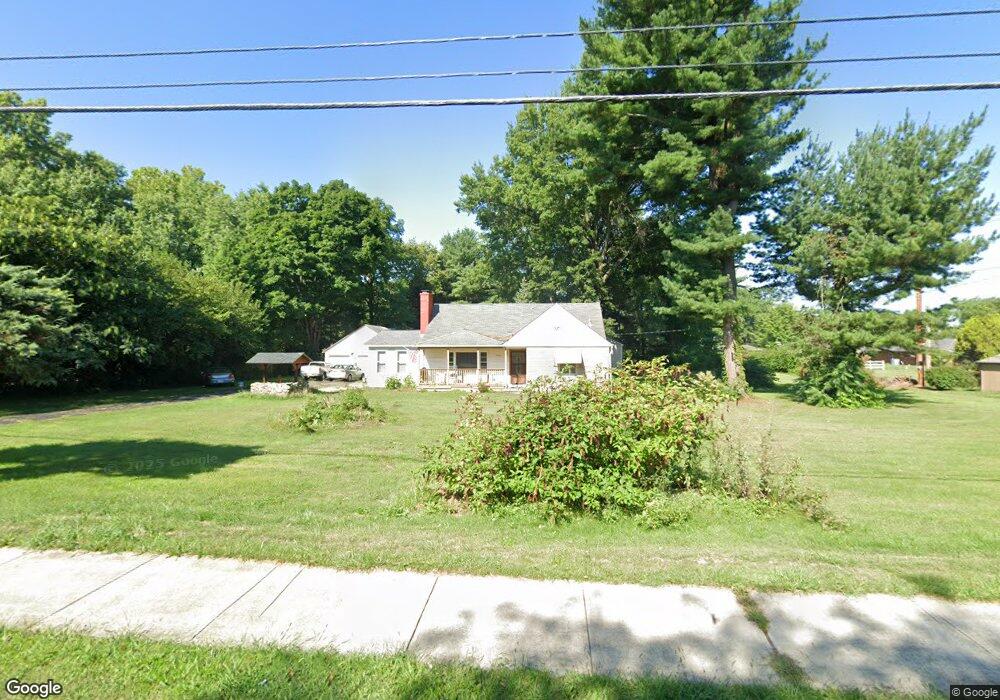
5219 Hendron Rd Groveport, OH 43125
Estimated Value: $263,000 - $319,544
4
Beds
1
Bath
1,336
Sq Ft
$215/Sq Ft
Est. Value
About This Home
This home is located at 5219 Hendron Rd, Groveport, OH 43125 and is currently estimated at $286,886, approximately $214 per square foot. 5219 Hendron Rd is a home located in Franklin County with nearby schools including Groveport Madison High School, Groveport Community School, and Madison Christian School.
Ownership History
Date
Name
Owned For
Owner Type
Purchase Details
Closed on
Aug 24, 2007
Sold by
Spence Dwayne R and Sethna Miriam D
Bought by
Coronel Luis E
Current Estimated Value
Home Financials for this Owner
Home Financials are based on the most recent Mortgage that was taken out on this home.
Original Mortgage
$107,920
Outstanding Balance
$68,539
Interest Rate
6.72%
Mortgage Type
Purchase Money Mortgage
Estimated Equity
$218,347
Purchase Details
Closed on
Aug 21, 2001
Sold by
Spence Clara M
Bought by
Spence Clara M and Spence Dwyane R
Purchase Details
Closed on
Feb 5, 1980
Bought by
Spence Clara M
Create a Home Valuation Report for This Property
The Home Valuation Report is an in-depth analysis detailing your home's value as well as a comparison with similar homes in the area
Home Values in the Area
Average Home Value in this Area
Purchase History
| Date | Buyer | Sale Price | Title Company |
|---|---|---|---|
| Coronel Luis E | $134,900 | Chicago Tit | |
| Spence Clara M | -- | -- | |
| Spence Clara M | -- | -- |
Source: Public Records
Mortgage History
| Date | Status | Borrower | Loan Amount |
|---|---|---|---|
| Open | Coronel Luis E | $107,920 |
Source: Public Records
Tax History Compared to Growth
Tax History
| Year | Tax Paid | Tax Assessment Tax Assessment Total Assessment is a certain percentage of the fair market value that is determined by local assessors to be the total taxable value of land and additions on the property. | Land | Improvement |
|---|---|---|---|---|
| 2024 | $4,080 | $83,200 | $34,720 | $48,480 |
| 2023 | $4,044 | $83,195 | $34,720 | $48,475 |
| 2022 | $3,699 | $60,760 | $17,850 | $42,910 |
| 2021 | $3,506 | $57,370 | $17,850 | $39,520 |
| 2020 | $3,501 | $57,160 | $17,850 | $39,310 |
| 2019 | $3,700 | $47,360 | $14,880 | $32,480 |
| 2018 | $3,124 | $47,360 | $14,880 | $32,480 |
| 2017 | $3,114 | $47,360 | $14,880 | $32,480 |
| 2016 | $2,912 | $37,770 | $14,140 | $23,630 |
| 2015 | $2,938 | $37,770 | $14,140 | $23,630 |
| 2014 | $2,766 | $37,770 | $14,140 | $23,630 |
| 2013 | $1,242 | $39,760 | $14,910 | $24,850 |
Source: Public Records
Map
Nearby Homes
- 199 Mohr Ave
- 303 Madison St
- 430 Maple St
- 218-222 Center St
- 250 Green Ave
- 287 College St
- 135 Front St
- 213 Front St
- 4822 Elmont Place
- 5298 Knight St
- 3450 Rohr Rd
- 3515 Rohr Rd
- 3463 Rohr Rd
- 5777 Ebright Rd
- 3461 Rohr Rd
- 5611 Shellbark St
- 0 Pontius Rd
- 5652 Red Alder St
- 7474 Groveport Rd
- 5634 Shagbark Place
- 5225 Hendron Rd
- 4095 Marlowa Dr
- 4089 Marlowa Dr
- 5323 Hendron Rd
- 4085 Marlowa Dr
- 5345 Hendron Rd
- 5062 Hendron Rd
- 4077 Marlowa Dr
- 4100 Marlowa Dr
- 4094 Marlowa Dr
- 4090 Marlowa Dr
- 4078 Marlowa Dr
- 4055 Marlowa Dr
- 4062 Marlowa Dr
- 4033 Marlowa Dr
- 4050 Marlowa Dr
- 4044 Marlowa Dr
- 5194 Hendron Rd
- 4025 Marlowa Dr
- 5119 Hendron Rd