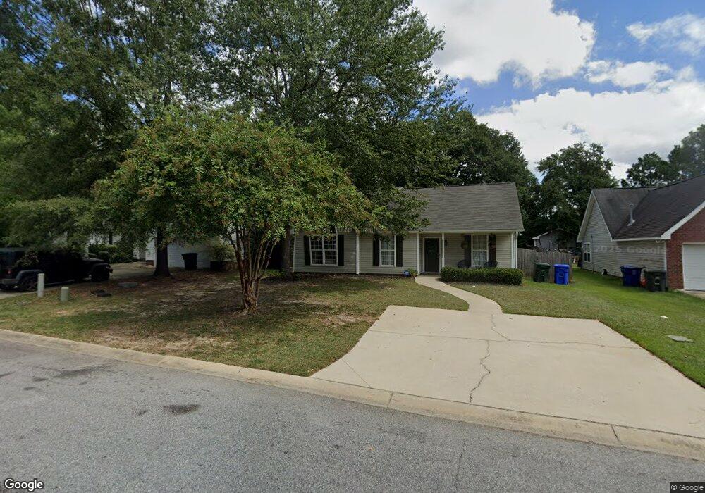
522 Burnside Dr Columbia, SC 29209
The Hamptons NeighborhoodEstimated Value: $218,467 - $232,000
3
Beds
2
Baths
1,161
Sq Ft
$194/Sq Ft
Est. Value
About This Home
This home is located at 522 Burnside Dr, Columbia, SC 29209 and is currently estimated at $225,617, approximately $194 per square foot. 522 Burnside Dr is a home located in Richland County with nearby schools including Meadowfield Elementary School, Hand Middle School, and Dreher High School.
Ownership History
Date
Name
Owned For
Owner Type
Purchase Details
Closed on
Jun 25, 2024
Sold by
Catamount Properties 2018 Llc
Bought by
Arroyavez Esther Q Hibbert
Current Estimated Value
Home Financials for this Owner
Home Financials are based on the most recent Mortgage that was taken out on this home.
Original Mortgage
$9,196
Interest Rate
7.02%
Purchase Details
Closed on
Feb 12, 2024
Sold by
Richland County Bank
Bought by
Catamount Properties 2018 Llc and Gelinas
Purchase Details
Closed on
Jul 15, 2016
Sold by
Barrett Daniel
Bought by
Russeau Jodi Elisse and Gelinas Judy
Home Financials for this Owner
Home Financials are based on the most recent Mortgage that was taken out on this home.
Original Mortgage
$120,280
Interest Rate
4.4%
Mortgage Type
FHA
Purchase Details
Closed on
Feb 26, 2016
Sold by
Us Bank National Association and Merrill Lynch Mortgage Investors Trus
Bought by
Barrett Daniel
Purchase Details
Closed on
Oct 28, 2015
Sold by
Richland County
Bought by
Bank Of America National Association and U S Bank National Association
Purchase Details
Closed on
Apr 25, 2005
Sold by
Rish Landon J
Bought by
Rish Carmila S
Home Financials for this Owner
Home Financials are based on the most recent Mortgage that was taken out on this home.
Original Mortgage
$95,300
Interest Rate
5.99%
Mortgage Type
New Conventional
Purchase Details
Closed on
Mar 24, 2003
Sold by
R A Powell Llc
Bought by
Rish Landon J and Rish Carmila S
Home Financials for this Owner
Home Financials are based on the most recent Mortgage that was taken out on this home.
Original Mortgage
$95,500
Interest Rate
5.82%
Purchase Details
Closed on
Dec 13, 2002
Sold by
Bradford Llc
Bought by
R A Powell Llc
Home Financials for this Owner
Home Financials are based on the most recent Mortgage that was taken out on this home.
Original Mortgage
$75,000
Interest Rate
6.07%
Create a Home Valuation Report for This Property
The Home Valuation Report is an in-depth analysis detailing your home's value as well as a comparison with similar homes in the area
Home Values in the Area
Average Home Value in this Area
Purchase History
| Date | Buyer | Sale Price | Title Company |
|---|---|---|---|
| Arroyavez Esther Q Hibbert | $229,900 | None Listed On Document | |
| Catamount Properties 2018 Llc | $156,000 | None Listed On Document | |
| Catamount Properties 2018 Llc | $156,000 | None Listed On Document | |
| Russeau Jodi Elisse | $122,500 | None Available | |
| Barrett Daniel | $30,673 | -- | |
| Bank Of America National Association | -- | -- | |
| Rish Carmila S | -- | -- | |
| Rish Landon J | $95,500 | -- | |
| R A Powell Llc | $19,500 | -- |
Source: Public Records
Mortgage History
| Date | Status | Borrower | Loan Amount |
|---|---|---|---|
| Closed | Arroyavez Esther Q Hibbert | $9,196 | |
| Open | Arroyavez Esther Q Hibbert | $218,405 | |
| Previous Owner | Russeau Jodi Elisse | $120,280 | |
| Previous Owner | Rish Carmila S | $95,300 | |
| Previous Owner | Rish Landon J | $95,500 | |
| Previous Owner | R A Powell Llc | $75,000 |
Source: Public Records
Tax History Compared to Growth
Tax History
| Year | Tax Paid | Tax Assessment Tax Assessment Total Assessment is a certain percentage of the fair market value that is determined by local assessors to be the total taxable value of land and additions on the property. | Land | Improvement |
|---|---|---|---|---|
| 2024 | $943 | $136,800 | $0 | $0 |
| 2023 | $943 | $4,756 | $0 | $0 |
| 2022 | $863 | $118,900 | $25,000 | $93,900 |
| 2021 | $892 | $4,760 | $0 | $0 |
| 2020 | $940 | $4,760 | $0 | $0 |
| 2019 | $947 | $4,760 | $0 | $0 |
| 2018 | $997 | $4,900 | $0 | $0 |
| 2017 | $971 | $4,900 | $0 | $0 |
| 2016 | $2,942 | $4,150 | $0 | $0 |
| 2015 | $793 | $4,150 | $0 | $0 |
| 2014 | $792 | $103,700 | $0 | $0 |
| 2013 | -- | $4,150 | $0 | $0 |
Source: Public Records
Map
Nearby Homes
- 509 Burnside Dr
- 206 Hampton Forest Dr
- 755 Burnside Dr
- 811 Rockwood Rd
- 404 Hampton Forest Dr
- 411 Hampton Forest Dr
- 444 Cami Forest Ln
- 513 Knollwood Dr
- 821 Walters Ln
- 1040 Coatesdale Rd
- 1284 Rockwood Rd
- 6627 Christie Rd
- 497 Galway Ln
- 6603 Christie Rd
- 148 Cottage Lake Way
- 813 Greenlawn Dr
- 174 Preston Green Dr
- 911 Fairwood Dr
- 1008 Haven Dr
- 225 E Lake Trail
- 518 Burnside Dr
- 526 Burnside Dr
- 514 Burnside Dr
- 530 Burnside Dr
- 523 Burnside Dr
- 519 Burnside Dr
- 527 Burnside Dr
- 508 Burnside Dr
- 534 Burnside Dr
- 515 Burnside Dr
- 531 Burnside Dr
- 504 Burnside Dr
- 535 Burnside Dr
- 538 Burnside Dr
- 843 Burnside Dr
- 847 Burnside Dr
- 839 Burnside Dr
- 539 Burnside Dr
- 851 Burnside Dr
- 505 Burnside Dr