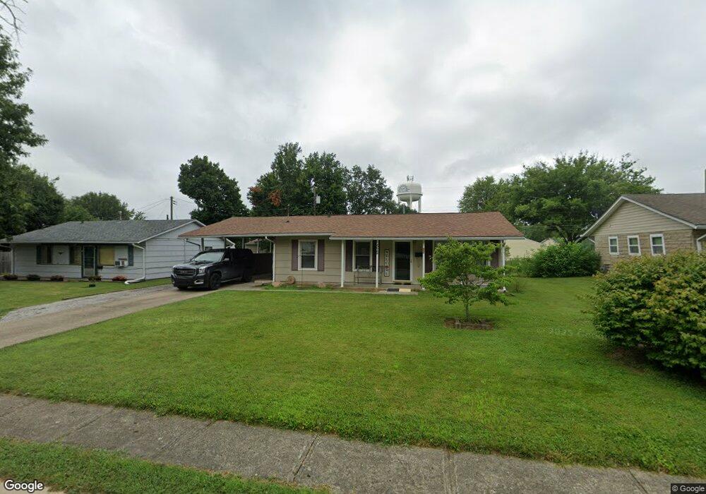
522 Delbrook Dr Whiteland, IN 46184
Estimated Value: $211,000 - $220,000
3
Beds
1
Bath
1,064
Sq Ft
$203/Sq Ft
Est. Value
About This Home
This home is located at 522 Delbrook Dr, Whiteland, IN 46184 and is currently estimated at $215,786, approximately $202 per square foot. 522 Delbrook Dr is a home located in Johnson County with nearby schools including Break-O-Day Elementary School, Clark-Pleasant Middle School, and Whiteland Community High School.
Ownership History
Date
Name
Owned For
Owner Type
Purchase Details
Closed on
Sep 16, 2009
Sold by
Davis Teresa and Davis Teresa F
Bought by
Davis Donald
Current Estimated Value
Purchase Details
Closed on
May 29, 2008
Sold by
Davis Donald
Bought by
Davis Teresa F
Purchase Details
Closed on
Apr 25, 2005
Sold by
Gibson Jeffrey C and Gibson Jill
Bought by
Davis Donald
Home Financials for this Owner
Home Financials are based on the most recent Mortgage that was taken out on this home.
Original Mortgage
$82,666
Outstanding Balance
$43,683
Interest Rate
6.05%
Mortgage Type
FHA
Estimated Equity
$172,103
Create a Home Valuation Report for This Property
The Home Valuation Report is an in-depth analysis detailing your home's value as well as a comparison with similar homes in the area
Home Values in the Area
Average Home Value in this Area
Purchase History
| Date | Buyer | Sale Price | Title Company |
|---|---|---|---|
| Davis Donald | -- | None Available | |
| Davis Teresa F | -- | None Available | |
| Davis Donald | -- | Chicago Title Ins Co |
Source: Public Records
Mortgage History
| Date | Status | Borrower | Loan Amount |
|---|---|---|---|
| Open | Davis Donald | $82,666 |
Source: Public Records
Tax History Compared to Growth
Tax History
| Year | Tax Paid | Tax Assessment Tax Assessment Total Assessment is a certain percentage of the fair market value that is determined by local assessors to be the total taxable value of land and additions on the property. | Land | Improvement |
|---|---|---|---|---|
| 2025 | $1,503 | $169,500 | $42,000 | $127,500 |
| 2024 | $1,503 | $160,800 | $42,000 | $118,800 |
| 2023 | $1,489 | $154,200 | $42,000 | $112,200 |
| 2022 | $1,468 | $142,600 | $35,000 | $107,600 |
| 2021 | $1,294 | $125,700 | $35,000 | $90,700 |
| 2020 | $788 | $92,900 | $23,200 | $69,700 |
| 2019 | $717 | $88,400 | $17,600 | $70,800 |
| 2018 | $702 | $87,000 | $14,900 | $72,100 |
| 2017 | $691 | $86,000 | $14,900 | $71,100 |
| 2016 | $515 | $78,000 | $14,900 | $63,100 |
| 2014 | $479 | $71,000 | $15,100 | $55,900 |
| 2013 | $479 | $72,700 | $15,100 | $57,600 |
Source: Public Records
Map
Nearby Homes
- 539 Delbrook Dr
- 239 Shelton Place
- 0 E 700 N Unit MBR22036500
- 230 Parkview Dr
- 624 Sweetbriar Ave
- 241 Mooreland Dr
- 269 Switchgrass Ln
- 287 Bluestem Ln
- 144 Bluestem Ln
- 229 Arlington St
- 250 Southlane Dr
- 389 Parkway St
- 409 Parkway St
- 135 Bradford Place
- 840 Sweetbriar Ave
- 131 Belaire Dr
- 821 Princeton Dr
- 12 Rypma Row
- 257 Creekway Ct
- 111 Meadow Creek Blvd
- 514 Delbrook Dr
- 528 Delbrook Dr
- 210 Mission Terrace Dr
- 324 Shelton Place
- 330 Shelton Place
- 536 Delbrook Dr
- 318 Shelton Place
- 525 Delbrook Dr
- 350 Parkview Dr
- 531 Delbrook Dr
- 517 Delbrook Dr
- 542 Delbrook Dr
- 340 Parkview Dr
- 412 Parkview Dr
- 310 Shelton Place
- 325 Hollybrook Dr
- 321 Shelton Place
- 430 Sonora Cir
- 315 Hollybrook Dr
- 337 Hollybrook Dr