Estimated Value: $139,751 - $166,000
3
Beds
2
Baths
1,100
Sq Ft
$141/Sq Ft
Est. Value
About This Home
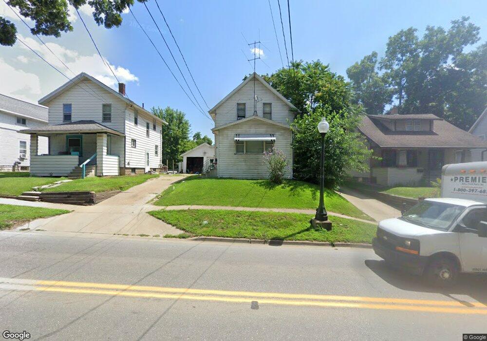
This home is located at 522 N State St, Ionia, MI 48846 and is currently estimated at $155,438, approximately $141 per square foot. 522 N State St is a home located in Ionia County with nearby schools including Ionia High School, Saints Peter and Paul Catholic School, and Ionia Seventh Day Adventist Elementary School.
Ownership History
Date
Name
Owned For
Owner Type
Purchase Details
Closed on
Oct 10, 2012
Sold by
Mckinch Donald and Mckinch Norma
Bought by
Hopkins Jolene and Hopkins Troy
Current Estimated Value
Purchase Details
Closed on
Oct 6, 2010
Sold by
Preston Matthew
Bought by
Mckinch Donald
Purchase Details
Closed on
Jan 30, 2007
Sold by
Weller Angela
Bought by
Ionia County National Bank
Purchase Details
Closed on
Jan 23, 2007
Sold by
Weller Nicholas
Bought by
Ionia County National Bank
Purchase Details
Closed on
Nov 18, 2004
Sold by
Morgan Teresa Jo and Jensen Teresa Jo
Bought by
Weller Nicholas
Home Financials for this Owner
Home Financials are based on the most recent Mortgage that was taken out on this home.
Original Mortgage
$73,677
Interest Rate
5.82%
Mortgage Type
Purchase Money Mortgage
Create a Home Valuation Report for This Property
The Home Valuation Report is an in-depth analysis detailing your home's value as well as a comparison with similar homes in the area
Home Values in the Area
Average Home Value in this Area
Purchase History
| Date | Buyer | Sale Price | Title Company |
|---|---|---|---|
| Hopkins Jolene | $10,000 | -- | |
| Mckinch Donald | -- | -- | |
| Ionia County National Bank | -- | None Available | |
| Ionia County National Bank | -- | None Available | |
| Weller Nicholas | $72,000 | -- |
Source: Public Records
Mortgage History
| Date | Status | Borrower | Loan Amount |
|---|---|---|---|
| Previous Owner | Weller Nicholas | $73,677 |
Source: Public Records
Tax History Compared to Growth
Tax History
| Year | Tax Paid | Tax Assessment Tax Assessment Total Assessment is a certain percentage of the fair market value that is determined by local assessors to be the total taxable value of land and additions on the property. | Land | Improvement |
|---|---|---|---|---|
| 2025 | $1,497 | $55,400 | $9,900 | $45,500 |
| 2024 | $1,425 | $55,400 | $9,900 | $45,500 |
| 2023 | $1,359 | $39,500 | $7,300 | $32,200 |
| 2022 | $1,294 | $35,400 | $6,500 | $28,900 |
| 2021 | $1,320 | $30,000 | $6,500 | $23,500 |
| 2020 | $1,248 | $30,000 | $6,500 | $23,500 |
| 2019 | $1,116 | $30,000 | $5,400 | $24,600 |
| 2018 | $1,271 | $27,400 | $4,800 | $22,600 |
| 2017 | $1,103 | $27,400 | $4,800 | $22,600 |
| 2016 | $1,116 | $22,700 | $2,500 | $20,200 |
| 2015 | -- | $22,700 | $2,500 | $20,200 |
| 2014 | $757 | $21,500 | $3,600 | $17,900 |
Source: Public Records
Map
Nearby Homes
- 407 Forest St
- 721 Chapman St
- 428 W Lincoln Ave
- 442 Baldie St
- 556 Price St
- 710 Elmwood Dr
- 916 Yeomans St
- 217 Dye St
- 200 W Lincoln Ave
- 118 Tower St
- 947 W Main St
- 1133 Yeomans St Unit 99
- 1133 Yeomans St Unit 118
- 1133 Yeomans St Unit 105
- 1133 Yeomans St Unit 243
- 1133 Yeomans St Unit 55
- 1133 Yeomans St Unit 130
- 1133 Yeomans St Unit 129
- 1133 Yeomans St Unit 138
- 1133 Yeomans St Unit 256
- 526 N State St
- 518 N State St
- 518 N State St
- 518 N State St Unit 1/2
- 514 N State St
- 519 N State St
- 515 N State St
- 530 N State St
- 644 W Lincoln Ave
- 507 N State St
- 638 W Lincoln Ave
- 523 N State St
- 634 W Lincoln Ave
- 630 W Lincoln Ave
- 710 W Lincoln Ave
- 711 Branch St
- 714 W Lincoln Ave
- 720 W Lincoln Ave
- 715 Branch St
- 627 W Lincoln Ave