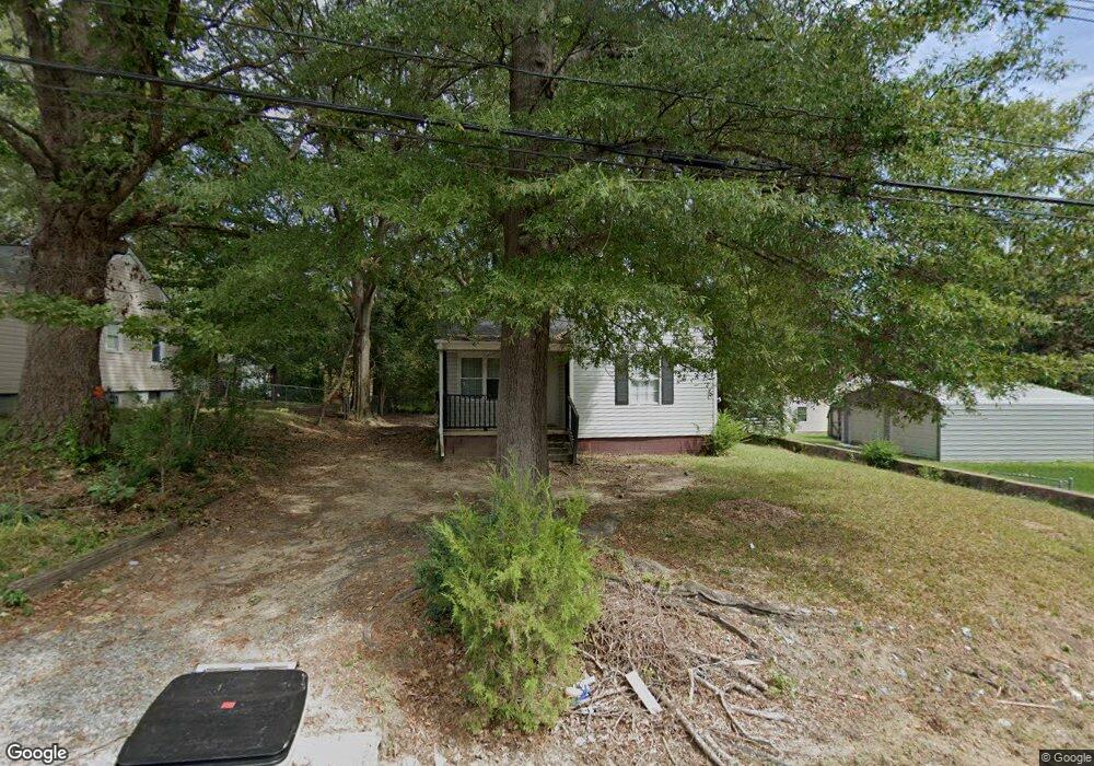
522 Scruggs St Gastonia, NC 28052
Estimated Value: $106,649 - $140,000
2
Beds
1
Bath
780
Sq Ft
$154/Sq Ft
Est. Value
About This Home
This home is located at 522 Scruggs St, Gastonia, NC 28052 and is currently estimated at $120,412, approximately $154 per square foot. 522 Scruggs St is a home located in Gaston County with nearby schools including Bessemer City Primary School, York Chester Middle School, and Hunter Huss High School.
Ownership History
Date
Name
Owned For
Owner Type
Purchase Details
Closed on
Aug 9, 2006
Sold by
Noles Edwin O and Noles Dawn A
Bought by
Ramsey Gerald C
Current Estimated Value
Purchase Details
Closed on
Oct 23, 2003
Sold by
Fannie Mae
Bought by
Noles Edwin O and Ramsey Gerald C
Purchase Details
Closed on
Sep 30, 2003
Sold by
Cloninger Henry Ray and Cloninger Brenda
Bought by
Federal National Mortgage Association
Purchase Details
Closed on
Apr 15, 2003
Sold by
Cloninger Henry Ray and Cloninger Brenda
Bought by
Federal National Mortgage Association
Create a Home Valuation Report for This Property
The Home Valuation Report is an in-depth analysis detailing your home's value as well as a comparison with similar homes in the area
Home Values in the Area
Average Home Value in this Area
Purchase History
| Date | Buyer | Sale Price | Title Company |
|---|---|---|---|
| Ramsey Gerald C | -- | Chicago Title Insurance Co | |
| Noles Edwin O | -- | -- | |
| Federal National Mortgage Association | $36,931 | -- | |
| Federal National Mortgage Association | $37,763 | -- |
Source: Public Records
Tax History Compared to Growth
Tax History
| Year | Tax Paid | Tax Assessment Tax Assessment Total Assessment is a certain percentage of the fair market value that is determined by local assessors to be the total taxable value of land and additions on the property. | Land | Improvement |
|---|---|---|---|---|
| 2025 | $761 | $71,150 | $12,500 | $58,650 |
| 2024 | $761 | $71,150 | $12,500 | $58,650 |
| 2023 | $768 | $71,150 | $12,500 | $58,650 |
| 2022 | $429 | $32,270 | $5,000 | $27,270 |
| 2021 | $436 | $32,270 | $5,000 | $27,270 |
| 2020 | $436 | $32,270 | $5,000 | $27,270 |
| 2019 | $439 | $32,270 | $5,000 | $27,270 |
| 2018 | $296 | $21,150 | $6,000 | $15,150 |
| 2017 | $296 | $21,150 | $6,000 | $15,150 |
| 2016 | $296 | $21,150 | $0 | $0 |
| 2014 | $510 | $36,412 | $12,000 | $24,412 |
Source: Public Records
Map
Nearby Homes
- 506 N Scruggs St
- 1205 W Mauney Ave
- 1406 W Walnut Ave
- 412 N Scruggs St
- 1341 Essex Ave
- 1324, 1330 Jay Ave Unit 13,14
- 406 N Boyd St
- 1426 Beechwood Dr
- 1210 Ware Ave
- 1213 Essex Ave
- 1514 W Walnut Ave
- 110 Mauney Cir
- 714 Apple Blossom Cir
- 0 Linwood Rd
- 1506 Lake St
- 1555 Collinston Dr
- 79 May St
- 95 May St
- 1759 Smith Ave
- 907 W Mauney Ave
- 524 N Scruggs St
- 524 Scruggs St
- 1323 W May Ave
- 1216 W Mauney Ave
- 1214 W Mauney Ave
- 518 Scruggs St
- 526 Scruggs St
- 526 N Scruggs St
- 219 N Scruggs St
- 217 N Scruggs St
- 244 N Scruggs St
- 215 N Scruggs St
- 1402 W Mauney Ave
- 1321 W May Ave
- 1212 W Mauney Ave
- 602 N Scruggs St
- 1404 W Mauney Ave
- 1317 W May Ave
- 1403 W May Ave
- 601 N Scruggs St