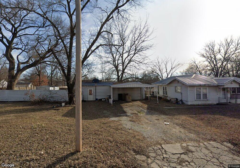
522 W 17th St Pawhuska, OK 74056
Estimated Value: $103,557 - $134,000
3
Beds
1
Bath
1,008
Sq Ft
$118/Sq Ft
Est. Value
About This Home
This home is located at 522 W 17th St, Pawhuska, OK 74056 and is currently estimated at $119,139, approximately $118 per square foot. 522 W 17th St is a home located in Osage County with nearby schools including Indian Camp Elementary School, Pawhuska Elementary School, and Pawhuska Middle School.
Ownership History
Date
Name
Owned For
Owner Type
Purchase Details
Closed on
Mar 26, 2013
Sold by
Henderson Trucking Llc
Bought by
Barnes Robert
Current Estimated Value
Purchase Details
Closed on
Feb 23, 2004
Sold by
Taylor Roger D
Bought by
Barnes Robert W
Purchase Details
Closed on
Jun 29, 2001
Sold by
Taylor Roger D and Taylor Debra S
Bought by
Taylor Roger D
Create a Home Valuation Report for This Property
The Home Valuation Report is an in-depth analysis detailing your home's value as well as a comparison with similar homes in the area
Home Values in the Area
Average Home Value in this Area
Purchase History
| Date | Buyer | Sale Price | Title Company |
|---|---|---|---|
| Barnes Robert | -- | None Available | |
| Barnes Robert W | $25,000 | -- | |
| Taylor Roger D | -- | -- |
Source: Public Records
Tax History Compared to Growth
Tax History
| Year | Tax Paid | Tax Assessment Tax Assessment Total Assessment is a certain percentage of the fair market value that is determined by local assessors to be the total taxable value of land and additions on the property. | Land | Improvement |
|---|---|---|---|---|
| 2024 | $477 | $6,171 | $744 | $5,427 |
| 2023 | $477 | $6,171 | $744 | $5,427 |
| 2022 | $461 | $6,039 | $744 | $5,295 |
| 2021 | $451 | $6,039 | $744 | $5,295 |
| 2020 | $459 | $6,039 | $744 | $5,295 |
| 2019 | $452 | $6,039 | $744 | $5,295 |
| 2018 | $448 | $6,039 | $744 | $5,295 |
| 2017 | $465 | $6,181 | $744 | $5,437 |
| 2016 | $467 | $6,181 | $744 | $5,437 |
| 2015 | $483 | $6,181 | $744 | $5,437 |
| 2014 | $493 | $6,181 | $744 | $5,437 |
| 2013 | $594 | $6,241 | $744 | $5,497 |
Source: Public Records
Map
Nearby Homes
- 501 W 17th St
- 1721 Bighill Ave
- 1715 Grandview Ave
- 1815 Grandview Ave
- 1700 Grandview Ave
- 1419 Leahy Ave
- 101 E 11th St
- 208 E 12th St
- 0 Prudom Ave
- 312 E 11th St
- 321 E 10th St
- 421 E 11th St
- 906 Rogers Ave
- 225 E 6th St
- 320 E 7th St
- 2019 Mckenzie Rd
- 2125 Mckenzie Rd
- 1205 Brenner Ave
- 1322 Boundary Ave
- 1318 Boundary Ave
- 521 W 16th St
- 515 W 16th St
- 1611 Bigchief Ave
- 515 W 17th St
- 600 W 17th St
- 1601 Whitehair Ave
- 1705 Bigchief Ave
- 1703 Whitehair Ave
- 1714 Whitehair Ave
- 1607 Bigchief Ave
- 420 W 17th St
- 612 W 17th St
- 1709 Bigchief Ave
- 520 W 16th St
- 1523 Bigchief Ave
- 1709 Whitehair Ave
- 1612 Bigchief Ave
- 1521 Whitehair Ave
- 1608 Bigchief Ave
- 417 W 17th St