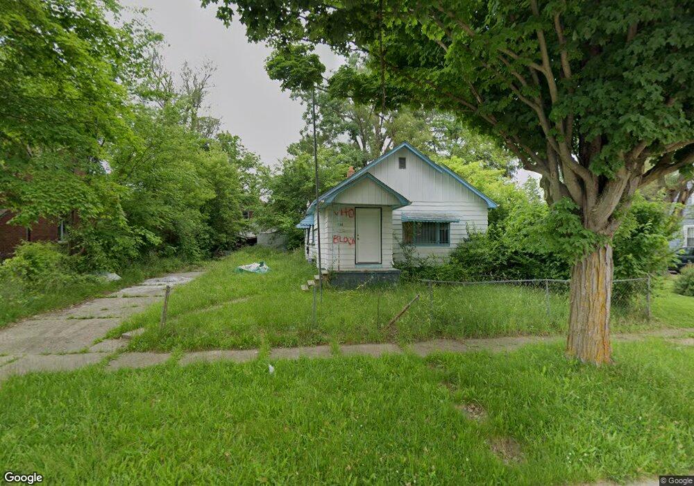
522 W Jamieson St Flint, MI 48505
King Avenue Plus NeighborhoodEstimated Value: $29,000 - $45,000
2
Beds
1
Bath
848
Sq Ft
$46/Sq Ft
Est. Value
About This Home
This home is located at 522 W Jamieson St, Flint, MI 48505 and is currently estimated at $38,628, approximately $45 per square foot. 522 W Jamieson St is a home located in Genesee County with nearby schools including Brownell STEM Academy, The New Standard Academy, and Greater Heights Academy.
Ownership History
Date
Name
Owned For
Owner Type
Purchase Details
Closed on
Jan 16, 2024
Sold by
Genesee County Land Bank Authority
Bought by
Sanders Kimberly
Current Estimated Value
Purchase Details
Closed on
Dec 20, 2022
Sold by
Genesee County Treasurer
Bought by
Genesee County Land Bank Authority
Purchase Details
Closed on
Jan 12, 2018
Sold by
Genesee County Land Bank Authoirty
Bought by
Towner Sandra Grace
Purchase Details
Closed on
Dec 20, 2017
Sold by
Cherry Deborah L
Bought by
Genesee County Land Bank Authority
Purchase Details
Closed on
Nov 2, 2015
Sold by
Dejesus Selma and Rodriguies Selma
Bought by
Dejesus Gloria
Purchase Details
Closed on
Mar 26, 2010
Sold by
Howard Stephanie
Bought by
Dejesus Celestino
Purchase Details
Closed on
Jun 30, 2005
Sold by
Dejesus Celestino
Bought by
Dejesus Celestino and Howard Stephanie
Create a Home Valuation Report for This Property
The Home Valuation Report is an in-depth analysis detailing your home's value as well as a comparison with similar homes in the area
Home Values in the Area
Average Home Value in this Area
Purchase History
| Date | Buyer | Sale Price | Title Company |
|---|---|---|---|
| Sanders Kimberly | $9,200 | None Listed On Document | |
| Genesee County Land Bank Authority | -- | -- | |
| Towner Sandra Grace | -- | None Available | |
| Genesee County Land Bank Authority | -- | None Available | |
| Dejesus Gloria | -- | Attorney | |
| Dejesus Celestino | -- | None Available | |
| Dejesus Celestino | -- | First American Title Ins Co |
Source: Public Records
Mortgage History
| Date | Status | Borrower | Loan Amount |
|---|---|---|---|
| Closed | Towner Sandra Grace | $0 |
Source: Public Records
Tax History Compared to Growth
Tax History
| Year | Tax Paid | Tax Assessment Tax Assessment Total Assessment is a certain percentage of the fair market value that is determined by local assessors to be the total taxable value of land and additions on the property. | Land | Improvement |
|---|---|---|---|---|
| 2025 | $265 | $9,000 | $0 | $0 |
| 2024 | $265 | $0 | $0 | $0 |
| 2023 | -- | $0 | $0 | $0 |
| 2022 | $0 | $6,800 | $0 | $0 |
| 2021 | $626 | $6,600 | $0 | $0 |
| 2020 | $675 | $8,600 | $0 | $0 |
| 2019 | $701 | $9,300 | $0 | $0 |
| 2018 | $221 | $0 | $0 | $0 |
| 2017 | $1,039 | $0 | $0 | $0 |
| 2016 | $820 | $0 | $0 | $0 |
| 2015 | -- | $0 | $0 | $0 |
| 2014 | -- | $0 | $0 | $0 |
| 2012 | -- | $11,200 | $0 | $0 |
Source: Public Records
Map
Nearby Homes
- 3422 Race St
- 409 W Genesee St
- 311 W Genesee St
- 200 W Mcclellan St
- 2718 N Chevrolet Ave
- 2913
- 2913 Martin Luther King Ave
- 1209 W Mcclellan St
- 1101 W Rankin St
- 3722 Sterling St
- 115 W Baker St
- 1402 W Dartmouth St
- 506 Green St
- 218 E Jackson Ave
- 3420 Fleming Rd
- 1521 W Dartmouth St
- 606 W Stewart Ave
- 2414 Delmar St
- 2907 Trumbull Ave
- 1713 W Dartmouth St
- 530 W Jamieson St
- 514 W Jamieson St
- 521 W Dewey St
- 525 W Dewey St
- 517 W Dewey St
- 601 W Dewey St
- 513 W Dewey St
- 606 W Jamieson St
- 521 W Jamieson St
- 502 W Jamieson St
- 3207 Iroquois Ave
- 529 W Jamieson St
- 605 W Dewey St
- 513 W Jamieson St
- 610 W Jamieson St
- 3213 Iroquois Ave
- 601 W Jamieson St
- 3221 Iroquois Ave
- 3119 Iroquois Ave
- 609 W Dewey St