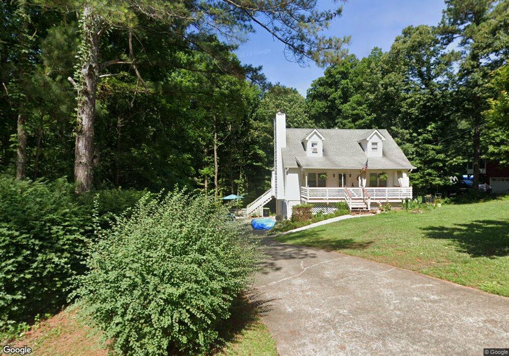
5220 Shadowood Dr Unit 2 Canton, GA 30114
Estimated Value: $385,000
3
Beds
2
Baths
1,526
Sq Ft
$252/Sq Ft
Est. Value
About This Home
This home is located at 5220 Shadowood Dr Unit 2, Canton, GA 30114 and is currently estimated at $385,000, approximately $252 per square foot. 5220 Shadowood Dr Unit 2 is a home located in Cherokee County with nearby schools including Sixes Elementary School, Freedom Middle School, and Woodstock High School.
Ownership History
Date
Name
Owned For
Owner Type
Purchase Details
Closed on
Jun 27, 2002
Sold by
Holloway Samuel and Holloway Suzanne S
Bought by
Guran Sorin M
Current Estimated Value
Home Financials for this Owner
Home Financials are based on the most recent Mortgage that was taken out on this home.
Original Mortgage
$126,500
Outstanding Balance
$52,890
Interest Rate
6.79%
Mortgage Type
FHA
Estimated Equity
$344,110
Purchase Details
Closed on
Apr 29, 1993
Sold by
Cherokee Federal Savings Bank Pat
Bought by
Holloway Suzanne S and Holloway Samuel L
Home Financials for this Owner
Home Financials are based on the most recent Mortgage that was taken out on this home.
Original Mortgage
$56,900
Interest Rate
7.51%
Create a Home Valuation Report for This Property
The Home Valuation Report is an in-depth analysis detailing your home's value as well as a comparison with similar homes in the area
Home Values in the Area
Average Home Value in this Area
Purchase History
| Date | Buyer | Sale Price | Title Company |
|---|---|---|---|
| Guran Sorin M | $127,500 | -- | |
| Holloway Suzanne S | $59,900 | -- |
Source: Public Records
Mortgage History
| Date | Status | Borrower | Loan Amount |
|---|---|---|---|
| Open | Guran Sorin M | $126,500 | |
| Previous Owner | Holloway Suzanne S | $56,900 |
Source: Public Records
Tax History
| Year | Tax Paid | Tax Assessment Tax Assessment Total Assessment is a certain percentage of the fair market value that is determined by local assessors to be the total taxable value of land and additions on the property. | Land | Improvement |
|---|---|---|---|---|
| 2025 | $3,111 | $139,288 | $26,000 | $113,288 |
| 2024 | $2,901 | $128,768 | $24,000 | $104,768 |
| 2023 | $2,382 | $124,808 | $24,000 | $100,808 |
| 2022 | $2,335 | $100,568 | $24,000 | $76,568 |
| 2021 | $2,173 | $85,128 | $18,240 | $66,888 |
| 2020 | $1,955 | $75,648 | $16,000 | $59,648 |
| 2019 | $1,817 | $69,680 | $15,200 | $54,480 |
| 2018 | $1,666 | $63,160 | $14,000 | $49,160 |
| 2017 | $1,519 | $140,900 | $12,800 | $43,560 |
| 2016 | $1,403 | $127,100 | $11,200 | $39,640 |
| 2015 | $1,284 | $114,900 | $10,800 | $35,160 |
| 2014 | $949 | $86,300 | $6,000 | $28,520 |
Source: Public Records
Map
Nearby Homes
- 2550 Mountain Brook Rd
- 412 Fernstone Dr
- 3161 Marble Quarry Rd
- 1302 Sixes Rd
- 1415 Sixes Rd
- 319 Hillgrove Dr
- 151 Wentworth Dr
- 1600 Mountain Trace
- 415 Crestmont Ln
- 520 Andes Ln
- 206 Sawtooth Ct
- 208 Sawtooth Ct
- 1600 Sixes Rd
- 246 Manous Way
- 276 Whitetail Cir
- 376 Whitetail Cir
- 408 Candy Ln
- 216 Manous Way
- 1243 Palm Ridge Trace
- 605 Garnet Ct Unit 3
- 5200 Shadowood Dr Unit 2
- 5190 Shadow Wood Dr
- 5190 Shadowood Dr
- 2869 Mountain Brook Rd
- 5245 Shadowood Dr
- 2875 Mountain Brook Rd
- 2853 Mountain Brook Rd
- 5225 Shadowood Dr
- 5215 Shadowood Dr Unit 2
- 490 Cove Rd
- 5170 Shadowood Dr
- 5170 Shadowood Dr Unit 2
- 5195 Shadowood Dr
- 2885 Mountain Brook Rd
- 5225 Shadow Wood Dr
- 510 Cove Rd Unit I
- 2833 Mountain Brook Rd Unit 1
- 5175 Shadowood Dr
- 5175 Shadowood Dr Unit 5175
- 5175 Shadowood Dr NE Unit 5175
Your Personal Tour Guide
Ask me questions while you tour the home.