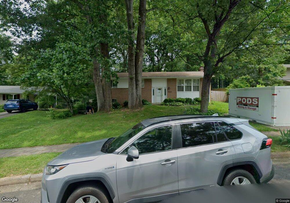
5221 Richardson Dr Fairfax, VA 22032
Estimated Value: $778,341 - $856,000
5
Beds
3
Baths
1,200
Sq Ft
$687/Sq Ft
Est. Value
About This Home
This home is located at 5221 Richardson Dr, Fairfax, VA 22032 and is currently estimated at $824,585, approximately $687 per square foot. 5221 Richardson Dr is a home located in Fairfax County with nearby schools including Laurel Ridge Elementary School, James W Robinson, Jr. Secondary School, and Holy Spirit School.
Ownership History
Date
Name
Owned For
Owner Type
Purchase Details
Closed on
Apr 30, 2015
Sold by
Alva Armando
Bought by
Milla Magda
Current Estimated Value
Home Financials for this Owner
Home Financials are based on the most recent Mortgage that was taken out on this home.
Original Mortgage
$312,500
Outstanding Balance
$242,473
Interest Rate
3.88%
Mortgage Type
New Conventional
Estimated Equity
$582,112
Purchase Details
Closed on
Jul 16, 2002
Sold by
Baker Allen C
Bought by
Alva Armando
Home Financials for this Owner
Home Financials are based on the most recent Mortgage that was taken out on this home.
Original Mortgage
$217,500
Interest Rate
6.73%
Mortgage Type
New Conventional
Create a Home Valuation Report for This Property
The Home Valuation Report is an in-depth analysis detailing your home's value as well as a comparison with similar homes in the area
Home Values in the Area
Average Home Value in this Area
Purchase History
| Date | Buyer | Sale Price | Title Company |
|---|---|---|---|
| Milla Magda | $123,995 | -- | |
| Alva Armando | $290,000 | -- |
Source: Public Records
Mortgage History
| Date | Status | Borrower | Loan Amount |
|---|---|---|---|
| Open | Milla Magda | $312,500 | |
| Previous Owner | Alva Armando | $217,500 |
Source: Public Records
Tax History Compared to Growth
Tax History
| Year | Tax Paid | Tax Assessment Tax Assessment Total Assessment is a certain percentage of the fair market value that is determined by local assessors to be the total taxable value of land and additions on the property. | Land | Improvement |
|---|---|---|---|---|
| 2025 | $8,024 | $715,430 | $286,000 | $429,430 |
| 2024 | $8,024 | $692,600 | $281,000 | $411,600 |
| 2023 | $7,700 | $682,360 | $281,000 | $401,360 |
| 2022 | $7,477 | $653,840 | $256,000 | $397,840 |
| 2021 | $6,723 | $572,890 | $236,000 | $336,890 |
| 2020 | $6,289 | $531,370 | $221,000 | $310,370 |
| 2019 | $6,128 | $517,760 | $216,000 | $301,760 |
| 2018 | $5,893 | $512,450 | $216,000 | $296,450 |
| 2017 | $5,737 | $494,100 | $206,000 | $288,100 |
| 2016 | $5,512 | $475,810 | $191,000 | $284,810 |
| 2015 | $5,310 | $475,810 | $191,000 | $284,810 |
| 2014 | -- | $462,990 | $181,000 | $281,990 |
Source: Public Records
Map
Nearby Homes
- 9710 Ashbourn Dr
- 5137 Richardson Dr
- 5307 Richardson Dr
- 9717 Commonwealth Blvd
- 9769 High Water Ct
- 5361 Gainsborough Dr
- 5313 Stonington Dr
- 9438 Wallingford Dr
- 9909 Lakepointe Dr
- 9513 Burdett Rd
- 9883 Becket Ct
- 5006 Lone Oak Place
- 5711 Crownleigh Ct
- 9896 Becket Ct
- 5207 Stonington Dr
- 9662 Westport Ln
- 5658 Sutherland Ct
- 5714 Mason Bluff Dr
- 5504 Winford Ct
- 4947 Mcfarland Ct
- 5223 Richardson Dr
- 5219 Richardson Dr
- 5241 Herzell Woods Ct
- 5239 Herzell Woods Ct
- 5240 Herzell Woods Ct
- 9802 Ward Ct
- 9804 Ward Ct
- 5220 Richardson Dr
- 9811 Covent Ct
- 5238 Herzell Woods Ct
- 5218 Richardson Dr
- 5237 Herzell Woods Ct
- 0 Burke Rd
- 9803 Bronte Dr
- 9801 Bronte Dr
- 9800 Ward Ct
- 9814 Covent Ct
- 9813 Covent Ct
- 5236 Herzell Woods Ct
- 9707 Bronte Dr