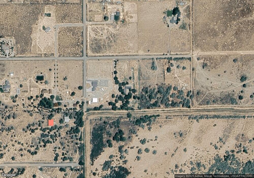
5221 W 100 S Cedar City, UT 84720
Estimated Value: $363,000 - $769,000
--
Bed
--
Bath
1,196
Sq Ft
$412/Sq Ft
Est. Value
About This Home
This home is located at 5221 W 100 S, Cedar City, UT 84720 and is currently estimated at $493,085, approximately $412 per square foot. 5221 W 100 S is a home located in Iron County with nearby schools including Iron Springs School, Cedar Middle School, and Cedar City High School.
Ownership History
Date
Name
Owned For
Owner Type
Purchase Details
Closed on
Sep 17, 2021
Sold by
Ann Chrisman Amelia
Bought by
Chrisman Steven R
Current Estimated Value
Home Financials for this Owner
Home Financials are based on the most recent Mortgage that was taken out on this home.
Original Mortgage
$241,284
Outstanding Balance
$219,223
Interest Rate
2.7%
Mortgage Type
FHA
Estimated Equity
$273,862
Purchase Details
Closed on
Dec 15, 2005
Sold by
Chrisman Jeff and Chrisman Amelia Ann
Bought by
Chrisman Amelia Ann and Chrisman Jeff
Purchase Details
Closed on
Apr 1, 2005
Sold by
Lyon Amelia Ann
Bought by
Lyon Amelia Ann and Chrisman Jeff
Home Financials for this Owner
Home Financials are based on the most recent Mortgage that was taken out on this home.
Original Mortgage
$90,660
Interest Rate
5.6%
Mortgage Type
Purchase Money Mortgage
Create a Home Valuation Report for This Property
The Home Valuation Report is an in-depth analysis detailing your home's value as well as a comparison with similar homes in the area
Home Values in the Area
Average Home Value in this Area
Purchase History
| Date | Buyer | Sale Price | Title Company |
|---|---|---|---|
| Chrisman Steven R | -- | Southern Utah Title | |
| Chrisman Amelia Ann | -- | -- | |
| Lyon Amelia Ann | -- | So Utah Title Co |
Source: Public Records
Mortgage History
| Date | Status | Borrower | Loan Amount |
|---|---|---|---|
| Open | Chrisman Steven R | $241,284 | |
| Previous Owner | Lyon Amelia Ann | $90,660 |
Source: Public Records
Tax History Compared to Growth
Tax History
| Year | Tax Paid | Tax Assessment Tax Assessment Total Assessment is a certain percentage of the fair market value that is determined by local assessors to be the total taxable value of land and additions on the property. | Land | Improvement |
|---|---|---|---|---|
| 2025 | $1,472 | $188,832 | $105,555 | $83,277 |
| 2023 | $1,456 | $193,225 | $84,445 | $108,780 |
| 2022 | $1,577 | $176,300 | $64,955 | $111,345 |
| 2021 | $1,208 | $134,980 | $38,025 | $96,955 |
| 2020 | $1,127 | $111,580 | $34,330 | $77,250 |
| 2019 | $1,047 | $99,415 | $32,350 | $67,065 |
| 2018 | $1,001 | $92,800 | $32,350 | $60,450 |
| 2017 | $1,000 | $92,885 | $32,350 | $60,535 |
| 2016 | $981 | $82,235 | $29,600 | $52,635 |
| 2015 | $957 | $76,520 | $0 | $0 |
| 2014 | $983 | $74,170 | $0 | $0 |
Source: Public Records
Map
Nearby Homes
- 280 N 5300 W
- 13.534 AC Hwy 56 Apprx 6100 W
- 0 Hwy 56 Frontage
- Hwy 56 W Frontage
- Hwy 56 W of Y
- 800 S 5300 W
- 800 S 5300 W Unit Lot 15 Ph 2
- 800 S 5300 W Unit Lot 14 Ph 2
- 800 S 5300 W Unit Lot 13 Ph 2
- 800 S 5300 W Unit Lot 12 Ph 2
- 800 S 5300 W Unit Lot 11 Ph 2
- 800 S 5300 W Unit Lot 10 Ph 2
- 800 S 5300 W Unit Lot 9 Ph 2
- 800 S 5300 W Unit Lot 8 Ph 2
- 800 S 5300 W Unit Lot 7 Ph 2
- 800 S 5300 W Unit Lot 6 Ph 2