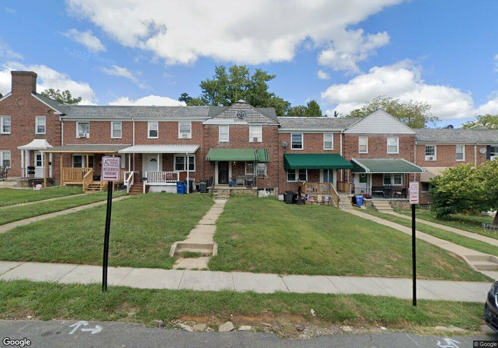
5222 Cromarty Rd Baltimore, MD 21229
Catonsville AreaEstimated Value: $186,000 - $256,000
About This Home
This home is located at 5222 Cromarty Rd, Baltimore, MD 21229 and is currently estimated at $224,424, approximately $175 per square foot. 5222 Cromarty Rd is a home located in Baltimore County with nearby schools including Westowne Elementary, Catonsville Middle School, and Catonsville High School.
Ownership History
We collect this data history from publicly available records. To have your information removed, we recommend requesting removal directly through your county’s website.
Purchase Details
Purchase Details
Home Financials for this Owner
Home Financials are based on the most recent Mortgage that was taken out on this home.Purchase Details
Purchase Details
Home Values in the Area
Average Home Value in this Area
Purchase History
We collect this data history from publicly available records. To have your information removed, we recommend requesting removal directly through your county’s website.
| Date | Buyer | Sale Price | Title Company |
|---|---|---|---|
| $184,800 | None Listed On Document | ||
| $159,900 | -- | ||
| $83,000 | -- | ||
| $47,200 | -- |
Mortgage History
We collect this data history from publicly available records. To have your information removed, we recommend requesting removal directly through your county’s website.
| Date | Status | Borrower | Loan Amount |
|---|---|---|---|
| Previous Owner | $44,186 | ||
| Previous Owner | $158,644 |
Tax History
We collect this data history from publicly available records. To have your information removed, we recommend requesting removal directly through your county’s website.
| Year | Tax Paid | Tax Assessment Tax Assessment Total Assessment is a certain percentage of the fair market value that is determined by local assessors to be the total taxable value of land and additions on the property. | Land | Improvement |
|---|---|---|---|---|
| 2025 | $2,593 | $159,367 | ||
| 2024 | $2,593 | $151,500 | $48,000 | $103,500 |
| 2023 | $1,460 | $149,800 | $0 | $0 |
| 2022 | $2,370 | $148,100 | $0 | $0 |
| 2021 | $1,957 | $146,400 | $48,000 | $98,400 |
| 2020 | $1,654 | $136,500 | $0 | $0 |
| 2019 | $1,534 | $126,600 | $0 | $0 |
| 2018 | $1,867 | $116,700 | $46,400 | $70,300 |
| 2017 | $1,836 | $116,700 | $0 | $0 |
| 2016 | $2,033 | $116,700 | $0 | $0 |
| 2015 | $2,033 | $118,600 | $0 | $0 |
| 2014 | $2,033 | $118,600 | $0 | $0 |
Map
- 601 Braeside Rd
- 724 Charing Cross Rd
- 614 Stamford Rd
- 5438 Masefield Rd
- 410 Kingston Rd
- 401 Kingston Rd
- 906 Masefield Rd
- 5306 Brabant Rd
- 10 Mardrew Rd
- 19 Mardrew Rd
- 1424 N Forest Park Ave
- 1418 N Forest Park Ave
- 1191 Granville Rd
- 5612 Saint Marys St
- 1024 Wedgewood Rd
- 4905 Briarclift Rd
- 1040 Wedgewood Rd
- 327 Stratford Rd
- 355 Whitfield Rd
- 5512 Medwick Garth N
- 805 Braeside Rd
- 807 Braeside Rd
- 803 Braeside Rd
- 809 Braeside Rd
- 801 Braeside Rd
- 811 Braeside Rd
- 813 Braeside Rd
- 815 Braeside Rd
- 5226 Cromarty Rd
- 5228 Cromarty Rd Unit B
- 5228 Cromarty Rd
- 817 Braeside Rd
- 5224 Cromarty Rd
- 819 Braeside Rd
- 821 Braeside Rd
- 5220 Cromarty Rd
- 816 Braeside Rd
- 808 Braeside Rd
- 810 Braeside Rd
- 806 Braeside Rd
Ask me questions while you tour the home.