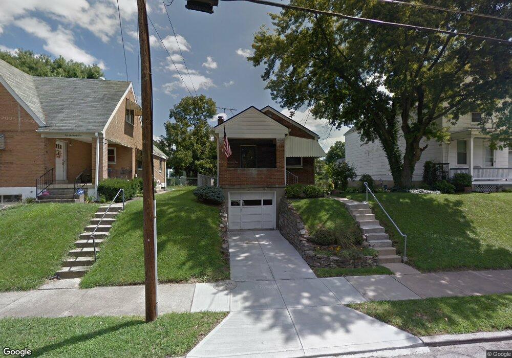
5222 Section Ave Cincinnati, OH 45212
Estimated Value: $161,000 - $168,000
2
Beds
1
Bath
800
Sq Ft
$206/Sq Ft
Est. Value
About This Home
This home is located at 5222 Section Ave, Cincinnati, OH 45212 and is currently estimated at $164,958, approximately $206 per square foot. 5222 Section Ave is a home located in Hamilton County with nearby schools including Norwood High School, Summit Academy Community School - Cincinnati, and Cornerstone Christian Academy.
Ownership History
Date
Name
Owned For
Owner Type
Purchase Details
Closed on
Apr 17, 2021
Sold by
King Eric T and King Kathryn S
Bought by
King Eric T and King Kathryn S
Current Estimated Value
Home Financials for this Owner
Home Financials are based on the most recent Mortgage that was taken out on this home.
Original Mortgage
$101,750
Outstanding Balance
$74,478
Interest Rate
3.1%
Mortgage Type
FHA
Estimated Equity
$90,480
Purchase Details
Closed on
Aug 6, 1993
Sold by
Hopper Lowell R
Bought by
King Eric T
Create a Home Valuation Report for This Property
The Home Valuation Report is an in-depth analysis detailing your home's value as well as a comparison with similar homes in the area
Home Values in the Area
Average Home Value in this Area
Purchase History
| Date | Buyer | Sale Price | Title Company |
|---|---|---|---|
| King Eric T | -- | First Integrity Title | |
| King Eric T | $56,000 | -- |
Source: Public Records
Mortgage History
| Date | Status | Borrower | Loan Amount |
|---|---|---|---|
| Open | King Eric T | $101,750 |
Source: Public Records
Tax History
| Year | Tax Paid | Tax Assessment Tax Assessment Total Assessment is a certain percentage of the fair market value that is determined by local assessors to be the total taxable value of land and additions on the property. | Land | Improvement |
|---|---|---|---|---|
| 2025 | $2,172 | $41,864 | $11,753 | $30,111 |
| 2024 | $2,109 | $41,864 | $11,753 | $30,111 |
| 2023 | $2,166 | $41,864 | $11,753 | $30,111 |
| 2022 | $1,872 | $30,359 | $8,890 | $21,469 |
| 2021 | $1,812 | $30,359 | $8,890 | $21,469 |
| 2020 | $1,818 | $30,359 | $8,890 | $21,469 |
| 2019 | $1,728 | $26,632 | $7,798 | $18,834 |
| 2018 | $1,730 | $26,632 | $7,798 | $18,834 |
| 2017 | $1,635 | $26,632 | $7,798 | $18,834 |
| 2016 | $1,741 | $27,426 | $7,329 | $20,097 |
| 2015 | $1,548 | $27,426 | $7,329 | $20,097 |
| 2014 | $1,548 | $27,426 | $7,329 | $20,097 |
| 2013 | $1,629 | $29,180 | $7,798 | $21,382 |
Source: Public Records
Map
Nearby Homes
- 5203 Rolston Ave
- 1945 Lawn Ave
- 1958 Catalina Ave
- 5119 Warren Ave
- 5121 Rolston Ave
- 5256 Warren Ave
- 5224 Hunter Ave
- 5234 Hunter Ave
- 5229 Globe Ave
- 5314 Section Ave
- 5258 Hunter Ave
- 5123 Globe Ave
- 5126 Globe Ave
- 1966 Avonlea Ave
- 5310 Globe Ave
- 5309 Carthage Ave
- 1933 Northcut Ave
- 1832 Catalina Ave
- 5336 Globe Ave
- 2134 Ross Ave
- 5218 Section Ave
- 5224 Section Ave
- 5214 Section Ave
- 5221 Warren Ave
- 5227 Warren Ave
- 5228 Section Ave
- 5229 Warren Ave
- 5213 Warren Ave
- 5208 Section Ave
- 1971 Catalina Ave
- 5233 Warren Ave
- 5219 Rhode Island Ave
- 5211 Warren Ave
- 5217 Rhode Island Ave
- 1967 Catalina Ave
- 5237 Warren Ave
- 5234 Section Ave
- 5209 Warren Ave
- 5209 Warren Ave
- 5204 Section Ave
Your Personal Tour Guide
Ask me questions while you tour the home.