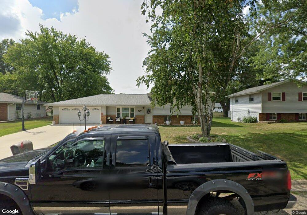
5222 W Airways Rd Peoria, IL 61607
Estimated Value: $130,769 - $197,000
3
Beds
2
Baths
1,260
Sq Ft
$141/Sq Ft
Est. Value
About This Home
This home is located at 5222 W Airways Rd, Peoria, IL 61607 and is currently estimated at $178,192, approximately $141 per square foot. 5222 W Airways Rd is a home located in Peoria County with nearby schools including Monroe Elementary School, Limestone Community High School, and New Life Christian Academy.
Ownership History
Date
Name
Owned For
Owner Type
Purchase Details
Closed on
Sep 2, 2014
Sold by
Young Terry L and Young Diana L
Bought by
Sprout Tera
Current Estimated Value
Home Financials for this Owner
Home Financials are based on the most recent Mortgage that was taken out on this home.
Original Mortgage
$110,000
Outstanding Balance
$84,150
Interest Rate
4.12%
Mortgage Type
New Conventional
Estimated Equity
$94,042
Purchase Details
Closed on
Oct 25, 2013
Bought by
Young Terry L and Young Diana L
Create a Home Valuation Report for This Property
The Home Valuation Report is an in-depth analysis detailing your home's value as well as a comparison with similar homes in the area
Home Values in the Area
Average Home Value in this Area
Purchase History
| Date | Buyer | Sale Price | Title Company |
|---|---|---|---|
| Sprout Tera | $120,000 | Attorney Only | |
| Young Terry L | $120,000 | -- |
Source: Public Records
Mortgage History
| Date | Status | Borrower | Loan Amount |
|---|---|---|---|
| Open | Sprout Tera | $110,000 |
Source: Public Records
Tax History Compared to Growth
Tax History
| Year | Tax Paid | Tax Assessment Tax Assessment Total Assessment is a certain percentage of the fair market value that is determined by local assessors to be the total taxable value of land and additions on the property. | Land | Improvement |
|---|---|---|---|---|
| 2024 | $3,722 | $48,780 | $7,960 | $40,820 |
| 2023 | $3,494 | $45,170 | $7,370 | $37,800 |
| 2022 | $3,245 | $42,110 | $6,960 | $35,150 |
| 2021 | $3,129 | $40,490 | $6,690 | $33,800 |
| 2020 | $2,947 | $39,700 | $6,560 | $33,140 |
| 2019 | $2,941 | $39,700 | $6,560 | $33,140 |
| 2018 | $2,896 | $39,680 | $6,550 | $33,130 |
| 2017 | $3,007 | $40,080 | $6,620 | $33,460 |
| 2016 | $2,903 | $40,490 | $6,690 | $33,800 |
| 2015 | $3,137 | $39,700 | $6,560 | $33,140 |
| 2014 | $2,699 | $43,300 | $6,450 | $36,850 |
| 2013 | -- | $43,300 | $6,450 | $36,850 |
Source: Public Records
Map
Nearby Homes
- 5115 W Harp Hollow Rd
- #8 W Harp Hollow Rd
- 5217 W Monroe Rd
- 1815 S Timber Ct
- 0 S Skyway Rd
- 5000 W Woodfern Rd
- 4815 Wanda Ave
- 909 Mcmullen Rd
- 923 S Johanson Rd
- 1000 Taylor Ln
- 1029 W Tall Oaks Ct
- 1123 S Maxwell Rd
- 4 Graham Ave
- 234 Harrison St
- 117 Harrison St
- 612 S Main St
- 0 Kim Moor Rd
- 5910 W Fairview Rd
- 850 S Kim Moor Rd
- 323 Buena Vista St
- 5216 W Airways Rd
- 5226 W Airways Rd
- 5215 W Harp Hollow Rd
- 5221 W Airways Rd
- 5210 W Airways Rd
- 5211 W Harp Hollow Rd
- 2120 S McDonald Ln
- 5304 W Airways Rd
- 5207 W Harp Hollow Rd
- 5215 W Airways Rd
- 2124 S McDonald Ln
- 5206 W Airways Rd
- 2116 S McDonald Ln
- 5303 W Airways Rd
- 5209 W Airways Rd
- 5203 W Harp Hollow Rd
- 5222 W Vale Ct
- 5312 W Airways Rd
- 5226 W Vale Ct Unit 8A
- 5205 W Airways Rd