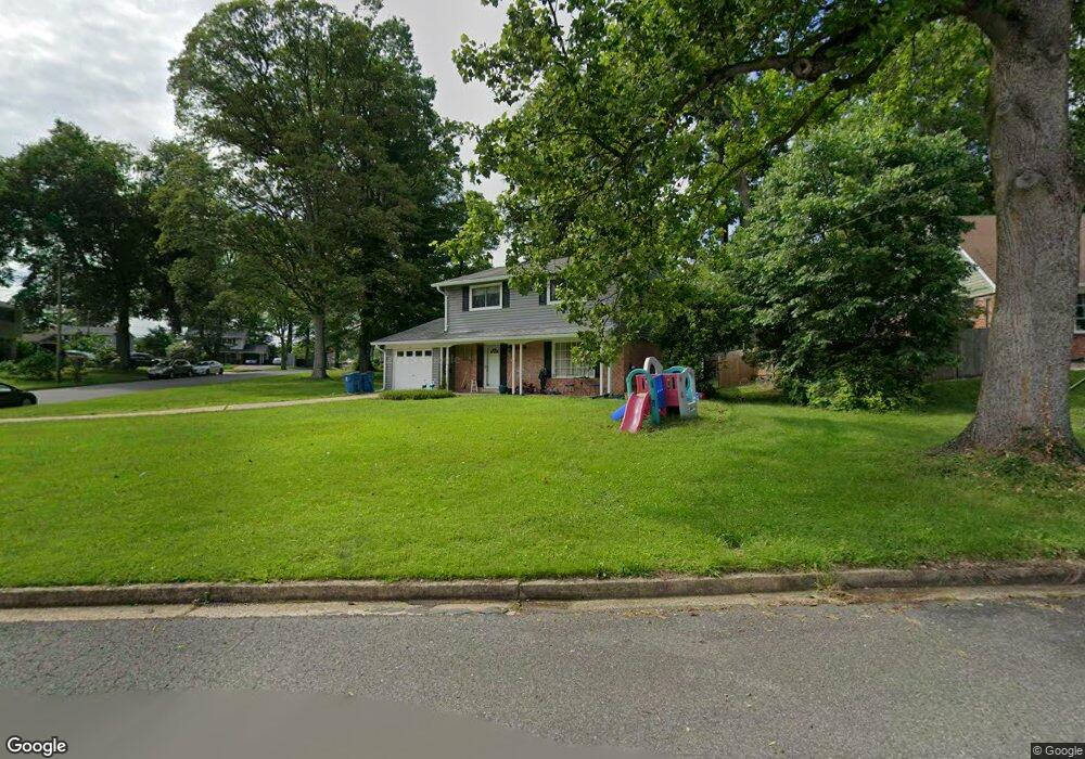
5223 Grantham St Springfield, VA 22151
Estimated Value: $763,000 - $820,000
4
Beds
3
Baths
1,938
Sq Ft
$406/Sq Ft
Est. Value
About This Home
This home is located at 5223 Grantham St, Springfield, VA 22151 and is currently estimated at $786,581, approximately $405 per square foot. 5223 Grantham St is a home located in Fairfax County with nearby schools including Kings Park Elementary School, Kings Glen Elementary School, and Lake Braddock Secondary School.
Ownership History
Date
Name
Owned For
Owner Type
Purchase Details
Closed on
Nov 20, 2019
Sold by
Kan Betty N and Kan Family Trust
Bought by
Novgrod Elizabeth S and Novgrod Jon M
Current Estimated Value
Purchase Details
Closed on
Sep 29, 1994
Sold by
Shiflette Jeffrey W
Bought by
Kan Darryl B
Home Financials for this Owner
Home Financials are based on the most recent Mortgage that was taken out on this home.
Original Mortgage
$105,000
Interest Rate
8.5%
Create a Home Valuation Report for This Property
The Home Valuation Report is an in-depth analysis detailing your home's value as well as a comparison with similar homes in the area
Home Values in the Area
Average Home Value in this Area
Purchase History
| Date | Buyer | Sale Price | Title Company |
|---|---|---|---|
| Novgrod Elizabeth S | -- | None Available | |
| Kan Darryl B | $188,500 | -- |
Source: Public Records
Mortgage History
| Date | Status | Borrower | Loan Amount |
|---|---|---|---|
| Previous Owner | Kan Darryl B | $105,000 |
Source: Public Records
Tax History
| Year | Tax Paid | Tax Assessment Tax Assessment Total Assessment is a certain percentage of the fair market value that is determined by local assessors to be the total taxable value of land and additions on the property. | Land | Improvement |
|---|---|---|---|---|
| 2025 | $7,791 | $739,210 | $311,000 | $428,210 |
| 2023 | $7,363 | $652,470 | $276,000 | $376,470 |
| 2022 | $7,354 | $643,120 | $271,000 | $372,120 |
| 2021 | $6,540 | $557,330 | $241,000 | $316,330 |
| 2020 | $6,325 | $534,420 | $236,000 | $298,420 |
| 2019 | $6,094 | $514,940 | $228,000 | $286,940 |
| 2018 | $5,703 | $495,940 | $209,000 | $286,940 |
| 2017 | $5,467 | $470,900 | $195,000 | $275,900 |
| 2016 | $5,455 | $470,900 | $195,000 | $275,900 |
Source: Public Records
Map
Nearby Homes
- 8621 Kenilworth Dr
- 5519 Yorkshire St
- 4962 Sabra Ln
- 5207 Capon Hill Place
- 8405 Thames St
- 8921 Braeburn Dr
- 5809 Shana Place
- 5460 Truxion Ct
- 4704 Federal Ct
- 4909 Tibbitt Ln
- 8527 Pappas Way
- 5835 Fitzhugh St
- 5844 Kara Place
- 8623 Pappas Way
- 8309 Highcliffe Ct
- 9532 Burdett Rd
- 5211 Inverchapel Rd
- 8311 Chapel Lake Ct
- 5818 Torington Dr Unit 859
- 8519 Westover Ct Unit 763
- 8814 Cromwell Dr
- 5221 Grantham St
- 8815 Victoria Rd
- 8900 Cromwell Dr
- 8813 Cromwell Dr
- 8812 Cromwell Dr
- 8815 Cromwell Dr
- 5220 Grantham St
- 8811 Cromwell Dr
- 8901 Cromwell Dr
- 8813 Victoria Rd
- 8810 Cromwell Dr
- 8902 Cromwell Dr
- 5219 Grantham St
- 8903 Victoria Rd
- 8820 Victoria Rd
- 8810 Trafalgar Ct
- 8809 Cromwell Dr
- 8903 Cromwell Dr
- 8811 Victoria Rd
Your Personal Tour Guide
Ask me questions while you tour the home.