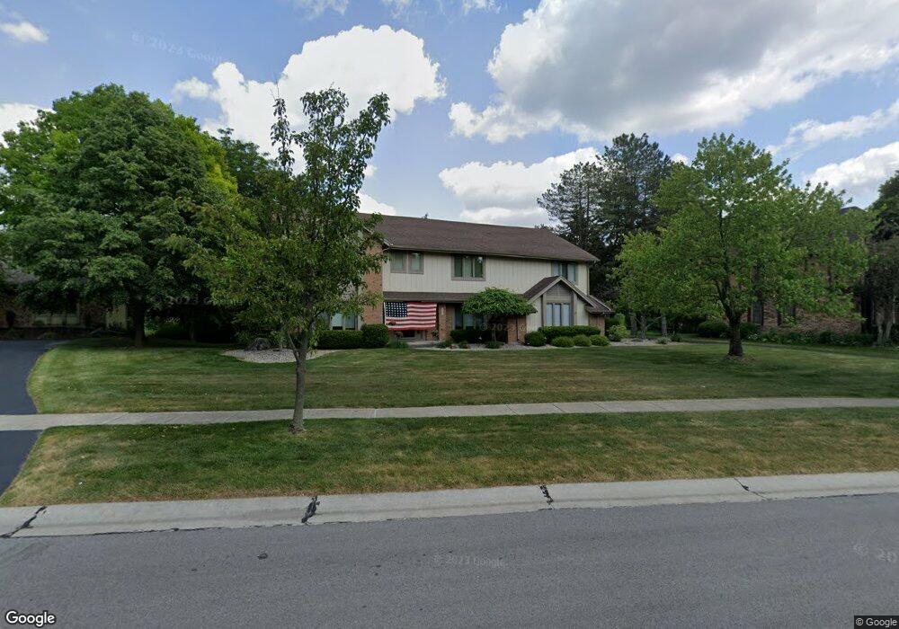
5224 Brookfield Ln Sylvania, OH 43560
Estimated Value: $376,000 - $493,000
5
Beds
3
Baths
3,731
Sq Ft
$120/Sq Ft
Est. Value
About This Home
This home is located at 5224 Brookfield Ln, Sylvania, OH 43560 and is currently estimated at $448,066, approximately $120 per square foot. 5224 Brookfield Ln is a home located in Lucas County with nearby schools including Highland Elementary School, Sylvania McCord Junior High School, and Sylvania Northview High School.
Ownership History
Date
Name
Owned For
Owner Type
Purchase Details
Closed on
Nov 23, 2005
Sold by
Lishewski Forrest E and Lishewski Ellen R
Bought by
Pfau Thomas W and Pfau Nancy S
Current Estimated Value
Home Financials for this Owner
Home Financials are based on the most recent Mortgage that was taken out on this home.
Original Mortgage
$183,920
Interest Rate
6.2%
Mortgage Type
Purchase Money Mortgage
Purchase Details
Closed on
Jul 6, 1993
Sold by
Berkoben R R and S R
Create a Home Valuation Report for This Property
The Home Valuation Report is an in-depth analysis detailing your home's value as well as a comparison with similar homes in the area
Home Values in the Area
Average Home Value in this Area
Purchase History
| Date | Buyer | Sale Price | Title Company |
|---|---|---|---|
| Pfau Thomas W | $229,900 | Metro Title Agency Inc | |
| -- | $210,000 | -- |
Source: Public Records
Mortgage History
| Date | Status | Borrower | Loan Amount |
|---|---|---|---|
| Previous Owner | Pfau Thomas W | $183,920 |
Source: Public Records
Tax History Compared to Growth
Tax History
| Year | Tax Paid | Tax Assessment Tax Assessment Total Assessment is a certain percentage of the fair market value that is determined by local assessors to be the total taxable value of land and additions on the property. | Land | Improvement |
|---|---|---|---|---|
| 2024 | $4,647 | $157,255 | $19,705 | $137,550 |
| 2023 | $7,906 | $118,195 | $16,905 | $101,290 |
| 2022 | $7,947 | $118,195 | $16,905 | $101,290 |
| 2021 | $8,159 | $118,195 | $16,905 | $101,290 |
| 2020 | $7,618 | $99,435 | $13,720 | $85,715 |
| 2019 | $7,328 | $99,435 | $13,720 | $85,715 |
| 2018 | $3,665 | $99,435 | $13,720 | $85,715 |
| 2017 | $7,261 | $90,720 | $10,290 | $80,430 |
| 2016 | $7,116 | $259,200 | $29,400 | $229,800 |
| 2015 | $6,694 | $259,200 | $29,400 | $229,800 |
| 2014 | $3,103 | $87,260 | $9,910 | $77,350 |
| 2013 | $6,207 | $87,260 | $9,910 | $77,350 |
Source: Public Records
Map
Nearby Homes
- 5235 Brookfield Ln
- 5346 Palisades Dr
- 8134 Little Rd
- 5310 Turnberry Ln
- 5666 Fox Hollow Ct
- 5646 Breezy Porch Dr
- 4902 Marble Cliff Blvd
- 7858 Erie St
- 6332 Brint Rd
- 6322 Brint Rd
- 6312 Brint Rd
- 6302 Brint Rd
- 7839 Hedingham Rd
- 7345 Country Commons Ln
- 8362 Sylvania Metamora Rd
- 7428 Kings Walk Ln
- 4504 Promenade Ln
- 7565 Peachtree Ln
- 4850 Tamworth Rd
- 5009 Island Park Blvd
- 5214 Brookfield Ln
- 5234 Brookfield Ln
- 5204 Brookfield Ln
- 5244 Brookfield Ln
- 5223 Brookfield Ln
- 5245 Brookfield Ln
- 5209 Brookfield Ln
- 5254 Brookfield Ln
- 5158 Brookfield Ln
- 5255 Brookfield Ln
- 5222 Fairmeadow Dr
- 5234 Fairmeadow Dr
- 5159 Brookfield Ln
- 5210 Fairmeadow Dr
- 5244 Fairmeadow Dr
- 5148 Brookfield Ln
- 5300 Brookfield Ln
- 5301 Brookfield Ln
- 5256 Fairmeadow Dr
- 5160 Fairmeadow Dr