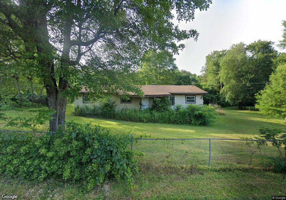
5224 Smawley Ave Morganton, NC 28655
Estimated Value: $139,000 - $261,000
3
Beds
2
Baths
1,512
Sq Ft
$131/Sq Ft
Est. Value
About This Home
This home is located at 5224 Smawley Ave, Morganton, NC 28655 and is currently estimated at $198,489, approximately $131 per square foot. 5224 Smawley Ave is a home located in Burke County with nearby schools including Glen Alpine Elementary School, Table Rock Middle School, and Freedom High School.
Ownership History
Date
Name
Owned For
Owner Type
Purchase Details
Closed on
Aug 12, 2008
Sold by
Stewart Gerald and Stewart Lenora J
Bought by
Kd Support Services Llc
Current Estimated Value
Home Financials for this Owner
Home Financials are based on the most recent Mortgage that was taken out on this home.
Original Mortgage
$35,000
Interest Rate
6.31%
Mortgage Type
Purchase Money Mortgage
Create a Home Valuation Report for This Property
The Home Valuation Report is an in-depth analysis detailing your home's value as well as a comparison with similar homes in the area
Home Values in the Area
Average Home Value in this Area
Purchase History
| Date | Buyer | Sale Price | Title Company |
|---|---|---|---|
| Kd Support Services Llc | $40,000 | None Available |
Source: Public Records
Mortgage History
| Date | Status | Borrower | Loan Amount |
|---|---|---|---|
| Closed | Kd Support Services Llc | $35,000 |
Source: Public Records
Tax History
| Year | Tax Paid | Tax Assessment Tax Assessment Total Assessment is a certain percentage of the fair market value that is determined by local assessors to be the total taxable value of land and additions on the property. | Land | Improvement |
|---|---|---|---|---|
| 2025 | $623 | $81,622 | $11,220 | $70,402 |
| 2024 | $623 | $81,622 | $11,220 | $70,402 |
| 2023 | $623 | $81,622 | $11,220 | $70,402 |
| 2022 | $637 | $68,987 | $11,220 | $57,767 |
| 2021 | $631 | $68,987 | $11,220 | $57,767 |
| 2020 | $627 | $68,987 | $11,220 | $57,767 |
| 2019 | $627 | $68,987 | $11,220 | $57,767 |
| 2018 | $620 | $68,885 | $11,220 | $57,665 |
| 2017 | $618 | $68,885 | $11,220 | $57,665 |
| 2016 | $602 | $68,885 | $11,220 | $57,665 |
| 2015 | $644 | $68,885 | $11,220 | $57,665 |
| 2014 | $643 | $74,624 | $11,220 | $63,404 |
| 2013 | $837 | $74,624 | $11,220 | $63,404 |
Source: Public Records
Map
Nearby Homes
- 3903 Dysartsville Rd
- 3613 Jamestown Rd
- 4148 Tallent Rd
- 4188 Tallent Rd
- 2705 US 70 W
- 1775 U S 70
- 4655 Mcalpine Ave
- 4540 Mcalpine Ave
- 3724 Kathy Rd
- 5895 Old Highway 70
- 00 Snowhill Church Rd
- 4186 Maple Trail
- 4184 Maple Trail
- 5264 Matthews Pond Rd
- 98 Sundown Rd
- 4555 Bristol Dr
- 4498 Bristol Dr Unit 24
- 4482 Bristol Dr Unit 25
- 4542 Bristol Dr Unit 22
- 4629 Bristol Dr Unit 14
- 5196 Smawley Ave
- 5210 Clontz Ave
- 5188 Clontz Ave
- 4075 Woods St
- 5170 Clontz Ave
- 5227 Clontz Ave
- 4051 Woods St
- 5168 Smawley Ave
- 5163 Clontz Ave
- 4025 Woods St
- 4046 Smawley St
- 5189 Coffee Dr
- 5148 Smawley Ave
- 4017 Woods St
- 4085 Dysartsville Rd
- 3978 Pritchard Dr
- 5163 Coffee Dr
- 4005 Dysartsville Rd
- 4045 Smawley St
- 4069 Smawley St
Your Personal Tour Guide
Ask me questions while you tour the home.