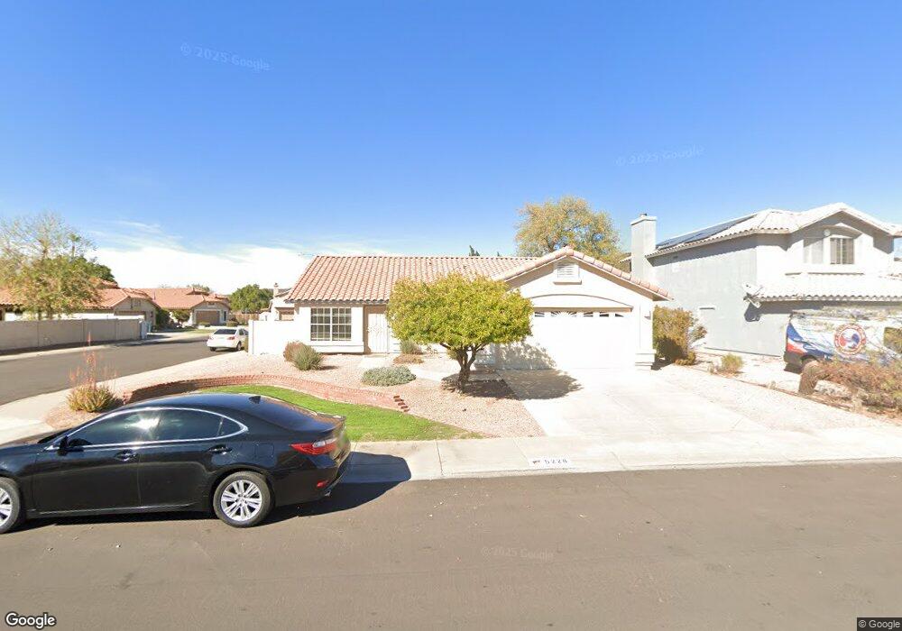
5228 W Tonto Rd Glendale, AZ 85308
Arrowhead NeighborhoodEstimated Value: $386,093 - $488,000
--
Bed
2
Baths
1,649
Sq Ft
$269/Sq Ft
Est. Value
About This Home
This home is located at 5228 W Tonto Rd, Glendale, AZ 85308 and is currently estimated at $443,523, approximately $268 per square foot. 5228 W Tonto Rd is a home located in Maricopa County with nearby schools including Mountain Shadows Elementary School, Desert Sky Middle School, and Deer Valley High School.
Ownership History
Date
Name
Owned For
Owner Type
Purchase Details
Closed on
Mar 24, 2014
Sold by
Essary Mary N
Bought by
Essary Mary N
Current Estimated Value
Home Financials for this Owner
Home Financials are based on the most recent Mortgage that was taken out on this home.
Original Mortgage
$142,450
Outstanding Balance
$41,586
Interest Rate
4.17%
Mortgage Type
FHA
Estimated Equity
$401,937
Purchase Details
Closed on
May 22, 2002
Sold by
Hayes Brian J
Bought by
Essary Mary N
Create a Home Valuation Report for This Property
The Home Valuation Report is an in-depth analysis detailing your home's value as well as a comparison with similar homes in the area
Home Values in the Area
Average Home Value in this Area
Purchase History
| Date | Buyer | Sale Price | Title Company |
|---|---|---|---|
| Essary Mary N | -- | None Available | |
| Essary Mary N | -- | Capital Title Agency Inc | |
| Essary Mary N | $151,000 | Capital Title Agency Inc |
Source: Public Records
Mortgage History
| Date | Status | Borrower | Loan Amount |
|---|---|---|---|
| Open | Essary Mary N | $142,450 |
Source: Public Records
Tax History Compared to Growth
Tax History
| Year | Tax Paid | Tax Assessment Tax Assessment Total Assessment is a certain percentage of the fair market value that is determined by local assessors to be the total taxable value of land and additions on the property. | Land | Improvement |
|---|---|---|---|---|
| 2025 | $1,583 | $19,669 | -- | -- |
| 2024 | $1,569 | $18,732 | -- | -- |
| 2023 | $1,569 | $31,500 | $6,300 | $25,200 |
| 2022 | $1,527 | $24,220 | $4,840 | $19,380 |
| 2021 | $1,610 | $22,750 | $4,550 | $18,200 |
| 2020 | $1,593 | $20,680 | $4,130 | $16,550 |
| 2019 | $1,553 | $18,930 | $3,780 | $15,150 |
| 2018 | $1,514 | $17,560 | $3,510 | $14,050 |
| 2017 | $1,473 | $17,110 | $3,420 | $13,690 |
| 2016 | $1,398 | $16,730 | $3,340 | $13,390 |
| 2015 | $1,296 | $14,500 | $2,900 | $11,600 |
Source: Public Records
Map
Nearby Homes
- 19519 N 53rd Dr
- 4932 W Oraibi Dr
- 19814 N 49th Dr
- 19731 N 55th Ave
- 5153 W Pontiac Dr
- 4918 W Wahalla Ln Unit 1
- 4824 W Kristal Way
- 5415 W Pontiac Dr
- 20283 N 51st Dr Unit 8B
- 20045 N 49th Dr
- 19016 N 52nd Ln
- 4780 W Piute Ave
- 18832 N 50th Ave
- 20390 N 54th Ave
- 4760 W Wahalla Ln
- 4908 W Wescott Dr
- 20391 N 55th Dr
- 18819 N 49th Ave
- 20615 N 55th Ave
- 4725 W Kristal Way
- 5224 W Tonto Rd
- 19721 N 52nd Dr
- 5232 W Tonto Rd
- 5220 W Tonto Rd
- 5227 W Tonto Rd
- 19720 N 52nd Dr
- 5223 W Tonto Rd
- 5236 W Tonto Rd
- 5231 W Tonto Rd
- 5216 W Tonto Rd
- 19725 N 52nd Dr
- 5219 W Tonto Rd
- 19722 N 52nd Ave
- 5235 W Tonto Rd
- 19724 N 52nd Dr
- 5240 W Tonto Rd
- 19729 N 52nd Dr
- 5215 W Tonto Rd
- 19728 N 52nd Dr
- 5232 W Oraibi Dr