Estimated Value: $378,582 - $469,000
2
Beds
1
Bath
800
Sq Ft
$539/Sq Ft
Est. Value
About This Home
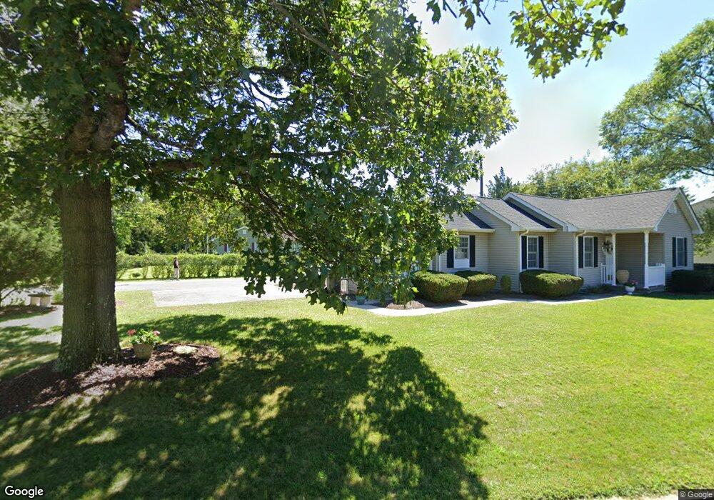
This home is located at 523 Adamston Rd, Brick, NJ 08723 and is currently estimated at $431,146, approximately $538 per square foot. 523 Adamston Rd is a home with nearby schools including Osbornville Elementary School, Lake Riviera Middle School, and Brick Township High School.
Ownership History
Date
Name
Owned For
Owner Type
Purchase Details
Closed on
Aug 17, 2007
Sold by
Brower Thomas and Brower Samantha
Bought by
Redmond Clay and Redmond Darrell
Current Estimated Value
Purchase Details
Closed on
Nov 16, 2005
Sold by
Bohach Lori and Bohach Gregg
Bought by
Brower Thomas
Home Financials for this Owner
Home Financials are based on the most recent Mortgage that was taken out on this home.
Original Mortgage
$42,000
Interest Rate
6.17%
Mortgage Type
Stand Alone Second
Purchase Details
Closed on
Nov 22, 1996
Sold by
Walsh Brian
Bought by
Hibbard Mark
Home Financials for this Owner
Home Financials are based on the most recent Mortgage that was taken out on this home.
Original Mortgage
$95,000
Interest Rate
7.81%
Create a Home Valuation Report for This Property
The Home Valuation Report is an in-depth analysis detailing your home's value as well as a comparison with similar homes in the area
Home Values in the Area
Average Home Value in this Area
Purchase History
| Date | Buyer | Sale Price | Title Company |
|---|---|---|---|
| Redmond Clay | $270,000 | None Available | |
| Brower Thomas | $261,000 | -- | |
| Hibbard Mark | $105,000 | -- |
Source: Public Records
Mortgage History
| Date | Status | Borrower | Loan Amount |
|---|---|---|---|
| Previous Owner | Brower Thomas | $42,000 | |
| Previous Owner | Brower Thomas | $208,800 | |
| Previous Owner | Hibbard Mark | $95,000 |
Source: Public Records
Tax History Compared to Growth
Tax History
| Year | Tax Paid | Tax Assessment Tax Assessment Total Assessment is a certain percentage of the fair market value that is determined by local assessors to be the total taxable value of land and additions on the property. | Land | Improvement |
|---|---|---|---|---|
| 2025 | $5,148 | $199,300 | $125,200 | $74,100 |
| 2024 | $4,893 | $199,300 | $125,200 | $74,100 |
| 2023 | $4,829 | $199,300 | $125,200 | $74,100 |
| 2022 | $4,829 | $199,300 | $125,200 | $74,100 |
| 2021 | $4,718 | $199,300 | $125,200 | $74,100 |
| 2020 | $4,668 | $199,300 | $125,200 | $74,100 |
| 2019 | $4,590 | $199,300 | $125,200 | $74,100 |
| 2018 | $4,484 | $199,300 | $125,200 | $74,100 |
| 2017 | $4,363 | $199,300 | $125,200 | $74,100 |
| 2016 | $4,341 | $199,300 | $125,200 | $74,100 |
| 2015 | $4,227 | $199,300 | $125,200 | $74,100 |
| 2014 | $4,193 | $199,300 | $125,200 | $74,100 |
Source: Public Records
Map
Nearby Homes
- 417 Mamie Dr
- 484 Bara St
- 463 Mamie Dr
- 455 Mamie Dr
- 0 Mantoloking Rd Unit 11584872
- 507 Riverside Dr S
- 618 Leanora St
- 470 Mantoloking Rd
- 10 Riverside Dr W
- 621 Preston St
- 570 Mantoloking Rd
- 474 Burnt Bark Rd
- 553 Kingfisher Cr
- 553 Kingfisher Cir
- 458 Drum Point Rd
- 455 Drum Point Rd
- 118 Law-Win Ct
- 82 E View Dr
- 00 Mantoloking Rd
- VZ0 Mantoloking Rd
- 524 Old Adamston Rd
- 522 Old Adamston Rd
- 480 Allison Place
- 513 Old Adamston Rd
- 518 Adamston Rd
- 524 Adamston Rd
- 511 Adamston Rd
- 530 Whitehorn Ct
- 481 Allison Place
- 520 Old Adamston Rd
- 521 Old Adamston Rd
- 509 Dorothy Place
- 525 Old Adamston Rd
- 528 Whitehorn Ct
- 390 Mamie Dr
- 526 Whitehorn Ct
- 511 Dorothy Place
- 507 Dorothy Place
- 507 Adamston Rd
- 531 Whitehorn Ct