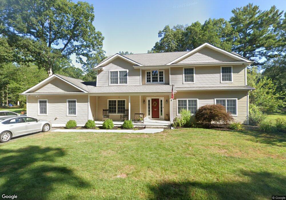
523 Clarkstown Rd Mays Landing, NJ 08330
Estimated Value: $522,961 - $989,000
--
Bed
--
Bath
4,130
Sq Ft
$162/Sq Ft
Est. Value
About This Home
This home is located at 523 Clarkstown Rd, Mays Landing, NJ 08330 and is currently estimated at $667,740, approximately $161 per square foot. 523 Clarkstown Rd is a home located in Atlantic County with nearby schools including George L. Hess Educational Complex, Joseph Shaner School, and William Davies Middle School.
Ownership History
Date
Name
Owned For
Owner Type
Purchase Details
Closed on
Dec 8, 2000
Sold by
Aberman Michael P and Aberman Lisa Ann
Bought by
Robinson Matthew C and Robinson Lori A
Current Estimated Value
Home Financials for this Owner
Home Financials are based on the most recent Mortgage that was taken out on this home.
Original Mortgage
$135,325
Outstanding Balance
$49,905
Interest Rate
7.71%
Estimated Equity
$617,835
Purchase Details
Closed on
May 28, 1999
Sold by
Marchese Massler Judith A
Bought by
Aberman Michael P and Aberman Lisa Ann
Home Financials for this Owner
Home Financials are based on the most recent Mortgage that was taken out on this home.
Original Mortgage
$132,900
Interest Rate
6.85%
Mortgage Type
FHA
Purchase Details
Closed on
Sep 25, 1995
Sold by
Day Sean M and Day Joan E
Bought by
Marchese Massler Judith A
Purchase Details
Closed on
Sep 20, 1991
Sold by
Sharp Jean E
Bought by
Day Sean
Create a Home Valuation Report for This Property
The Home Valuation Report is an in-depth analysis detailing your home's value as well as a comparison with similar homes in the area
Home Values in the Area
Average Home Value in this Area
Purchase History
| Date | Buyer | Sale Price | Title Company |
|---|---|---|---|
| Robinson Matthew C | $142,500 | Fidelity National Title Ins | |
| Aberman Michael P | $133,000 | Fidelity National Title Ins | |
| Marchese Massler Judith A | $124,000 | Congress Title Corp | |
| Day Sean | $85,000 | -- |
Source: Public Records
Mortgage History
| Date | Status | Borrower | Loan Amount |
|---|---|---|---|
| Open | Robinson Matthew C | $135,325 | |
| Previous Owner | Aberman Michael P | $132,900 |
Source: Public Records
Tax History Compared to Growth
Tax History
| Year | Tax Paid | Tax Assessment Tax Assessment Total Assessment is a certain percentage of the fair market value that is determined by local assessors to be the total taxable value of land and additions on the property. | Land | Improvement |
|---|---|---|---|---|
| 2025 | $9,665 | $281,700 | $55,900 | $225,800 |
| 2024 | $9,665 | $281,700 | $55,900 | $225,800 |
| 2023 | $9,088 | $281,700 | $55,900 | $225,800 |
| 2022 | $9,088 | $281,700 | $55,900 | $225,800 |
| 2021 | $9,068 | $281,700 | $55,900 | $225,800 |
| 2020 | $9,068 | $281,700 | $55,900 | $225,800 |
| 2019 | $9,090 | $281,700 | $55,900 | $225,800 |
| 2018 | $8,772 | $281,700 | $55,900 | $225,800 |
| 2017 | $8,634 | $281,700 | $55,900 | $225,800 |
| 2016 | $8,392 | $281,700 | $55,900 | $225,800 |
| 2015 | $8,107 | $281,700 | $55,900 | $225,800 |
| 2014 | $8,146 | $310,100 | $68,900 | $241,200 |
Source: Public Records
Map
Nearby Homes
- 570 North St
- 116 Post Rd
- 1303 W Riverside Dr
- 1410 Cantillon Blvd
- 355 Penny Ln
- 246 Old River Rd
- 15 Lowell St
- 225 Old River Rd
- 148 Marucci Place
- 1403 Loretta Ave
- 109 Deal Ln
- 1404 Loretta Ave
- 1 Lafayette Ave
- 504 Meadowbrook Dr
- 112 Giunta Walk
- 1305 Matthews Ave
- 98 Gasko Rd
- 144 Knights Bridge Way
- 105 Knights Bridge Way
- 76 Gasko Rd
- 529 Clarkstown Rd
- 519 Clarkstown Rd
- 524 Gravelly Run Rd
- 513 Clarkstown Rd
- 525 Gravelly Run Rd
- 516 Clarkstown Rd
- 529 Gravelly Run Rd
- 512 Clarkstown Rd
- 474 Franklin Dr
- 472 Franklin Dr
- 476 Franklin Dr
- 528 Gravelly Run Rd
- 547 Gravelly Run Rd
- 470 Franklin Dr
- 478 Clarkstown Rd
- 545 Clarkstown Rd
- 471 Franklin Dr
- 473 Franklin Dr
- 532 Gravelly Run Rd
- 530 Clarkstown Rd