Estimated Value: $415,000 - $474,000
4
Beds
2
Baths
2,385
Sq Ft
$187/Sq Ft
Est. Value
About This Home
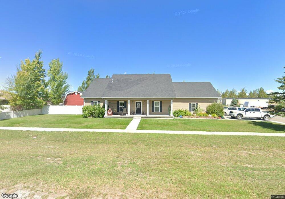
This home is located at 523 E Clark St, Lyman, WY 82937 and is currently estimated at $445,089, approximately $186 per square foot. 523 E Clark St is a home with nearby schools including Urie Elementary School, Lyman Intermediate School, and Lyman High School.
Ownership History
Date
Name
Owned For
Owner Type
Purchase Details
Closed on
May 14, 2021
Sold by
Maxfield James R and Maxfield Natasha L
Bought by
Maxfield James R and Maxfield Natasha L
Current Estimated Value
Purchase Details
Closed on
May 15, 2009
Sold by
Homestead Village Inc
Bought by
Maxfield Natasha L and Maxfield Natasha
Purchase Details
Closed on
Sep 12, 2007
Sold by
Homestead Village Inc
Bought by
Barker Janet B
Create a Home Valuation Report for This Property
The Home Valuation Report is an in-depth analysis detailing your home's value as well as a comparison with similar homes in the area
Home Values in the Area
Average Home Value in this Area
Purchase History
| Date | Buyer | Sale Price | Title Company |
|---|---|---|---|
| Maxfield James R | -- | None Available | |
| Natasha Maxfield Living Trust | -- | None Listed On Document | |
| Maxfield Natasha L | -- | None Available | |
| Barker Janet B | -- | None Available |
Source: Public Records
Tax History
| Year | Tax Paid | Tax Assessment Tax Assessment Total Assessment is a certain percentage of the fair market value that is determined by local assessors to be the total taxable value of land and additions on the property. | Land | Improvement |
|---|---|---|---|---|
| 2025 | $2,660 | $29,068 | $3,149 | $25,919 |
| 2024 | $2,647 | $39,022 | $4,747 | $34,275 |
| 2023 | $2,518 | $37,108 | $4,102 | $33,006 |
| 2022 | $1,070 | $31,438 | $3,838 | $27,600 |
| 2021 | $2,016 | $29,638 | $3,838 | $25,800 |
| 2020 | $1,826 | $27,003 | $2,875 | $24,128 |
| 2019 | $1,652 | $24,474 | $2,875 | $21,599 |
| 2018 | $1,483 | $21,964 | $2,875 | $19,089 |
| 2017 | $1,490 | $22,092 | $3,018 | $19,074 |
| 2016 | $1,534 | $22,728 | $3,018 | $19,710 |
| 2015 | -- | $22,773 | $3,018 | $19,755 |
| 2014 | -- | $22,748 | $0 | $0 |
Source: Public Records
Map
Nearby Homes
- 206 Prairie View Dr
- 217 East St N
- 219 East St N
- 109 E Clark St
- 205 N Main
- 301 E Street S
- 161 Brinton Rd
- 211 Connors Way
- 140 Connors Way
- 316 W Platts Dr
- 314 W Sage St
- 501 W Owen Ave
- BLE Sub Blk 1 Lot 1
- 506 Pinnacle Dr
- 84 Edmund Rd
- 295 County Road 253
- 771 Emigrant Rd
- 748 County Road 241
- 859 County Road 241
- 0 Wyoming 414
- 501 E Clark St
- 601 E Clark St
- 623 E Clark St
- 403 E Clark St
- 401 E Clark St
- 701 E Clark St
- 234 Prairie View Dr
- 708 E Clark St
- 301 N Elm St
- 0 Dogwood St
- 220 Prairie View Dr
- 307 N Elm St
- 321 E Clark St
- 313 N Elm St
- 302 N Elm St Unit Business Loop I 80/
- 210 2nd St
- 407 E Walnut St
- 308 N Elm St
- 312 N Elm St
- 302 E Clark St