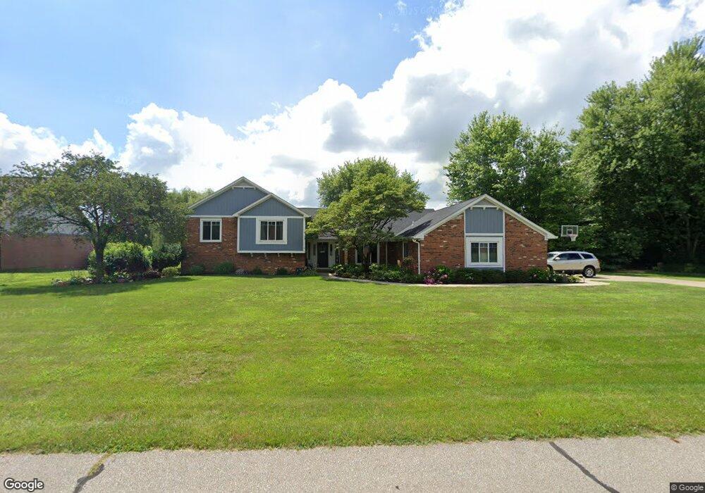
523 E Davis Dr Franklin, IN 46131
Estimated Value: $381,760 - $436,000
3
Beds
3
Baths
2,910
Sq Ft
$140/Sq Ft
Est. Value
About This Home
This home is located at 523 E Davis Dr, Franklin, IN 46131 and is currently estimated at $408,690, approximately $140 per square foot. 523 E Davis Dr is a home located in Johnson County with nearby schools including Creekside Elementary School, Custer Baker Intermediate School, and Franklin Community Middle School.
Ownership History
Date
Name
Owned For
Owner Type
Purchase Details
Closed on
Aug 10, 2012
Sold by
Auld John W and Auld Elizabeth H
Bought by
Tarvin Timothy L and Tarvin Angel D
Current Estimated Value
Home Financials for this Owner
Home Financials are based on the most recent Mortgage that was taken out on this home.
Original Mortgage
$231,000
Outstanding Balance
$156,741
Interest Rate
3.54%
Mortgage Type
New Conventional
Estimated Equity
$254,612
Create a Home Valuation Report for This Property
The Home Valuation Report is an in-depth analysis detailing your home's value as well as a comparison with similar homes in the area
Home Values in the Area
Average Home Value in this Area
Purchase History
| Date | Buyer | Sale Price | Title Company |
|---|---|---|---|
| Tarvin Timothy L | -- | None Available |
Source: Public Records
Mortgage History
| Date | Status | Borrower | Loan Amount |
|---|---|---|---|
| Open | Tarvin Timothy L | $231,000 |
Source: Public Records
Tax History
| Year | Tax Paid | Tax Assessment Tax Assessment Total Assessment is a certain percentage of the fair market value that is determined by local assessors to be the total taxable value of land and additions on the property. | Land | Improvement |
|---|---|---|---|---|
| 2025 | $2,903 | $389,800 | $53,100 | $336,700 |
| 2024 | $2,903 | $304,700 | $46,500 | $258,200 |
| 2023 | $2,968 | $311,900 | $46,500 | $265,400 |
| 2022 | $3,437 | $311,900 | $46,500 | $265,400 |
| 2021 | $2,998 | $267,700 | $29,500 | $238,200 |
| 2020 | $2,813 | $251,600 | $29,500 | $222,100 |
| 2019 | $2,725 | $253,400 | $29,500 | $223,900 |
| 2018 | $2,050 | $213,500 | $29,500 | $184,000 |
| 2017 | $2,017 | $211,200 | $29,500 | $181,700 |
| 2016 | $2,083 | $210,700 | $29,500 | $181,200 |
| 2014 | $1,969 | $205,900 | $34,400 | $171,500 |
| 2013 | $1,969 | $217,800 | $34,400 | $183,400 |
Source: Public Records
Map
Nearby Homes
- 506 Galahad Dr
- 1238 Atlas Ln
- 1286 Murphy Dr
- 492 Pelenor Dr
- 876 N Centerline Rd
- 1455 Cecil Ln
- 1424 Crabapple Rd
- 1408 Crabapple Rd
- 1338 Swan Dr
- 1664 Woodside Cir
- 1212 Crabapple Rd
- 925 Mallory Pkwy
- 1712 Turning Leaf Dr
- 1198 Supernova Dr
- 00 W State Road 144
- 1117 Foxtail Dr
- 1228 Pegasus Dr
- 1195 Andromeda Dr
- 1009 Foxtail Dr
- 1177 Pegasus Dr
- 559 E Davis Dr
- 528 E Davis Dr
- 504 E Davis Dr
- 550 E Davis Dr
- 500 E Davis Dr
- 562 E Davis Dr
- 604 E Davis Dr
- 300 Creekview Dr
- 632 E Davis Dr
- 0 Creekview Dr Unit 2826178
- 0 Creekview Dr Unit MBR2654368
- 0 Creekview Dr Unit MBR2770632
- 676 E Davis Dr
- 283 Creekview Dr
- 311 Creekview Dr
- 00 Creekside Dr N
- 703 Davis Dr
- 317 E Creekside Ct W
- 747 E Davis Dr
- 706 E Davis Dr
Your Personal Tour Guide
Ask me questions while you tour the home.