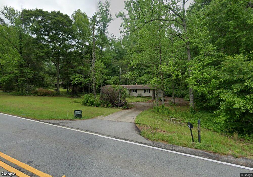
523 Forrest Ave Fayetteville, GA 30214
Estimated Value: $383,000 - $401,424
3
Beds
3
Baths
2,406
Sq Ft
$164/Sq Ft
Est. Value
About This Home
This home is located at 523 Forrest Ave, Fayetteville, GA 30214 and is currently estimated at $394,856, approximately $164 per square foot. 523 Forrest Ave is a home located in Fayette County with nearby schools including Bennett's Mill Middle School, Fayette County High School, and Rising Star Montessori School.
Ownership History
Date
Name
Owned For
Owner Type
Purchase Details
Closed on
Mar 17, 2020
Sold by
King Estelita
Bought by
Price Shirley
Current Estimated Value
Home Financials for this Owner
Home Financials are based on the most recent Mortgage that was taken out on this home.
Original Mortgage
$198,412
Outstanding Balance
$175,387
Interest Rate
3.4%
Mortgage Type
FHA
Estimated Equity
$219,469
Purchase Details
Closed on
Jun 10, 2019
Sold by
Federal National Mtg Association
Bought by
King Estelita
Purchase Details
Closed on
Oct 26, 2018
Sold by
Illingworth Thomas B Estate
Bought by
Federal National Mtg Association
Create a Home Valuation Report for This Property
The Home Valuation Report is an in-depth analysis detailing your home's value as well as a comparison with similar homes in the area
Home Values in the Area
Average Home Value in this Area
Purchase History
| Date | Buyer | Sale Price | Title Company |
|---|---|---|---|
| Price Shirley | $235,000 | -- | |
| King Estelita | $151,000 | -- | |
| Federal National Mtg Association | $146,250 | -- |
Source: Public Records
Mortgage History
| Date | Status | Borrower | Loan Amount |
|---|---|---|---|
| Open | Price Shirley | $198,412 |
Source: Public Records
Tax History Compared to Growth
Tax History
| Year | Tax Paid | Tax Assessment Tax Assessment Total Assessment is a certain percentage of the fair market value that is determined by local assessors to be the total taxable value of land and additions on the property. | Land | Improvement |
|---|---|---|---|---|
| 2024 | $2,557 | $144,704 | $24,000 | $120,704 |
| 2023 | $2,557 | $138,920 | $24,000 | $114,920 |
| 2022 | $2,472 | $130,240 | $20,000 | $110,240 |
| 2021 | $2,147 | $93,760 | $20,000 | $73,760 |
| 2020 | $1,994 | $70,360 | $12,000 | $58,360 |
| 2019 | $2,385 | $83,240 | $12,000 | $71,240 |
| 2018 | $593 | $77,920 | $12,000 | $65,920 |
| 2017 | $522 | $68,280 | $12,000 | $56,280 |
| 2016 | $506 | $63,520 | $12,800 | $50,720 |
| 2015 | $477 | $58,520 | $12,800 | $45,720 |
| 2014 | $451 | $53,280 | $12,800 | $40,480 |
| 2013 | -- | $53,840 | $0 | $0 |
Source: Public Records
Map
Nearby Homes
- Columbia Plan at Arborvale
- Oak Park Plan at Arborvale
- Esquire Place Plan at Arborvale
- Cumberland Plan at Arborvale
- Lehigh Plan at Arborvale
- 225 S Shore Terrace
- E OF 118 Stanley Rd
- 195 Tana Dr
- 115 Westside Way
- 230 White Rd
- 560 Hawthorne Dr
- 585 Huddleston Rd
- 125 Marilyn Ct
- 160 Winona Dr
- 150 Rolison Way
- 235 Rolison Way
- 170 Liberty Dr
- 150 Bartow St Unit LOT 5
- 140 Bartow St Unit LOT 4
- 130 Reese St
- 110 Oak Leaf Ct Unit 1
- 120 Ashland Way Unit 1
- 120 Oak Leaf Ct
- 529 Forrest Ave
- 0 Forrest Ave Hwy 92 N
- 493 Forrest Ave
- 493 Forrest Ave Unit 6621822
- 140 Winterthur Place
- 100 Oak Leaf Ct
- 115 Oak Leaf Ct
- 539 Forrest Ave
- 105 Oak Leaf Ct Unit 1
- 0 Oak Leaf Ct Unit 2935779
- 155 Winterthur Place
- 155 Winterthur Place Unit 6
- 545 Forrest Ave
- 530 Forrest Ave
- 115 Winterthur Ct
- 105 Winterthur Ct
- 125 Ashland Way