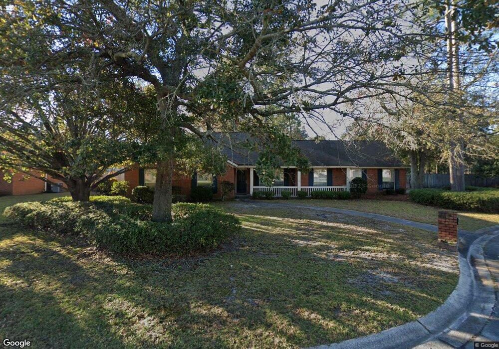
523 Maxwelton Cir Hinesville, GA 31313
Estimated Value: $287,000 - $307,000
4
Beds
2
Baths
2,373
Sq Ft
$124/Sq Ft
Est. Value
About This Home
This home is located at 523 Maxwelton Cir, Hinesville, GA 31313 and is currently estimated at $294,590, approximately $124 per square foot. 523 Maxwelton Cir is a home located in Liberty County with nearby schools including Button Gwinnett Elementary School, Snelson-Golden Middle School, and Bradwell Institute.
Ownership History
Date
Name
Owned For
Owner Type
Purchase Details
Closed on
May 1, 2003
Sold by
Coppit George L and Coppit Jennifer E
Bought by
Morris Mark W and Morris Martha N
Current Estimated Value
Purchase Details
Closed on
Jun 30, 2000
Sold by
Armstrong Peter J
Bought by
Coppit George L
Purchase Details
Closed on
Jul 19, 1996
Sold by
Mastromichalis Georg
Bought by
Armstrong Peter J
Purchase Details
Closed on
Aug 18, 1994
Bought by
Mastromichalis Georg
Purchase Details
Closed on
Sep 27, 1993
Bought by
Hallmark Homes
Create a Home Valuation Report for This Property
The Home Valuation Report is an in-depth analysis detailing your home's value as well as a comparison with similar homes in the area
Home Values in the Area
Average Home Value in this Area
Purchase History
| Date | Buyer | Sale Price | Title Company |
|---|---|---|---|
| Morris Mark W | $140,000 | -- | |
| Coppit George L | $127,000 | -- | |
| Armstrong Peter J | $126,900 | -- | |
| Mastromichalis Georg | $123,500 | -- | |
| Hallmark Homes | -- | -- |
Source: Public Records
Tax History Compared to Growth
Tax History
| Year | Tax Paid | Tax Assessment Tax Assessment Total Assessment is a certain percentage of the fair market value that is determined by local assessors to be the total taxable value of land and additions on the property. | Land | Improvement |
|---|---|---|---|---|
| 2024 | $5,361 | $113,319 | $14,000 | $99,319 |
| 2023 | $5,361 | $101,410 | $14,000 | $87,410 |
| 2022 | $3,727 | $84,087 | $14,000 | $70,087 |
| 2021 | $3,303 | $73,633 | $14,000 | $59,633 |
| 2020 | $3,053 | $67,716 | $12,800 | $54,916 |
| 2019 | $3,064 | $68,420 | $12,800 | $55,620 |
| 2018 | $3,081 | $69,124 | $12,800 | $56,324 |
| 2017 | $2,299 | $69,828 | $12,800 | $57,028 |
| 2016 | $3,002 | $70,532 | $12,800 | $57,732 |
| 2015 | $2,773 | $70,532 | $12,800 | $57,732 |
| 2014 | $2,773 | $64,686 | $12,800 | $51,886 |
| 2013 | -- | $83,104 | $14,000 | $69,104 |
Source: Public Records
Map
Nearby Homes
- 520 Wellington Way
- 201 Ash Blvd
- 489 Elm St
- 617 Oak St
- 505 Franklin St
- 509 Franklin St
- 108 Cherrydale St
- 615 Scott St
- 125 Stafford St
- 0 County Line Rd Unit 1644022
- 0 County Line Rd Unit 18961791
- 108 W General Screven Way
- 614 Demere St
- 480 Dykes St
- 668 Windhaven Dr
- 612 Olive St
- 104 Cedar St
- 148 Marron Way
- 617 Pineview Ct
- 521 Maxwelton Cir
- 525 Maxwelton Cir
- 506 Windsor Ct
- 522 Wellington Way
- 526 Maxwelton Cir Unit 94
- 526 Maxwelton Cir
- 522 Maxwelton Cir
- 520 Maxwelton Cir
- 524 Maxwelton Cir
- 504 Windsor Ct
- 505 Windsor Ct
- 555 Brockington Cir
- 518 Wellington Way
- 557 Brockington Cir
- 540 Wellington Way
- 542 Wellington Way
- 521 Bennington Ct
- 528 Wellington Way
- 553 Brockington Cir
- 527 Wellington Way