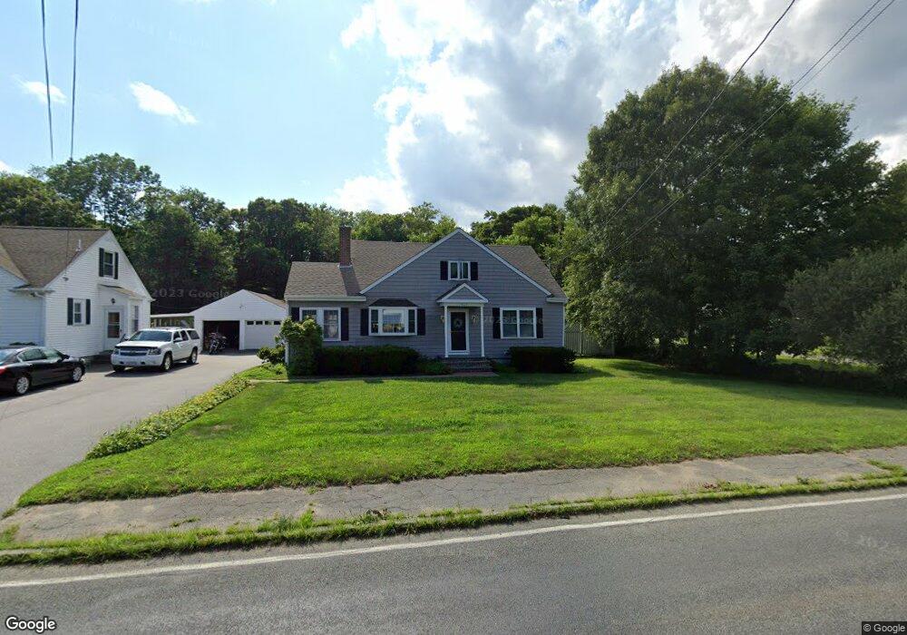
523 Sanford Rd Westport, MA 02790
North Westport NeighborhoodEstimated Value: $498,093 - $578,000
2
Beds
2
Baths
1,728
Sq Ft
$309/Sq Ft
Est. Value
About This Home
This home is located at 523 Sanford Rd, Westport, MA 02790 and is currently estimated at $534,273, approximately $309 per square foot. 523 Sanford Rd is a home located in Bristol County with nearby schools including Alice A. Macomber Primary School, Westport Elementary School, and Westport Middle-High School.
Ownership History
Date
Name
Owned For
Owner Type
Purchase Details
Closed on
Sep 11, 1974
Bought by
Goncalves Manuel and Goncalves Kathleen M
Current Estimated Value
Create a Home Valuation Report for This Property
The Home Valuation Report is an in-depth analysis detailing your home's value as well as a comparison with similar homes in the area
Home Values in the Area
Average Home Value in this Area
Purchase History
| Date | Buyer | Sale Price | Title Company |
|---|---|---|---|
| Goncalves Manuel | -- | -- |
Source: Public Records
Mortgage History
| Date | Status | Borrower | Loan Amount |
|---|---|---|---|
| Open | Goncalves Manuel | $45,000 | |
| Closed | Goncalves Manuel | $60,000 | |
| Closed | Goncalves Manuel | $46,000 | |
| Closed | Goncalves Manuel | $10,020 |
Source: Public Records
Tax History Compared to Growth
Tax History
| Year | Tax Paid | Tax Assessment Tax Assessment Total Assessment is a certain percentage of the fair market value that is determined by local assessors to be the total taxable value of land and additions on the property. | Land | Improvement |
|---|---|---|---|---|
| 2025 | $3,506 | $470,600 | $166,800 | $303,800 |
| 2024 | $3,448 | $446,000 | $148,100 | $297,900 |
| 2023 | $3,355 | $411,100 | $134,900 | $276,200 |
| 2022 | $2,853 | $336,400 | $134,900 | $201,500 |
| 2021 | $3,372 | $273,400 | $111,500 | $161,900 |
| 2020 | $2,267 | $268,900 | $107,000 | $161,900 |
| 2019 | $2,173 | $262,800 | $107,000 | $155,800 |
| 2018 | $2,078 | $254,300 | $108,300 | $146,000 |
| 2017 | $1,970 | $247,200 | $104,800 | $142,400 |
| 2016 | $1,884 | $238,200 | $101,400 | $136,800 |
| 2015 | $1,715 | $216,300 | $103,700 | $112,600 |
Source: Public Records
Map
Nearby Homes
- 527 Sanford Rd
- 532 Sanford Rd
- 511 Sanford Rd
- 524 Sanford Rd Unit 528
- 536 Sanford Rd
- 515 Sanford Rd
- 503 Sanford Rd
- 510 Sanford Rd
- 12 N Dr
- 547 Sanford Rd
- 19 N Dr
- 46 L Dr
- 508 Sanford Rd
- 20 N Dr
- 498 Sanford Rd
- 548 Sanford Rd
- 14 E Dr
- 0 Sanford Rd Unit 73027363
- 0 Sanford Rd Unit 73012298
- 0 Sanford Rd Unit 72996867