Estimated Value: $333,000 - $491,000
--
Bed
--
Bath
--
Sq Ft
0.92
Acres
About This Home
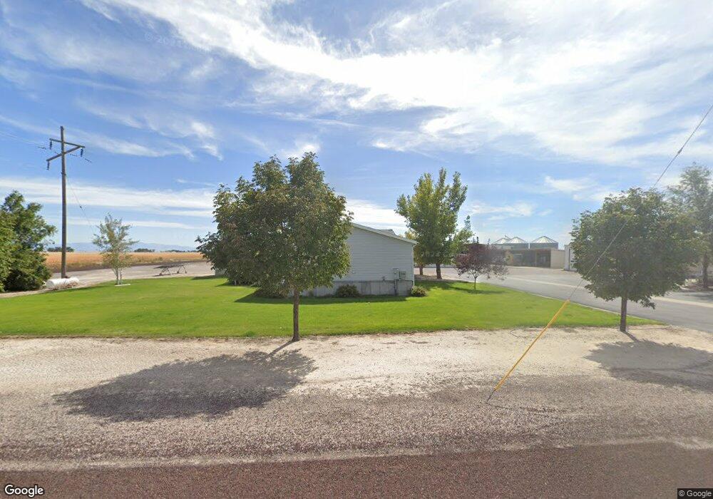
This home is located at 523 W 1500 S, Delta, UT 84624 and is currently estimated at $412,000. 523 W 1500 S is a home with nearby schools including Cba Center and White River Academy.
Ownership History
Date
Name
Owned For
Owner Type
Purchase Details
Closed on
Mar 13, 2006
Sold by
Knight Kevin D and Knight Tana L
Bought by
Knight Don and Knight Jayne
Current Estimated Value
Purchase Details
Closed on
Dec 28, 2005
Sold by
Knight Don and Knight Jayne
Bought by
Knight Kevin D and Knight Tana L
Create a Home Valuation Report for This Property
The Home Valuation Report is an in-depth analysis detailing your home's value as well as a comparison with similar homes in the area
Home Values in the Area
Average Home Value in this Area
Purchase History
| Date | Buyer | Sale Price | Title Company |
|---|---|---|---|
| Knight Don | -- | -- | |
| Knight Kevin D | -- | First American Title Insuran |
Source: Public Records
Tax History Compared to Growth
Tax History
| Year | Tax Paid | Tax Assessment Tax Assessment Total Assessment is a certain percentage of the fair market value that is determined by local assessors to be the total taxable value of land and additions on the property. | Land | Improvement |
|---|---|---|---|---|
| 2025 | $1,823 | $224,584 | $16,500 | $208,084 |
| 2024 | $1,823 | $213,380 | $13,750 | $199,630 |
| 2023 | $1,999 | $213,380 | $13,750 | $199,630 |
| 2022 | $1,528 | $135,356 | $13,750 | $121,606 |
| 2021 | $1,158 | $98,962 | $12,100 | $86,862 |
| 2020 | $1,075 | $92,527 | $12,100 | $80,427 |
| 2019 | $1,065 | $92,527 | $12,100 | $80,427 |
| 2018 | $836 | $74,495 | $12,100 | $62,395 |
| 2017 | $835 | $71,195 | $8,800 | $62,395 |
| 2016 | $798 | $71,195 | $8,800 | $62,395 |
| 2015 | $797 | $71,195 | $8,800 | $62,395 |
| 2014 | -- | $71,195 | $8,800 | $62,395 |
| 2013 | -- | $82,116 | $8,800 | $73,316 |
Source: Public Records
Map
Nearby Homes
- 294 S 300 W
- 242 S 400 W
- 328 S Center St
- 32 E 300 S
- 38 E 300 S
- 435 W 100 S
- 163 W 100 S
- 321 E 200 S
- 625 E Birch Dr
- 331 W 200 N
- 0 E Highway 6 Unit LotWP001 16586023
- 44 E 300 S
- 185 N 200 W
- 17000 W 2500 Rd S
- 16700 W 2500 South Rd
- 16800 W 2500 South Rd
- 665 Bristlecone Ln
- 451 W 300 N
- 786 Bristlecone Ln
- 325 N 100 W
- 547 W 1500 S
- 1055 S 500 W
- 1520 S Lone Tree Rd
- 1004 S 500 W
- 1005 S 500 W
- 1549 S Lone Tree Rd
- 1250 S West St W
- 1098 W W 1500 South St St
- 851 W 1000 S
- 2012 S 500 W
- 2020 S Lone Tree Rd
- 1022 S Lone Tree Rd
- 625 S 500 W
- 2222 S 500 W
- 610 S 500 W
- 1250 S East St W
- 2125 S Lonetree Rd
- 136 E 2000 S
- 845 S Lone Tree Rd
- 1188 W 1000 S