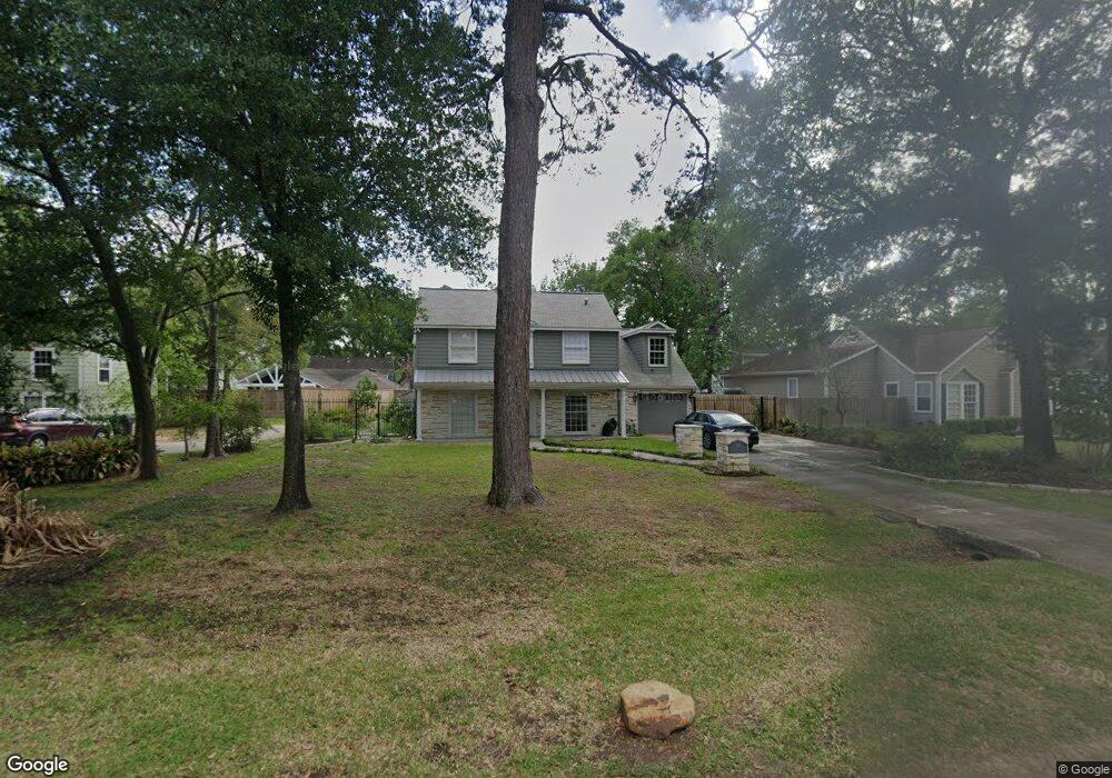
523 W 32nd St Houston, TX 77018
Oak Forest-Garden Oaks NeighborhoodEstimated Value: $988,000 - $1,453,000
3
Beds
3
Baths
2,925
Sq Ft
$384/Sq Ft
Est. Value
About This Home
This home is located at 523 W 32nd St, Houston, TX 77018 and is currently estimated at $1,124,557, approximately $384 per square foot. 523 W 32nd St is a home located in Harris County with nearby schools including Garden Oaks Montessori, Frank Black Middle School, and Booker T Washington Sr High.
Ownership History
Date
Name
Owned For
Owner Type
Purchase Details
Closed on
Nov 10, 2009
Sold by
Hayes Ralph L and Rieger Charlotte
Bought by
Wahl John Melcer and Wahl Candace Baker
Current Estimated Value
Home Financials for this Owner
Home Financials are based on the most recent Mortgage that was taken out on this home.
Original Mortgage
$348,400
Outstanding Balance
$226,325
Interest Rate
4.9%
Mortgage Type
New Conventional
Estimated Equity
$898,232
Create a Home Valuation Report for This Property
The Home Valuation Report is an in-depth analysis detailing your home's value as well as a comparison with similar homes in the area
Home Values in the Area
Average Home Value in this Area
Purchase History
| Date | Buyer | Sale Price | Title Company |
|---|---|---|---|
| Wahl John Melcer | -- | Charter Title Company |
Source: Public Records
Mortgage History
| Date | Status | Borrower | Loan Amount |
|---|---|---|---|
| Open | Wahl John Melcer | $348,400 |
Source: Public Records
Tax History Compared to Growth
Tax History
| Year | Tax Paid | Tax Assessment Tax Assessment Total Assessment is a certain percentage of the fair market value that is determined by local assessors to be the total taxable value of land and additions on the property. | Land | Improvement |
|---|---|---|---|---|
| 2025 | $7,603 | $996,791 | $519,855 | $476,936 |
| 2024 | $7,603 | $891,124 | $519,855 | $371,269 |
| 2023 | $7,603 | $969,600 | $495,100 | $474,500 |
| 2022 | $17,705 | $890,400 | $408,458 | $481,942 |
| 2021 | $17,037 | $731,000 | $383,703 | $347,297 |
| 2020 | $18,215 | $752,214 | $383,703 | $368,511 |
| 2019 | $18,244 | $721,000 | $383,703 | $337,297 |
| 2018 | $10,619 | $736,328 | $346,570 | $389,758 |
| 2017 | $18,619 | $736,328 | $346,570 | $389,758 |
| 2016 | $18,619 | $736,328 | $346,570 | $389,758 |
| 2015 | $10,143 | $736,666 | $346,570 | $390,096 |
| 2014 | $10,143 | $651,071 | $247,550 | $403,521 |
Source: Public Records
Map
Nearby Homes
- 519 W 31st St
- 824 & 828 W 32nd St
- 520 W 30th St
- 431 W 30th St
- 524 W 34th St
- 408 W 30th St
- 544 W 28th St
- 336 W 32nd St
- 531 W 27th St
- 509 W 27th St
- 2710 Nicholson St
- 2708 N Shepherd Dr
- 312 W 32nd St
- 822 W 31st St
- 717 Sue Barnett Dr
- 326 W 28th St
- 710 Sue Barnett Dr
- 515 W 25th St Unit 1
- 804 W 27th St
- 2608 Ashland St