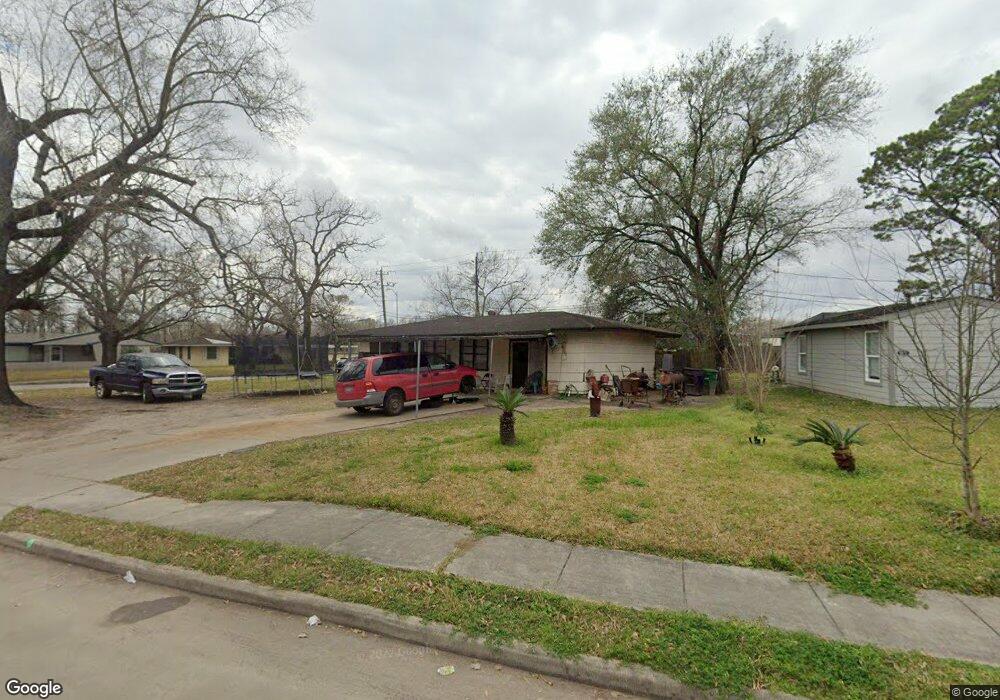
5230 Kelso St Houston, TX 77021
OST-South Union NeighborhoodEstimated Value: $152,000 - $201,000
4
Beds
1
Bath
1,203
Sq Ft
$142/Sq Ft
Est. Value
About This Home
This home is located at 5230 Kelso St, Houston, TX 77021 and is currently estimated at $170,953, approximately $142 per square foot. 5230 Kelso St is a home located in Harris County with nearby schools including Hartsfield Elementary Animal and Environmental Sciences Magnet, Cullen Middle School, and Yates High School.
Ownership History
Date
Name
Owned For
Owner Type
Purchase Details
Closed on
Mar 31, 2021
Sold by
Bourdeaux Steffanie Doutrive
Bought by
Ak Capital 2 Llc
Current Estimated Value
Purchase Details
Closed on
Feb 3, 2012
Sold by
Unity National Bank
Bought by
Nuru Mustafa
Purchase Details
Closed on
Jun 9, 2011
Sold by
Rollins Lola Faye
Bought by
Unity National Bank
Purchase Details
Closed on
Jun 9, 2003
Sold by
Estate Of Alice W Pierce
Bought by
Rollins Lola F
Home Financials for this Owner
Home Financials are based on the most recent Mortgage that was taken out on this home.
Original Mortgage
$60,000
Interest Rate
5.65%
Mortgage Type
Purchase Money Mortgage
Create a Home Valuation Report for This Property
The Home Valuation Report is an in-depth analysis detailing your home's value as well as a comparison with similar homes in the area
Home Values in the Area
Average Home Value in this Area
Purchase History
| Date | Buyer | Sale Price | Title Company |
|---|---|---|---|
| Ak Capital 2 Llc | -- | None Available | |
| Nuru Mustafa | -- | American Title Company | |
| Unity National Bank | $40,000 | None Available | |
| Rollins Lola F | -- | Stewart Title Co |
Source: Public Records
Mortgage History
| Date | Status | Borrower | Loan Amount |
|---|---|---|---|
| Previous Owner | Rollins Lola F | $60,000 |
Source: Public Records
Tax History Compared to Growth
Tax History
| Year | Tax Paid | Tax Assessment Tax Assessment Total Assessment is a certain percentage of the fair market value that is determined by local assessors to be the total taxable value of land and additions on the property. | Land | Improvement |
|---|---|---|---|---|
| 2025 | $2,736 | $121,223 | $94,260 | $26,963 |
| 2024 | $2,736 | $130,754 | $94,260 | $36,494 |
| 2023 | $2,736 | $128,153 | $94,260 | $33,893 |
| 2022 | $2,640 | $113,934 | $86,405 | $27,529 |
| 2021 | $2,287 | $98,109 | $62,840 | $35,269 |
| 2020 | $1,809 | $71,335 | $39,275 | $32,060 |
| 2019 | $1,626 | $61,478 | $33,384 | $28,094 |
| 2018 | $1,131 | $44,710 | $23,565 | $21,145 |
| 2017 | $1,182 | $44,710 | $23,565 | $21,145 |
| 2016 | $1,182 | $44,710 | $23,565 | $21,145 |
| 2015 | $1,020 | $44,710 | $23,565 | $21,145 |
| 2014 | $1,020 | $39,665 | $19,638 | $20,027 |
Source: Public Records
Map
Nearby Homes
- 6527 Beekman Rd
- 5218 Kelso St
- 5244 Enyart St
- 5210 Enyart St
- 5601 Malmedy Rd
- 5219 Cosby St
- 5107 Gren St
- 5259 Perry St
- 5251 Perry St
- 5103 Yellowstone Blvd
- 5224 Dewberry St
- 5022 Balkin St
- 5035 Andrea St
- 5213 Malmedy Rd
- 5111 Cosby St
- 5322 Dewberry St
- 5251 Dewberry St
- 5534 Bataan Rd
- 5433 Chennault Rd
- 5014 Yellowstone Blvd