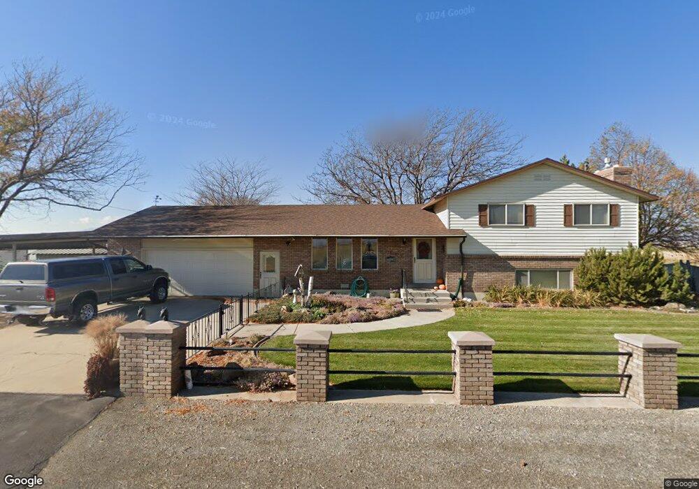
5230 S 1850 W Spanish Fork, UT 84660
Estimated Value: $581,000 - $1,524,000
4
Beds
2
Baths
1,636
Sq Ft
$685/Sq Ft
Est. Value
About This Home
This home is located at 5230 S 1850 W, Spanish Fork, UT 84660 and is currently estimated at $1,120,575, approximately $684 per square foot. 5230 S 1850 W is a home with nearby schools including Brockbank Elementary School, Spanish Fork Jr High School, and Spanish Fork High School.
Ownership History
Date
Name
Owned For
Owner Type
Purchase Details
Closed on
Mar 1, 2024
Sold by
Robert And Charlette Williams Family Tru
Bought by
Benincosa Warren L and Benincosa Melinda
Current Estimated Value
Purchase Details
Closed on
Apr 20, 2012
Sold by
Williams Charlette B
Bought by
Williams Charlette B and Charlette B Williams Family Tr
Purchase Details
Closed on
Sep 2, 2011
Sold by
Williams Charlette B
Bought by
Williams Charlette B and Charlette B Williams Family Tr
Create a Home Valuation Report for This Property
The Home Valuation Report is an in-depth analysis detailing your home's value as well as a comparison with similar homes in the area
Home Values in the Area
Average Home Value in this Area
Purchase History
| Date | Buyer | Sale Price | Title Company |
|---|---|---|---|
| Benincosa Warren L | -- | Key Land Title | |
| Williams Charlette B | -- | None Available | |
| Williams Charlette B | -- | None Available |
Source: Public Records
Tax History Compared to Growth
Tax History
| Year | Tax Paid | Tax Assessment Tax Assessment Total Assessment is a certain percentage of the fair market value that is determined by local assessors to be the total taxable value of land and additions on the property. | Land | Improvement |
|---|---|---|---|---|
| 2025 | $2,631 | $282,678 | $427,100 | $396,600 |
| 2024 | $2,631 | $263,042 | $0 | $0 |
| 2023 | $2,694 | $269,467 | $0 | $0 |
| 2022 | $2,671 | $794,100 | $433,700 | $360,400 |
| 2021 | $2,318 | $565,800 | $294,800 | $271,000 |
| 2020 | $2,038 | $525,300 | $254,300 | $271,000 |
| 2019 | $1,836 | $444,300 | $197,900 | $246,400 |
| 2018 | $1,757 | $400,300 | $177,900 | $222,400 |
| 2017 | $1,547 | $120,257 | $0 | $0 |
| 2016 | $1,324 | $99,793 | $0 | $0 |
| 2015 | $1,273 | $95,155 | $0 | $0 |
| 2014 | $1,274 | $95,256 | $0 | $0 |
Source: Public Records
Map
Nearby Homes
- 5200 S River Dr Unit 3
- 5272 S River Ln
- 2182 W 4600 S
- 5500 W 5600 S
- 5310 S 3200 W
- 5884 S 3200 W
- 6550 S 1050 W
- 4248 S 3200 W
- 559 N Mitchell Dr
- 833 W 250 N
- 226 N 860 W Unit 156
- 956 W 40 N
- 1040 W Center St
- 1299 W 250 S
- 1841 N 630 St W Unit 71
- 1788 N 630 St W Unit 47
- 1826 N 630 St W Unit 101
- 393 N 400 W
- 13 N 710 W
- 1377 W 450 S