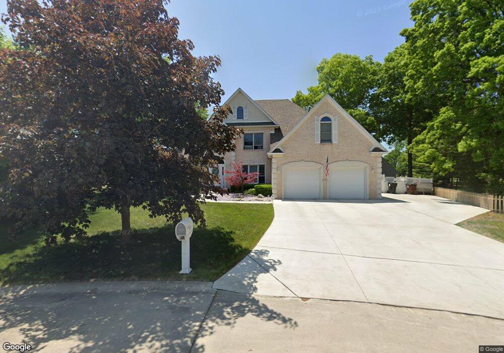
5231 W Brookshire St Monroe, MI 48161
Estimated Value: $428,336 - $456,000
5
Beds
4
Baths
2,912
Sq Ft
$152/Sq Ft
Est. Value
About This Home
This home is located at 5231 W Brookshire St, Monroe, MI 48161 and is currently estimated at $442,834, approximately $152 per square foot. 5231 W Brookshire St is a home located in Monroe County with nearby schools including Monroe High School, St Mary's Catholic Elementary School, and Pathway Christian School - PERMANENTLY CLOSED.
Ownership History
Date
Name
Owned For
Owner Type
Purchase Details
Closed on
May 28, 2015
Sold by
Mignano Anthony J and Mignano Pamela S
Bought by
Banek Steven M
Current Estimated Value
Home Financials for this Owner
Home Financials are based on the most recent Mortgage that was taken out on this home.
Original Mortgage
$270,000
Outstanding Balance
$207,772
Interest Rate
3.65%
Mortgage Type
New Conventional
Estimated Equity
$235,062
Create a Home Valuation Report for This Property
The Home Valuation Report is an in-depth analysis detailing your home's value as well as a comparison with similar homes in the area
Home Values in the Area
Average Home Value in this Area
Purchase History
| Date | Buyer | Sale Price | Title Company |
|---|---|---|---|
| Banek Steven M | $310,000 | Lawyers Title |
Source: Public Records
Mortgage History
| Date | Status | Borrower | Loan Amount |
|---|---|---|---|
| Open | Banek Steven M | $270,000 |
Source: Public Records
Tax History Compared to Growth
Tax History
| Year | Tax Paid | Tax Assessment Tax Assessment Total Assessment is a certain percentage of the fair market value that is determined by local assessors to be the total taxable value of land and additions on the property. | Land | Improvement |
|---|---|---|---|---|
| 2025 | $5,345 | $210,900 | $210,900 | $0 |
| 2024 | $1,976 | $202,950 | $0 | $0 |
| 2023 | $1,882 | $186,700 | $0 | $0 |
| 2022 | $4,818 | $186,700 | $0 | $0 |
| 2021 | $4,655 | $177,400 | $0 | $0 |
| 2020 | $4,604 | $161,700 | $0 | $0 |
| 2019 | $1,590 | $161,700 | $0 | $0 |
| 2018 | $3,650 | $139,750 | $0 | $0 |
| 2017 | $3,565 | $139,750 | $0 | $0 |
| 2016 | $3,630 | $138,250 | $0 | $0 |
| 2015 | $3,395 | $139,700 | $0 | $0 |
| 2014 | $3,390 | $139,700 | $0 | $0 |
| 2013 | -- | $132,850 | $0 | $0 |
Source: Public Records
Map
Nearby Homes
- 15024 Shadowood Dr
- 14960 S Dixie Hwy
- 5489 Wimbledon Park Dr
- 14922 Wildwood Dr
- 5376 Kay Dr
- 0 S Dixie Hwy
- 15060 Timberlane St
- 5026 Robinwood Dr
- 15350 S Telegraph Rd
- 0 S Telegraph Rd Unit 50171785
- 4911 Skylark Dr
- 4899 Skylark Dr
- 5399 E Dunbar Rd
- 15156 Oak Valley Ln
- 5714 E Dunbar Rd
- 0 Southpointe Pkwy Unit 50111716
- 5300 Torrington Dr Unit 4
- 4530 W Albain Rd
- 5732 Rosewood Dr
- 14359 S Dixie Hwy
- 5243 W Brookshire St
- 5255 W Brookshire St
- 5230 W Brookshire St
- 5242 W Brookshire St
- 5267 W Brookshire St
- 5254 W Brookshire St
- 5266 W Brookshire St
- 5200 W Brookshire St
- 5279 W Brookshire St
- 5278 W Brookshire St
- 5290 W Brookshire St
- 15113 S Dixie Hwy
- 302 Meadowlands Ct
- 302 Meadowlands Ct Unit 302
- 304 Meadowlands Ct
- 301 Meadowlands Ct
- 204 Meadowlands Ct
- 303 Meadowlands Ct
- 203 Meadowlands Ct
- 202 Meadowlands Ct