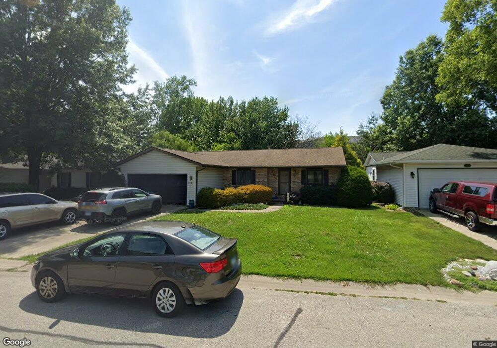
5233 Buford St Springfield, IL 62703
Estimated Value: $167,000 - $205,000
3
Beds
2
Baths
1,450
Sq Ft
$132/Sq Ft
Est. Value
About This Home
This home is located at 5233 Buford St, Springfield, IL 62703 and is currently estimated at $191,798, approximately $132 per square foot. 5233 Buford St is a home located in Sangamon County with nearby schools including Ball Elementary School, Glenwood Intermediate School, and Glenwood Middle School.
Ownership History
Date
Name
Owned For
Owner Type
Purchase Details
Closed on
Jun 12, 2024
Sold by
Thompson Robert R and Thompson Janna K
Bought by
Thompson Janna K
Current Estimated Value
Purchase Details
Closed on
Jun 1, 2009
Purchase Details
Closed on
Feb 19, 2003
Purchase Details
Closed on
Oct 17, 2001
Purchase Details
Closed on
Feb 17, 1995
Create a Home Valuation Report for This Property
The Home Valuation Report is an in-depth analysis detailing your home's value as well as a comparison with similar homes in the area
Purchase History
| Date | Buyer | Sale Price | Title Company |
|---|---|---|---|
| Thompson Janna K | -- | None Listed On Document | |
| -- | $115,600 | -- | |
| -- | -- | -- | |
| -- | $92,000 | -- | |
| -- | $85,500 | -- |
Source: Public Records
Tax History
| Year | Tax Paid | Tax Assessment Tax Assessment Total Assessment is a certain percentage of the fair market value that is determined by local assessors to be the total taxable value of land and additions on the property. | Land | Improvement |
|---|---|---|---|---|
| 2024 | $3,226 | $49,762 | $7,513 | $42,249 |
| 2023 | $3,030 | $45,453 | $6,862 | $38,591 |
| 2022 | $2,877 | $42,802 | $6,509 | $36,293 |
| 2021 | $2,779 | $41,199 | $6,265 | $34,934 |
| 2020 | $2,766 | $41,260 | $6,274 | $34,986 |
| 2019 | $2,719 | $41,116 | $6,252 | $34,864 |
| 2018 | $2,599 | $40,130 | $6,222 | $33,908 |
| 2017 | $2,541 | $39,612 | $6,142 | $33,470 |
| 2016 | $2,492 | $39,034 | $6,052 | $32,982 |
| 2015 | $2,479 | $38,568 | $5,980 | $32,588 |
| 2014 | $2,348 | $38,319 | $5,941 | $32,378 |
| 2013 | $2,301 | $36,778 | $5,942 | $30,836 |
Source: Public Records
Map
Nearby Homes
- 33 Sarah Ave
- 0 Toronto Rd
- 6214 Hayley Ct
- 128 Volare Ln
- 4013 S Milan Rd
- 6200 Wind Tree Rd
- 2208 Trowbridge Rd
- 0 Varsity Ct
- 130 Genoa Dr
- 4421 Venetian Dr
- 2121 Lake Crest Dr
- 6401 Raintree Place
- 108 Maple Grove St
- 6712 Phlox Dr
- 106 Maple Grove St
- 112 Maple Grove St
- 116 Maple Grove St
- 110 Maple Grove St
- 2311 Chesapeake Landing
- 114 Maple Grove St
Your Personal Tour Guide
Ask me questions while you tour the home.