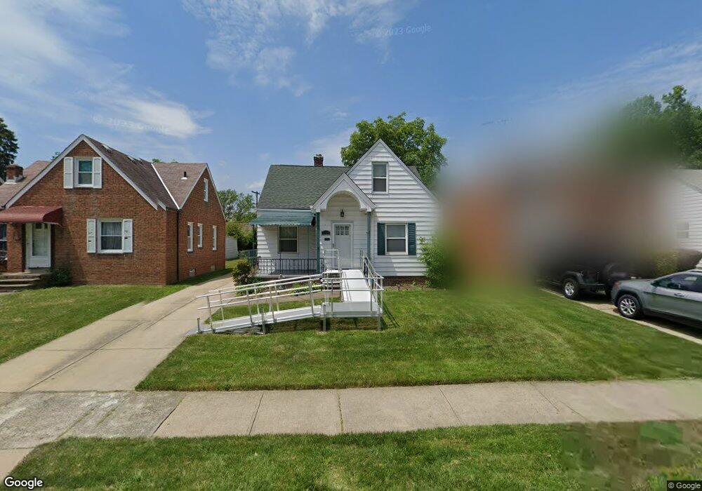
5234 Philip Ave Maple Heights, OH 44137
Estimated Value: $116,000 - $146,000
3
Beds
2
Baths
1,234
Sq Ft
$103/Sq Ft
Est. Value
About This Home
This home is located at 5234 Philip Ave, Maple Heights, OH 44137 and is currently estimated at $127,542, approximately $103 per square foot. 5234 Philip Ave is a home located in Cuyahoga County with nearby schools including Abraham Lincoln Elementary School, Rockside/ J.F. Kennedy School, and Barack Obama School.
Ownership History
Date
Name
Owned For
Owner Type
Purchase Details
Closed on
Jan 20, 2016
Sold by
Mims Chester L
Bought by
Andesite Residential Opportunity Fund Ll
Current Estimated Value
Purchase Details
Closed on
Apr 11, 2013
Sold by
Mims Dorothy M
Bought by
Mims Chester L
Purchase Details
Closed on
Nov 29, 2005
Sold by
Allen Herman L and Allen Joann
Bought by
Mims Chester L and Mims Dorothy M
Home Financials for this Owner
Home Financials are based on the most recent Mortgage that was taken out on this home.
Original Mortgage
$71,920
Interest Rate
8.91%
Mortgage Type
Fannie Mae Freddie Mac
Purchase Details
Closed on
Jul 27, 1988
Sold by
Missal John A
Bought by
Allen Herman L
Purchase Details
Closed on
Mar 28, 1985
Sold by
Missal John A and Missal Sonia
Bought by
Missal John A
Purchase Details
Closed on
Jan 1, 1975
Bought by
Missal John A and Missal Sonia
Create a Home Valuation Report for This Property
The Home Valuation Report is an in-depth analysis detailing your home's value as well as a comparison with similar homes in the area
Home Values in the Area
Average Home Value in this Area
Purchase History
| Date | Buyer | Sale Price | Title Company |
|---|---|---|---|
| Andesite Residential Opportunity Fund Ll | $25,000 | Attorney | |
| Mims Chester L | -- | Attorney | |
| Mims Chester L | $89,900 | Northstar Title Agency | |
| Allen Herman L | $59,900 | -- | |
| Missal John A | -- | -- | |
| Missal John A | -- | -- |
Source: Public Records
Mortgage History
| Date | Status | Borrower | Loan Amount |
|---|---|---|---|
| Previous Owner | Mims Chester L | $71,920 |
Source: Public Records
Tax History Compared to Growth
Tax History
| Year | Tax Paid | Tax Assessment Tax Assessment Total Assessment is a certain percentage of the fair market value that is determined by local assessors to be the total taxable value of land and additions on the property. | Land | Improvement |
|---|---|---|---|---|
| 2024 | $3,343 | $36,330 | $7,140 | $29,190 |
| 2023 | $2,291 | $20,790 | $4,340 | $16,450 |
| 2022 | $2,283 | $20,790 | $4,340 | $16,450 |
| 2021 | $2,434 | $20,790 | $4,340 | $16,450 |
| 2020 | $2,082 | $15,750 | $3,290 | $12,460 |
| 2019 | $1,958 | $45,000 | $9,400 | $35,600 |
| 2018 | $1,030 | $15,750 | $3,290 | $12,460 |
| 2017 | $1,932 | $14,250 | $3,010 | $11,240 |
| 2016 | $1,756 | $14,250 | $3,010 | $11,240 |
| 2015 | $2,724 | $14,250 | $3,010 | $11,240 |
| 2014 | -- | $15,650 | $3,330 | $12,320 |
Source: Public Records
Map
Nearby Homes
- 5231 Philip Ave
- 5257 Philip Ave
- 5212 Catherine St
- 5185 Clement Ave
- 5208 Clement Ave
- 5320 Clement Ave
- 5239 Arch St
- 5110 Philip Ave
- 5199 Arch St
- 5082 Philip Ave
- 17204 Maple Heights Blvd
- 17916 North Blvd
- 17912 North Blvd
- 5061 Philip Ave
- 5234 Erwin St
- 5210 Theodore St
- 5425 Grasmere Ave
- 5031 Cato St
- 5493 Thomas St
- 5247 Henry St
- 5238 Philip Ave
- 5230 Philip Ave
- 5242 Philip Ave
- 5226 Philip Ave
- 5246 Philip Ave
- 5222 Philip Ave
- 5193 Catherine St
- 5201 Catherine St
- 5250 Philip Ave
- 5216 Philip Ave
- 5189 Catherine St
- 5205 Catherine St
- 5235 Philip Ave
- 5237 Philip Ave
- 5185 Catherine St
- 5254 Philip Ave
- 5227 Philip Ave
- 5214 Philip Ave
- 5241 Philip Ave
- 5209 Catherine St