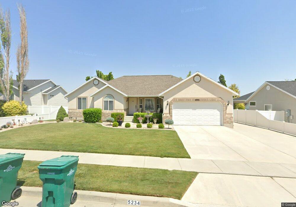
5234 W Lowe Peak Dr Riverton, UT 84096
Estimated Value: $632,284 - $750,000
3
Beds
3
Baths
3,661
Sq Ft
$189/Sq Ft
Est. Value
About This Home
This home is located at 5234 W Lowe Peak Dr, Riverton, UT 84096 and is currently estimated at $691,821, approximately $188 per square foot. 5234 W Lowe Peak Dr is a home located in Salt Lake County with nearby schools including Foothills School, South Hills Middle School, and Mountain Ridge High School.
Ownership History
Date
Name
Owned For
Owner Type
Purchase Details
Closed on
May 17, 2013
Sold by
Coats Steve J and Coats Patricia L
Bought by
Coats Steve and Coats Pat L
Current Estimated Value
Home Financials for this Owner
Home Financials are based on the most recent Mortgage that was taken out on this home.
Original Mortgage
$150,000
Outstanding Balance
$69,781
Interest Rate
3.41%
Mortgage Type
New Conventional
Estimated Equity
$622,040
Purchase Details
Closed on
Aug 15, 2007
Sold by
Bell H Richard and Bell Leslie J
Bought by
Coats Steve and Coats Pat L
Purchase Details
Closed on
Nov 3, 1999
Sold by
Development Associates Inc
Bought by
Bell H Richard and Bell Leslie J
Home Financials for this Owner
Home Financials are based on the most recent Mortgage that was taken out on this home.
Original Mortgage
$149,500
Interest Rate
7.82%
Mortgage Type
Construction
Create a Home Valuation Report for This Property
The Home Valuation Report is an in-depth analysis detailing your home's value as well as a comparison with similar homes in the area
Home Values in the Area
Average Home Value in this Area
Purchase History
| Date | Buyer | Sale Price | Title Company |
|---|---|---|---|
| Coats Steve | -- | Highland Title Ag | |
| Coats Steve J | -- | Highland Title Agency | |
| Coats Steve | -- | Us Title Of Utah | |
| Bell H Richard | -- | Merrill Title |
Source: Public Records
Mortgage History
| Date | Status | Borrower | Loan Amount |
|---|---|---|---|
| Open | Coats Steve | $150,000 | |
| Previous Owner | Bell H Richard | $149,500 | |
| Closed | Bell H Richard | $6,975 |
Source: Public Records
Tax History Compared to Growth
Tax History
| Year | Tax Paid | Tax Assessment Tax Assessment Total Assessment is a certain percentage of the fair market value that is determined by local assessors to be the total taxable value of land and additions on the property. | Land | Improvement |
|---|---|---|---|---|
| 2025 | $3,249 | $605,900 | $195,600 | $410,300 |
| 2024 | $3,249 | $562,400 | $179,700 | $382,700 |
| 2023 | $3,442 | $561,600 | $166,400 | $395,200 |
| 2022 | $3,538 | $566,300 | $163,100 | $403,200 |
| 2021 | $2,944 | $419,600 | $125,800 | $293,800 |
| 2020 | $2,874 | $381,900 | $97,900 | $284,000 |
| 2019 | $2,723 | $355,700 | $93,200 | $262,500 |
| 2018 | $2,602 | $334,600 | $86,100 | $248,500 |
| 2017 | $2,473 | $310,000 | $86,100 | $223,900 |
| 2016 | $2,373 | $285,400 | $86,100 | $199,300 |
| 2015 | $2,159 | $251,700 | $86,200 | $165,500 |
| 2014 | $2,070 | $236,600 | $82,100 | $154,500 |
Source: Public Records
Map
Nearby Homes
- 14032 Lewiston Peak Dr
- 5288 Shaggy Peak Dr
- 14054 Elk Horn Peak Dr
- 14121 Elk Horn Peak Dr
- 14254 S Amber Rose Ln
- 14048 van Cott Peak Cir
- 14322 Pepper Grass Ln
- 13908 S 5180 W
- 14049 S van Cott Peak Cir
- 13878 S Shaggy Peak Dr
- 5248 Little Water Peak Dr
- 5206 W Windom Rd
- 5418 W Morning Light Dr
- 14242 S Crown Rose Dr
- 5036 W Cedar Point Peak Dr
- 5030 Little Water Peak Dr
- 5232 W Courtly Ln
- 5532 W Morning Light Dr
- 5198 W Courtly Ln
- 14483 S Ryegate Dr
- 5234 Lowe Peak Dr
- 5222 Lowe Peak Dr
- 14083 S Lewiston Peak Dr Unit 485
- 14083 S Lewiston Peak Dr
- 14083 Lewiston Peak Dr
- 5212 Lowe Peak Dr
- 5227 Butterfield Peak Cir
- 5212 W Lowe Peak Dr
- 5227 W Butterfield Peak Cir
- 5213 Butterfield Peak Cir
- 14099 Lewiston Peak Dr
- 14122 S Lowe Peak Cir
- 14122 Lowe Peak Cir
- 14071 Lewiston Peak Dr
- 14121 Lowe Peak Cir
- 14123 Lewiston Peak Dr
- 5198 Lowe Peak Dr
- 5203 Butterfield Peak Cir
- 14057 S Lewiston Peak Dr
- 5203 W Butterfield Peak Cir