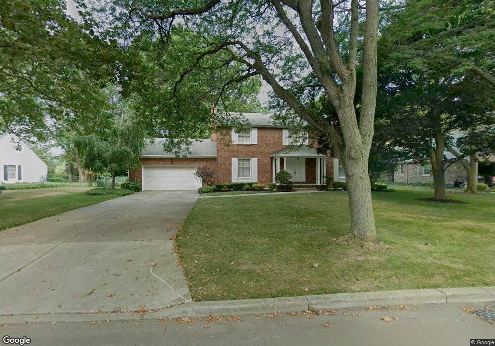
5236 Hewitt Pkwy Lewiston, NY 14092
Estimated Value: $497,000 - $658,000
4
Beds
3
Baths
2,950
Sq Ft
$186/Sq Ft
Est. Value
About This Home
This home is located at 5236 Hewitt Pkwy, Lewiston, NY 14092 and is currently estimated at $548,947, approximately $186 per square foot. 5236 Hewitt Pkwy is a home located in Niagara County with nearby schools including Primary Education Center, Intermediate Education Center, and Lewiston Porter Middle School.
Ownership History
Date
Name
Owned For
Owner Type
Purchase Details
Closed on
Aug 13, 2019
Sold by
Stefik Robert M and Stefik William A
Bought by
Stefik Robert M and Stefik William A
Current Estimated Value
Purchase Details
Closed on
Aug 13, 2009
Sold by
Stefik Robert-Estate
Bought by
Stefik Robert
Home Financials for this Owner
Home Financials are based on the most recent Mortgage that was taken out on this home.
Original Mortgage
$103,000
Interest Rate
5.36%
Mortgage Type
Stand Alone Refi Refinance Of Original Loan
Purchase Details
Closed on
Aug 5, 2009
Sold by
Stefik David W and Stefik Robert M
Bought by
Stefik Robert M and Stefik William A
Home Financials for this Owner
Home Financials are based on the most recent Mortgage that was taken out on this home.
Original Mortgage
$103,000
Interest Rate
5.36%
Mortgage Type
Stand Alone Refi Refinance Of Original Loan
Create a Home Valuation Report for This Property
The Home Valuation Report is an in-depth analysis detailing your home's value as well as a comparison with similar homes in the area
Home Values in the Area
Average Home Value in this Area
Purchase History
| Date | Buyer | Sale Price | Title Company |
|---|---|---|---|
| Stefik Robert M | -- | None Available | |
| Stefik Robert | $203,000 | Jay Bertt | |
| Stefik Robert M | $203,000 | None Available |
Source: Public Records
Mortgage History
| Date | Status | Borrower | Loan Amount |
|---|---|---|---|
| Closed | Stefik Robert M | $103,000 |
Source: Public Records
Tax History Compared to Growth
Tax History
| Year | Tax Paid | Tax Assessment Tax Assessment Total Assessment is a certain percentage of the fair market value that is determined by local assessors to be the total taxable value of land and additions on the property. | Land | Improvement |
|---|---|---|---|---|
| 2024 | $7,820 | $176,500 | $34,100 | $142,400 |
| 2023 | $8,859 | $176,500 | $34,100 | $142,400 |
| 2022 | $7,786 | $176,500 | $34,100 | $142,400 |
| 2021 | $7,703 | $176,500 | $34,100 | $142,400 |
| 2020 | $7,183 | $176,500 | $34,100 | $142,400 |
| 2019 | $6,664 | $176,500 | $34,100 | $142,400 |
| 2018 | $6,880 | $176,500 | $34,100 | $142,400 |
| 2017 | $6,664 | $176,500 | $34,100 | $142,400 |
| 2016 | $6,654 | $176,500 | $34,100 | $142,400 |
| 2015 | -- | $176,500 | $34,100 | $142,400 |
| 2014 | -- | $176,500 | $34,100 | $142,400 |
Source: Public Records
Map
Nearby Homes
- 450 Barton Dr
- 5129 Woodland Dr
- 5117 Woodland Dr
- 5079 Forest Rd
- 722 Tuscarora St
- 0 S 5th St
- 5158 Country Club Trail
- 270 S 4th St
- 305 S 1st St
- 933 Creek Road Extension
- 700 Mountain View Dr
- 737 Mountain View Dr
- 5092 Dana Dr
- 490 Ridge St
- 481 Onondaga St
- 5236 Bridle Path Ln
- 901 Onondaga St
- 663 Cayuga Dr
- 890 Onondaga St
- Berkley Essex Ridge Plan at Essex Ridge
- 5230 Hewitt Pkwy
- 5244 Hewitt Pkwy
- 5250 Hewitt Pkwy
- 5235 Fort Gray Dr
- 5241 Fort Gray Dr
- 456 Fort Gray Dr
- 448 Fort Gray Dr
- 5249 Fort Gray Dr
- 5227 Fort Gray Dr
- 5256 Hewitt Pkwy
- 5237 Hewitt Pkwy
- 5243 Hewitt Pkwy
- 5229 Hewitt Pkwy
- 442 Fort Gray Dr
- 5255 Fort Gray Dr
- 5251 Hewitt Pkwy
- 5223 Hewitt Pkwy
- 5264 Hewitt Pkwy
- 5263 Fort Gray Dr
- 468 Fort Gray Dr