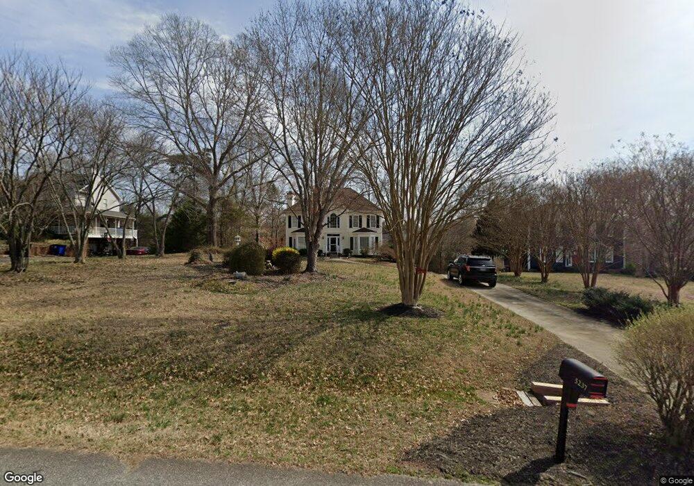
5237 Bridge Pointe Dr Clemmons, NC 27012
Estimated Value: $360,898 - $415,000
3
Beds
3
Baths
2,206
Sq Ft
$175/Sq Ft
Est. Value
About This Home
This home is located at 5237 Bridge Pointe Dr, Clemmons, NC 27012 and is currently estimated at $385,725, approximately $174 per square foot. 5237 Bridge Pointe Dr is a home located in Forsyth County with nearby schools including Ward Elementary School, Clemmons Middle School, and West Forsyth High.
Ownership History
Date
Name
Owned For
Owner Type
Purchase Details
Closed on
Mar 6, 2026
Sold by
Howard Michael and Howard Eileen C
Bought by
Howard Michael
Current Estimated Value
Purchase Details
Closed on
Aug 26, 2005
Sold by
Hill Stephen W and Hill Marie L
Bought by
Howard Michael D and Howard Eileen C
Home Financials for this Owner
Home Financials are based on the most recent Mortgage that was taken out on this home.
Original Mortgage
$110,000
Interest Rate
5.61%
Mortgage Type
Fannie Mae Freddie Mac
Purchase Details
Closed on
Nov 15, 2001
Sold by
Carpenter Alan and Carpenter Margaret S
Bought by
Hill Stephen W and Hill Marie L
Home Financials for this Owner
Home Financials are based on the most recent Mortgage that was taken out on this home.
Original Mortgage
$136,800
Interest Rate
6.57%
Create a Home Valuation Report for This Property
The Home Valuation Report is an in-depth analysis detailing your home's value as well as a comparison with similar homes in the area
Purchase History
| Date | Buyer | Sale Price | Title Company |
|---|---|---|---|
| Howard Michael | -- | None Listed On Document | |
| Howard Michael D | $207,500 | -- | |
| Hill Stephen W | $171,000 | -- |
Source: Public Records
Mortgage History
| Date | Status | Borrower | Loan Amount |
|---|---|---|---|
| Previous Owner | Howard Michael D | $110,000 | |
| Previous Owner | Hill Stephen W | $136,800 | |
| Closed | Hill Stephen W | $25,650 |
Source: Public Records
Tax History
| Year | Tax Paid | Tax Assessment Tax Assessment Total Assessment is a certain percentage of the fair market value that is determined by local assessors to be the total taxable value of land and additions on the property. | Land | Improvement |
|---|---|---|---|---|
| 2025 | $1,830 | $349,200 | $55,000 | $294,200 |
| 2024 | $1,830 | $246,700 | $53,500 | $193,200 |
| 2023 | $1,830 | $246,700 | $53,500 | $193,200 |
| 2022 | $1,830 | $246,700 | $53,500 | $193,200 |
| 2021 | $1,830 | $246,700 | $53,500 | $193,200 |
| 2020 | $1,652 | $203,700 | $40,000 | $163,700 |
| 2019 | $1,672 | $203,700 | $40,000 | $163,700 |
| 2018 | $1,603 | $203,700 | $40,000 | $163,700 |
| 2016 | $1,430 | $180,758 | $31,500 | $149,258 |
| 2015 | $1,430 | $180,758 | $31,500 | $149,258 |
| 2014 | $1,386 | $180,758 | $31,500 | $149,258 |
Source: Public Records
Map
Nearby Homes
- 6021 Stone Bluff Dr
- 6004 Stone Bluff Dr
- 6033 Stone Bluff Dr
- 5229 Bridge Pointe Dr
- 5220 Bridge Pointe Dr
- 6045 Stone Bluff Dr
- 6049 Frye Bridge Rd
- 6055 Frye Bridge Rd
- 6061 Frye Bridge Rd
- 0 Frye Bridge Rd Unit 1202070
- 5920 Loop Rd
- 6168 Sunny Brook Dr
- 6279 Queens Gate Ct
- 245 Centenary Ridge Dr
- 315 Daffodil Fields Trail
- 5519 Misty Hill Cir
- 4875 Hampton Rd
- 5703 Midstream Cir
- 7013 Orchard Path Dr
- 5333 Quartz Ave
- 5241 Bridge Pointe Dr
- 5233 Bridge Pointe Dr
- 5245 Bridge Pointe Dr
- 6025 Stone Bluff Dr
- 6029 Stone Bluff Dr
- 5236 Bridge Pointe Dr
- 6017 Stone Bluff Dr
- 5240 Bridge Pointe Dr
- 5249 Bridge Pointe Dr
- 5225 Bridge Pointe Dr
- 5244 Bridge Pointe Dr
- 5232 Bridge Pointe Dr
- 6013 Stone Bluff Dr
- 5228 Bridge Pointe Dr
- 5253 Bridge Pointe Dr
- 6037 Stone Bluff Dr
- 6012 Stone Bluff Dr
- 6008 Stone Bluff Dr
- 6004 Shea Meadows Dr
- 6001 Shea Meadows Dr
Your Personal Tour Guide
Ask me questions while you tour the home.