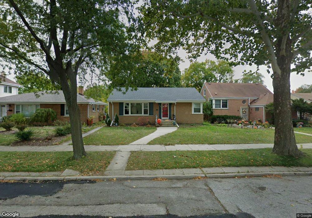
5237 Davis St Skokie, IL 60077
Southwest Skokie NeighborhoodEstimated Value: $410,000 - $452,000
3
Beds
2
Baths
1,400
Sq Ft
$311/Sq Ft
Est. Value
About This Home
This home is located at 5237 Davis St, Skokie, IL 60077 and is currently estimated at $435,999, approximately $311 per square foot. 5237 Davis St is a home located in Cook County with nearby schools including Old Orchard Jr High School, Jane Stenson School, and Niles North High School.
Ownership History
Date
Name
Owned For
Owner Type
Purchase Details
Closed on
Jul 12, 2014
Sold by
Brodwin Morris E
Bought by
Kane Thomas and Kane Jennifer
Current Estimated Value
Home Financials for this Owner
Home Financials are based on the most recent Mortgage that was taken out on this home.
Original Mortgage
$236,634
Outstanding Balance
$180,851
Interest Rate
4.25%
Mortgage Type
FHA
Estimated Equity
$255,148
Create a Home Valuation Report for This Property
The Home Valuation Report is an in-depth analysis detailing your home's value as well as a comparison with similar homes in the area
Home Values in the Area
Average Home Value in this Area
Purchase History
| Date | Buyer | Sale Price | Title Company |
|---|---|---|---|
| Kane Thomas | $241,000 | Multiple |
Source: Public Records
Mortgage History
| Date | Status | Borrower | Loan Amount |
|---|---|---|---|
| Open | Kane Thomas | $236,634 |
Source: Public Records
Tax History Compared to Growth
Tax History
| Year | Tax Paid | Tax Assessment Tax Assessment Total Assessment is a certain percentage of the fair market value that is determined by local assessors to be the total taxable value of land and additions on the property. | Land | Improvement |
|---|---|---|---|---|
| 2024 | $8,212 | $25,804 | $6,770 | $19,034 |
| 2023 | $7,992 | $32,869 | $6,770 | $26,099 |
| 2022 | $7,992 | $32,869 | $6,770 | $26,099 |
| 2021 | $6,804 | $24,861 | $4,166 | $20,695 |
| 2020 | $6,737 | $24,861 | $4,166 | $20,695 |
| 2019 | $6,894 | $27,980 | $4,166 | $23,814 |
| 2018 | $6,557 | $24,337 | $3,775 | $20,562 |
| 2017 | $6,604 | $24,337 | $3,775 | $20,562 |
| 2016 | $6,314 | $24,337 | $3,775 | $20,562 |
| 2015 | $6,013 | $21,544 | $3,255 | $18,289 |
| 2014 | $5,208 | $21,544 | $3,255 | $18,289 |
| 2013 | $5,181 | $21,544 | $3,255 | $18,289 |
Source: Public Records
Map
Nearby Homes
- 5346 Suffield Terrace
- 5247 Suffield Ct
- 5317 Suffield Ct
- 5352 Greenwood St
- 8950 Lavergne Ave
- 9011 Bronx Ave
- 9012 Lamon Ave
- 8940 Lamon Ave
- 8836 Bronx Ave
- 8717 Gross Point Rd
- 5536 Greenwood St
- 8914 La Crosse Ave Unit 2S
- 5309 Crain St
- 5032 Crain St
- 9234 Central Ave
- 4801 Grove St
- 9508 Leamington Ave
- 8828 Central Ave
- 9244 Gross Point Rd Unit A103
- 8655 Harms Rd
- 5237 Davis St
- 5241 Davis St
- 5233 Davis St
- 5245 Davis St
- 5227 Davis St
- 5249 Davis St
- 5234 Suffield Terrace
- 5223 Davis St
- 5238 Suffield Terrace
- 5230 Suffield Terrace
- 5244 Suffield Terrace
- 5228 Suffield Terrace
- 5253 Davis St
- 5236 Davis St
- 5248 Suffield Terrace
- 5222 Suffield Terrace
- 5232 Davis St
- 5217 Davis St
- 5238 Davis St
- 5238 Davis St