Estimated Value: $143,000 - $176,000
2
Beds
1
Bath
1,328
Sq Ft
$118/Sq Ft
Est. Value
About This Home
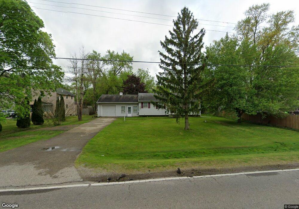
This home is located at 5237 W Court St, Flint, MI 48532 and is currently estimated at $156,674, approximately $117 per square foot. 5237 W Court St is a home located in Genesee County with nearby schools including Carman-Ainsworth High School, Genesee STEM Academy, and St. Paul Lutheran School.
Ownership History
Date
Name
Owned For
Owner Type
Purchase Details
Closed on
Dec 27, 2019
Sold by
Welsch Rodney A
Bought by
Welsch Rodney A and Welsch Larry L
Current Estimated Value
Purchase Details
Closed on
Oct 4, 2011
Sold by
Secretary Of Housing & Urban Development
Bought by
Welsch Rodney A and Welsch Charlene R
Purchase Details
Closed on
Aug 18, 2010
Sold by
Cook Brian
Bought by
Wells Fargo Bank Na
Purchase Details
Closed on
Mar 24, 2005
Sold by
Halverson Kathryn L
Bought by
Cook Brian
Create a Home Valuation Report for This Property
The Home Valuation Report is an in-depth analysis detailing your home's value as well as a comparison with similar homes in the area
Home Values in the Area
Average Home Value in this Area
Purchase History
| Date | Buyer | Sale Price | Title Company |
|---|---|---|---|
| Welsch Rodney A | -- | None Listed On Document | |
| Welsch Rodney A | $39,600 | Lighthouse Title Inc | |
| Wells Fargo Bank Na | $119,943 | None Available | |
| Cook Brian | $116,200 | Metropolitan Title Company |
Source: Public Records
Tax History Compared to Growth
Tax History
| Year | Tax Paid | Tax Assessment Tax Assessment Total Assessment is a certain percentage of the fair market value that is determined by local assessors to be the total taxable value of land and additions on the property. | Land | Improvement |
|---|---|---|---|---|
| 2025 | $1,801 | $62,800 | $0 | $0 |
| 2024 | $929 | $60,900 | $0 | $0 |
| 2023 | $886 | $55,400 | $0 | $0 |
| 2022 | $784 | $41,000 | $0 | $0 |
| 2021 | $1,590 | $36,500 | $0 | $0 |
| 2020 | $1,015 | $35,900 | $0 | $0 |
| 2019 | $1,010 | $35,500 | $0 | $0 |
| 2018 | $1,764 | $38,200 | $0 | $0 |
| 2017 | $2,143 | $38,200 | $0 | $0 |
| 2016 | $1,966 | $36,200 | $0 | $0 |
| 2015 | $1,385 | $36,200 | $0 | $0 |
| 2014 | $822 | $34,700 | $0 | $0 |
| 2012 | -- | $36,300 | $36,300 | $0 |
Source: Public Records
Map
Nearby Homes
- 1460 S Dye Rd
- 5345 Birchtree Ct
- 0000 Reuben Reuben St
- 1417 Grassmere Ave
- 5325 N Dyewood Dr
- 3.9 Acres W Court St
- 5406 Litchfield Dr
- 1442 Mintola Ave
- 5323 Elmsford Dr
- 4480 Corunna Rd
- 4474 Corunna Rd
- 6007 Corunna Rd
- 1455 S Linden Rd
- 5297 Oaktree Dr
- 0 Charter Dr Unit 50153638
- 5503 Westchester Dr
- 6090 Lancaster Dr
- 2 Charter Dr
- 6098 Corunna Rd
- 2462 Valley Oaks Cir
- 5229 W Court St
- 1377 S Dye Rd
- 1383 S Dye Rd
- 5221 W Court St
- 5242 W Court St
- 5215 W Court St
- 5232 W Court St
- 1397 S Dye Rd
- 1393 S Dye Rd
- 5209 W Court St
- 5222 W Court St
- 1401 S Dye Rd
- 5273 W Court St
- 5203 W Court St
- 1341 S Dye Rd
- 5214 W Court St
- 1333 S Dye Rd
- 1415 S Dye Rd
- 5272 W Court St
- 1388 S Dye Rd