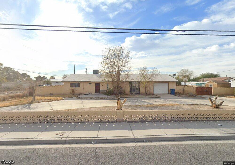
5239 E Owens Ave Las Vegas, NV 89110
Estimated Value: $325,000 - $538,000
3
Beds
3
Baths
1,680
Sq Ft
$253/Sq Ft
Est. Value
About This Home
This home is located at 5239 E Owens Ave, Las Vegas, NV 89110 and is currently estimated at $425,392, approximately $253 per square foot. 5239 E Owens Ave is a home located in Clark County with nearby schools including Stanford Elementary School, Duane D. Keller Middle School, and Eldorado High School.
Ownership History
Date
Name
Owned For
Owner Type
Purchase Details
Closed on
Jan 12, 2010
Sold by
Deutsche Bank National Trust Company
Bought by
Hill Nicky G
Current Estimated Value
Home Financials for this Owner
Home Financials are based on the most recent Mortgage that was taken out on this home.
Original Mortgage
$84,442
Outstanding Balance
$56,967
Interest Rate
5.5%
Mortgage Type
FHA
Estimated Equity
$368,425
Purchase Details
Closed on
Sep 17, 2009
Sold by
Lahera Andres G and Lahera Lucila B
Bought by
Deutsche Bank National Trust Company and One West Bank Fsb
Purchase Details
Closed on
Oct 16, 1996
Sold by
Thomas Rodney L and Thomas Kimberly E
Bought by
Lahera Andres G and Lahera Lucila B
Home Financials for this Owner
Home Financials are based on the most recent Mortgage that was taken out on this home.
Original Mortgage
$127,000
Interest Rate
6.92%
Create a Home Valuation Report for This Property
The Home Valuation Report is an in-depth analysis detailing your home's value as well as a comparison with similar homes in the area
Home Values in the Area
Average Home Value in this Area
Purchase History
| Date | Buyer | Sale Price | Title Company |
|---|---|---|---|
| Hill Nicky G | $86,000 | Chicago Title Las Vegas | |
| Deutsche Bank National Trust Company | $80,000 | Accommodation | |
| Lahera Andres G | $140,000 | United Title |
Source: Public Records
Mortgage History
| Date | Status | Borrower | Loan Amount |
|---|---|---|---|
| Open | Hill Nicky G | $84,442 | |
| Previous Owner | Lahera Andres G | $127,000 |
Source: Public Records
Tax History Compared to Growth
Tax History
| Year | Tax Paid | Tax Assessment Tax Assessment Total Assessment is a certain percentage of the fair market value that is determined by local assessors to be the total taxable value of land and additions on the property. | Land | Improvement |
|---|---|---|---|---|
| 2025 | $1,147 | $78,078 | $43,750 | $34,328 |
| 2024 | $1,401 | $78,078 | $43,750 | $34,328 |
| 2023 | $1,401 | $75,912 | $42,000 | $33,912 |
| 2022 | $1,228 | $66,634 | $35,000 | $31,634 |
| 2021 | $1,051 | $56,770 | $26,250 | $30,520 |
| 2020 | $1,017 | $57,022 | $26,250 | $30,772 |
| 2019 | $987 | $55,336 | $24,500 | $30,836 |
| 2018 | $959 | $49,001 | $18,900 | $30,101 |
| 2017 | $1,461 | $49,799 | $18,900 | $30,899 |
| 2016 | $909 | $43,831 | $15,750 | $28,081 |
| 2015 | $906 | $35,985 | $9,800 | $26,185 |
| 2014 | $879 | $29,094 | $8,925 | $20,169 |
Source: Public Records
Map
Nearby Homes
- 4541 E Owens Ave
- 1667 Rockwell Ln
- 1385 Ringe Ln
- 5320 Meikle Ln
- 4928 E Monroe Ave
- 1831 Castleberry Ln
- 0 Meikle Ln
- 5383 E Washington Ave
- 4932 E Washington Ave
- 1139 Betty Ln
- 2130 Trebbiano Way
- 1654 Nesting Way
- 5754 Cinnabar Ave
- 1112 Sandy Cove St
- 5772 Cinnabar Ave
- 1345 Stokes St
- 4637 Baby Bird Ln
- 4809 Sunny Brook Ave
- 2190 Clancy St
- 4828 Lakestream Ave
- 1594 Ringe Ln
- 1607 White Skies Ct
- 1578 Ringe Ln
- 1613 White Skies Ct
- 1613 White Skies Ct Unit none
- 1563 Betty Ln
- 5230 E Owens Ave
- 5230 E Owens Ave Unit B
- 5230 E Owens Ave Unit A
- 1608 White Skies Ct
- 1619 White Skies Ct
- 1579 Betty Ln
- 1560 Ringe Ln
- 5210 E Owens Ave
- 1614 White Skies Ct
- 1625 White Skies Ct
- 1620 White Skies Ct
- 5259 Birdstone Ct
- 1631 White Skies Ct
- 1620 Ringe Ln