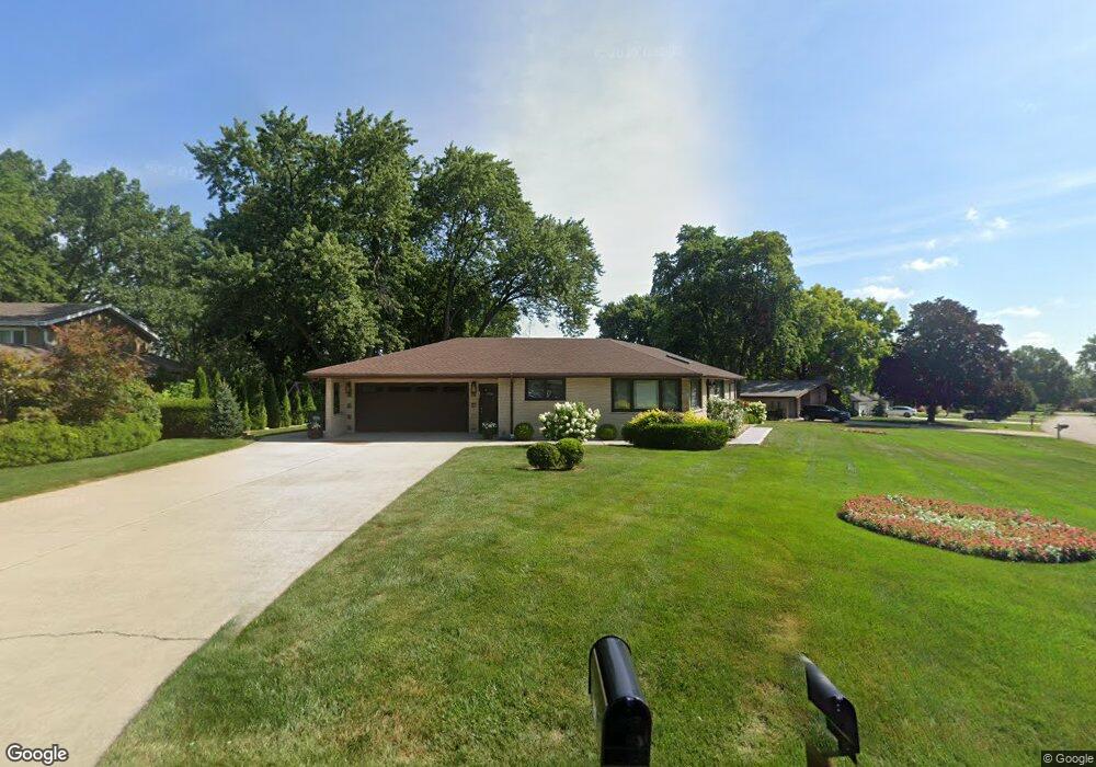
524 E Monterey Ave Schaumburg, IL 60193
South Schaumburg NeighborhoodEstimated Value: $476,566 - $508,000
4
Beds
4
Baths
1,886
Sq Ft
$261/Sq Ft
Est. Value
About This Home
This home is located at 524 E Monterey Ave, Schaumburg, IL 60193 and is currently estimated at $491,392, approximately $260 per square foot. 524 E Monterey Ave is a home located in Cook County with nearby schools including Frederick Nerge Elementary School, Margaret Mead Junior High School, and J B Conant High School.
Ownership History
Date
Name
Owned For
Owner Type
Purchase Details
Closed on
May 2, 2017
Sold by
Buzek Vernon J and Buzek Karen A
Bought by
Tynebor Renata M and Lewkowicz Zenon
Current Estimated Value
Home Financials for this Owner
Home Financials are based on the most recent Mortgage that was taken out on this home.
Original Mortgage
$261,250
Outstanding Balance
$215,171
Interest Rate
4.1%
Mortgage Type
New Conventional
Estimated Equity
$276,221
Create a Home Valuation Report for This Property
The Home Valuation Report is an in-depth analysis detailing your home's value as well as a comparison with similar homes in the area
Home Values in the Area
Average Home Value in this Area
Purchase History
| Date | Buyer | Sale Price | Title Company |
|---|---|---|---|
| Tynebor Renata M | $275,000 | Attorneys Title Guaranty Fun |
Source: Public Records
Mortgage History
| Date | Status | Borrower | Loan Amount |
|---|---|---|---|
| Open | Tynebor Renata M | $261,250 |
Source: Public Records
Tax History
| Year | Tax Paid | Tax Assessment Tax Assessment Total Assessment is a certain percentage of the fair market value that is determined by local assessors to be the total taxable value of land and additions on the property. | Land | Improvement |
|---|---|---|---|---|
| 2025 | $8,399 | $44,000 | $9,371 | $34,629 |
| 2024 | $8,399 | $33,037 | $8,330 | $24,707 |
| 2023 | $9,176 | $37,000 | $8,330 | $28,670 |
| 2022 | $9,176 | $37,000 | $8,330 | $28,670 |
| 2021 | $7,159 | $26,688 | $23,428 | $3,260 |
| 2020 | $7,096 | $26,688 | $23,428 | $3,260 |
| 2019 | $7,108 | $29,654 | $23,428 | $6,226 |
| 2018 | $7,657 | $28,968 | $19,783 | $9,185 |
| 2017 | $8,234 | $31,346 | $19,783 | $11,563 |
| 2016 | $7,936 | $31,346 | $19,783 | $11,563 |
| 2015 | $8,057 | $29,619 | $16,660 | $12,959 |
| 2014 | $7,964 | $29,619 | $16,660 | $12,959 |
| 2013 | $7,748 | $29,619 | $16,660 | $12,959 |
Source: Public Records
Map
Nearby Homes
- 620 S Point Dr
- 518 E Niagara Ave
- 1055 Hampton Harbor Unit 1055
- 1100 Boston Harbor Unit 7004
- 826 Thornton Ct Unit 2AL
- 615 Newberry Dr
- 539 Newberry Dr
- 677 Cumberland Trail Unit 2B
- 647 Cumberland Trail Unit AA1
- 1323 S Roselle Rd
- 970 Yosemite Trail Unit A5
- 13 W Monterey Ave
- 380 Ventura Club Dr
- 366 Ventura Club Dr
- 1671 Nebraska Dr
- 1630 Myrtle Park St
- 100 Pratt Blvd
- 1500 Illinois St
- 134 Lunt Ave
- 455 E Granville Ave
- 520 E Monterey Ave
- 534 Oneida Dr
- 533 Oneida Dr
- 521 E Monterey Ave
- 600 Oneida Dr
- 510 E Monterey Ave
- 1333 Sunset Dr
- 531 Hillcrest Dr
- 515 E Monterey Ave
- 537 Hillcrest Dr
- 1422 S Monterey Ave
- 1421 S Monterey Ave
- 525 Hillcrest Dr
- 606 Oneida Dr
- 601 Oneida Dr
- 1407 Sunset Dr
- 601 S Point Dr
- 519 Hillcrest Dr
- 1432 S Monterey Ave
- 1433 S Monterey Ave
Your Personal Tour Guide
Ask me questions while you tour the home.