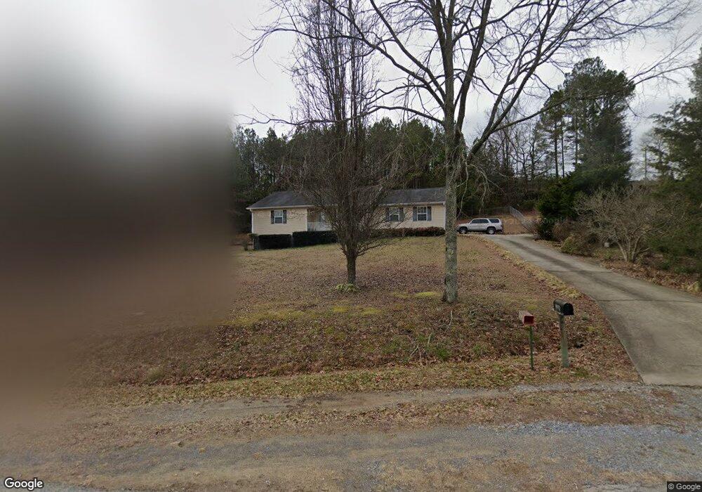
524 Fields Rd Cedartown, GA 30125
Estimated Value: $246,000 - $327,000
2
Beds
2
Baths
1,245
Sq Ft
$223/Sq Ft
Est. Value
About This Home
This home is located at 524 Fields Rd, Cedartown, GA 30125 and is currently estimated at $278,042, approximately $223 per square foot. 524 Fields Rd is a home located in Polk County with nearby schools including Cedar Christian School.
Ownership History
Date
Name
Owned For
Owner Type
Purchase Details
Closed on
Jul 30, 2025
Sold by
Cauthen Ricky W
Bought by
Cauthen Anita Gail and Cauthen Ricky W
Current Estimated Value
Purchase Details
Closed on
Jul 7, 2011
Sold by
Wells Mildred I
Bought by
Wells Mildred I
Purchase Details
Closed on
Jan 11, 2005
Sold by
Wells Albert C
Bought by
Forrester Harold L and Forrester Evelyn
Purchase Details
Closed on
Aug 30, 2004
Sold by
Ryan Donald E and Ryan Ruby S
Bought by
Wells Albert C and Wells Mildred I
Purchase Details
Closed on
Dec 4, 1974
Sold by
Lankford Otis
Bought by
Ryan Donald and Ryan Ruby S
Purchase Details
Closed on
Feb 16, 1974
Bought by
Lankford Otis
Create a Home Valuation Report for This Property
The Home Valuation Report is an in-depth analysis detailing your home's value as well as a comparison with similar homes in the area
Purchase History
| Date | Buyer | Sale Price | Title Company |
|---|---|---|---|
| Cauthen Anita Gail | -- | -- | |
| Wells Mildred I | -- | -- | |
| Forrester Harold L | $7,000 | -- | |
| Wells Albert C | -- | -- | |
| Wells Albert C | $30,000 | -- | |
| Ryan Donald | -- | -- | |
| Lankford Otis | -- | -- |
Source: Public Records
Tax History
| Year | Tax Paid | Tax Assessment Tax Assessment Total Assessment is a certain percentage of the fair market value that is determined by local assessors to be the total taxable value of land and additions on the property. | Land | Improvement |
|---|---|---|---|---|
| 2025 | $1,876 | $115,336 | $24,930 | $90,406 |
| 2024 | $1,742 | $98,034 | $15,581 | $82,453 |
| 2023 | $1,337 | $69,743 | $15,581 | $54,162 |
| 2022 | $1,047 | $57,494 | $10,388 | $47,106 |
| 2021 | $1,060 | $57,494 | $10,388 | $47,106 |
| 2020 | $1,062 | $57,494 | $10,388 | $47,106 |
| 2019 | $1,020 | $51,297 | $10,388 | $40,909 |
| 2018 | $945 | $47,650 | $10,388 | $37,262 |
| 2017 | $929 | $47,650 | $10,388 | $37,262 |
| 2016 | $949 | $48,376 | $11,114 | $37,262 |
| 2015 | $962 | $48,827 | $11,114 | $37,713 |
| 2014 | $968 | $48,827 | $11,114 | $37,713 |
Source: Public Records
Map
Nearby Homes
- 0 Wieuca Way Unit 10614129
- 000 Wieuca Way
- TRACT2 Wieuca Way
- 142 Acres On Judkin Mill Rd
- 95 Wieuca Way
- 45 York Cir
- 77 Morris Dr
- 00 Buchanan Hwy
- 567 Morton Springs Rd
- 102 acres Youngs Farm Rd
- 874 Judkin Mill Rd
- 0 Buchanan Hwy Unit 10558945
- 0 Youngs Farm Rd Unit 26490185
- 55 Lovvorn Rd
- 4550 Buchanan Hwy
- 0 Old Esom Hill Loop Unit 10611077
- 0 Old Esom Hill Loop Unit 7654342
- 1706 Antioch Rd
- 232 Tuck St
- 160 Tate Rd
- 516 Fields Rd
- 510 Fields Rd
- 130 Tallapoosa Hwy
- 9236 Tallapoosa Hwy
- 62 Tallapoosa Hwy
- 2692 Buchanan Hwy
- 79 Tallapoosa Hwy
- 100 Tallapoosa Hwy
- 0 Tallapoosa Hwy
- 0 Tallapoosa Hwy Unit 7146054
- 0 Tallapoosa Hwy Unit 20088088
- 0 Tallapoosa Hwy Unit 8034905
- 0 Tallapoosa Hwy Unit 8089232
- 0 Tallapoosa Hwy Unit 8364354
- 255 Tallapoosa Hwy
- 2663 Buchanan Hwy
- 2667 Buchanan Hwy
- 337 Fields Rd
- 301 Tallapoosa Hwy
- 338 Tallapoosa Hwy
Your Personal Tour Guide
Ask me questions while you tour the home.