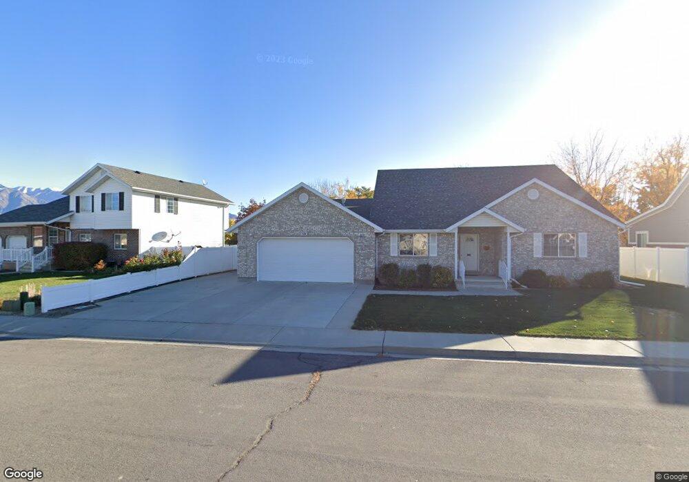
524 Mitchell Dr Spanish Fork, UT 84660
Estimated Value: $526,000 - $586,000
3
Beds
2
Baths
2,502
Sq Ft
$223/Sq Ft
Est. Value
About This Home
This home is located at 524 Mitchell Dr, Spanish Fork, UT 84660 and is currently estimated at $557,255, approximately $222 per square foot. 524 Mitchell Dr is a home located in Utah County with nearby schools including Brockbank Elementary School, Spanish Fork Jr High School, and Spanish Fork High School.
Ownership History
Date
Name
Owned For
Owner Type
Purchase Details
Closed on
Nov 14, 2025
Sold by
Hult Arnold F and Hult Linda
Bought by
Arnold And Linda Hult Family Trust and Hult
Current Estimated Value
Purchase Details
Closed on
Apr 12, 2012
Sold by
Hult Arnold F and Hult Linda K
Bought by
Hult Arnold F and Hult Linda K
Purchase Details
Closed on
Apr 19, 2001
Sold by
Ar Mitch Inc
Bought by
Hult Arnold F and Hult Linda K
Home Financials for this Owner
Home Financials are based on the most recent Mortgage that was taken out on this home.
Original Mortgage
$65,000
Interest Rate
6.98%
Create a Home Valuation Report for This Property
The Home Valuation Report is an in-depth analysis detailing your home's value as well as a comparison with similar homes in the area
Home Values in the Area
Average Home Value in this Area
Purchase History
| Date | Buyer | Sale Price | Title Company |
|---|---|---|---|
| Arnold And Linda Hult Family Trust | -- | None Listed On Document | |
| Hult Arnold F | -- | None Available | |
| Hult Arnold F | -- | -- |
Source: Public Records
Mortgage History
| Date | Status | Borrower | Loan Amount |
|---|---|---|---|
| Previous Owner | Hult Arnold F | $65,000 |
Source: Public Records
Tax History
| Year | Tax Paid | Tax Assessment Tax Assessment Total Assessment is a certain percentage of the fair market value that is determined by local assessors to be the total taxable value of land and additions on the property. | Land | Improvement |
|---|---|---|---|---|
| 2025 | $2,594 | $297,000 | -- | -- |
| 2024 | $2,594 | $267,355 | $0 | $0 |
| 2023 | $2,640 | $272,415 | $0 | $0 |
| 2022 | $2,571 | $260,205 | $0 | $0 |
| 2021 | $2,155 | $348,900 | $131,000 | $217,900 |
| 2020 | $2,004 | $315,400 | $119,100 | $196,300 |
| 2019 | $1,861 | $308,200 | $111,900 | $196,300 |
| 2018 | $1,675 | $268,100 | $97,400 | $170,700 |
| 2017 | $1,645 | $141,515 | $0 | $0 |
| 2016 | $1,653 | $140,305 | $0 | $0 |
| 2015 | $1,672 | $140,305 | $0 | $0 |
| 2014 | $1,596 | $134,365 | $0 | $0 |
Source: Public Records
Map
Nearby Homes
Your Personal Tour Guide
Ask me questions while you tour the home.