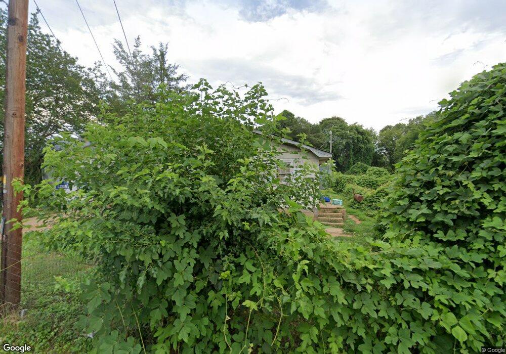
524 Porter St Shelby, NC 28150
Estimated Value: $144,338 - $177,000
--
Bed
--
Bath
1,120
Sq Ft
$144/Sq Ft
Est. Value
About This Home
This home is located at 524 Porter St, Shelby, NC 28150 and is currently estimated at $161,085, approximately $143 per square foot. 524 Porter St is a home located in Cleveland County with nearby schools including Graham Elementary School, Shelby Middle School, and Shelby High School.
Ownership History
Date
Name
Owned For
Owner Type
Purchase Details
Closed on
Feb 28, 2024
Sold by
Stephen Ireland Trust
Bought by
Herb And Lois Hanse Aving Trust
Current Estimated Value
Purchase Details
Closed on
Mar 15, 2023
Sold by
Sparks John Alan and Sparks Katherine Leneave
Bought by
Stephan Ireland Trust
Purchase Details
Closed on
Feb 4, 2020
Sold by
Sparks John Alan and Sparks Katherine Leneave
Bought by
Sparks John Alan and Sparks Katherine Leneave
Create a Home Valuation Report for This Property
The Home Valuation Report is an in-depth analysis detailing your home's value as well as a comparison with similar homes in the area
Home Values in the Area
Average Home Value in this Area
Purchase History
| Date | Buyer | Sale Price | Title Company |
|---|---|---|---|
| Herb And Lois Hanse Aving Trust | $170,000 | None Listed On Document | |
| Stephan Ireland Trust | $27,000 | -- | |
| Sparks John Alan | -- | None Available |
Source: Public Records
Tax History Compared to Growth
Tax History
| Year | Tax Paid | Tax Assessment Tax Assessment Total Assessment is a certain percentage of the fair market value that is determined by local assessors to be the total taxable value of land and additions on the property. | Land | Improvement |
|---|---|---|---|---|
| 2025 | $1,284 | $129,012 | $4,715 | $124,297 |
| 2024 | $349 | $26,896 | $2,542 | $24,354 |
| 2023 | $347 | $26,896 | $2,542 | $24,354 |
| 2022 | $347 | $26,896 | $2,542 | $24,354 |
| 2021 | $349 | $26,896 | $2,542 | $24,354 |
| 2020 | $246 | $18,000 | $2,460 | $15,540 |
| 2019 | $246 | $18,000 | $2,460 | $15,540 |
| 2018 | $244 | $18,000 | $2,460 | $15,540 |
| 2017 | $239 | $18,000 | $2,460 | $15,540 |
| 2016 | $238 | $18,000 | $2,460 | $15,540 |
| 2015 | $341 | $27,903 | $2,460 | $25,443 |
| 2014 | $341 | $27,903 | $2,460 | $25,443 |
Source: Public Records
Map
Nearby Homes
- 213 Knott St
- 207 Knott St
- 319 Black St
- 515 Suttle St
- 424 Airline Extension
- 905 Hawthorne Rd
- 911 Earl St
- 506 E Marion St
- 421 Carolina Ave
- 214 Belvedere Ave
- 406 Jacob St
- 930 Elizabeth Rd
- 304 Belvedere Ave
- 823 Frederick St
- 324 Beaumonde Ave
- 605 E Graham St
- 409 Forest Hill Dr
- 8 Bolt Dr
- 921 Logan St
- 310 S Poston St
- 214 Black St
- 215 Lineberger St
- 217 Lineberger St
- 211 Lineberger St
- 207 Lineberger St
- 305 Lineberger St
- 205 Lineberger St
- 212 Lineberger St
- 216 Lineberger St
- 307 Lineberger St
- 203 Lineberger St
- 607 Suttle St
- 662 Suttle St
- 605 Suttle St
- 516 Porter St
- 609 Suttle St
- 601 Suttle St
- 531 Suttle St
- 318 Black St
- 107 Lineberger St