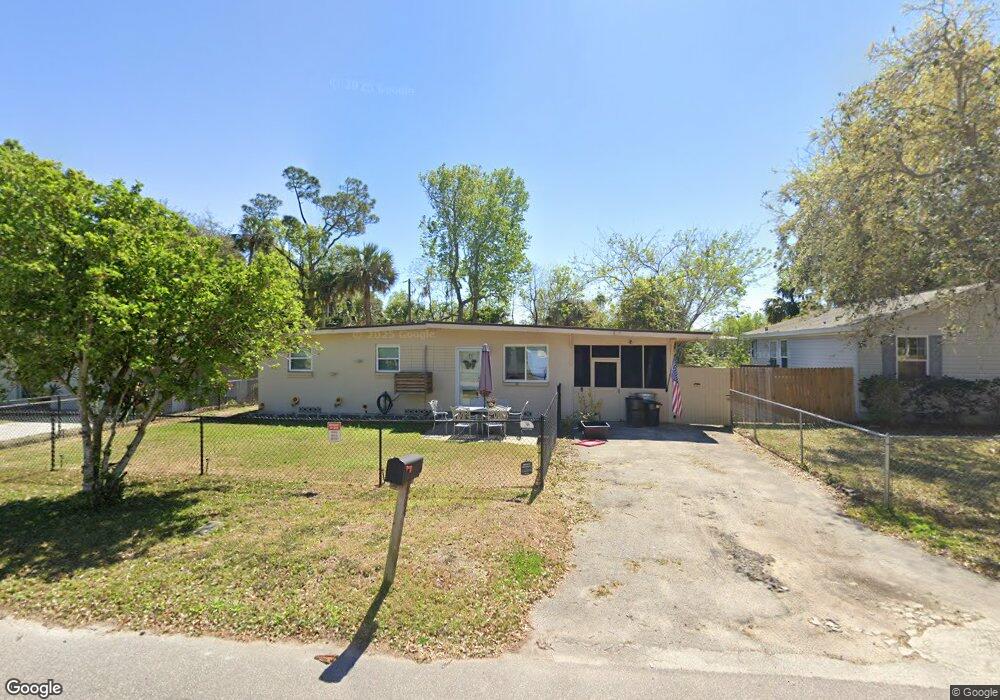
524 Powers Ave Port Orange, FL 32127
Estimated Value: $144,000 - $213,000
3
Beds
1
Bath
1,068
Sq Ft
$165/Sq Ft
Est. Value
About This Home
This home is located at 524 Powers Ave, Port Orange, FL 32127 and is currently estimated at $176,302, approximately $165 per square foot. 524 Powers Ave is a home located in Volusia County with nearby schools including Sugar Mill Elementary School, Silver Sands Middle School, and Spruce Creek High School.
Ownership History
Date
Name
Owned For
Owner Type
Purchase Details
Closed on
May 21, 2021
Sold by
Jones Kristina M
Bought by
Sargent Christina L
Current Estimated Value
Home Financials for this Owner
Home Financials are based on the most recent Mortgage that was taken out on this home.
Original Mortgage
$97,000
Outstanding Balance
$87,906
Interest Rate
3.1%
Mortgage Type
New Conventional
Estimated Equity
$88,396
Purchase Details
Closed on
Nov 10, 2000
Sold by
Bartholomew Ruth Ann and Hofmeister David Lynn
Bought by
Jones Kristina M
Home Financials for this Owner
Home Financials are based on the most recent Mortgage that was taken out on this home.
Original Mortgage
$58,710
Interest Rate
7.83%
Mortgage Type
Purchase Money Mortgage
Purchase Details
Closed on
Oct 15, 1973
Bought by
Jones Kristina M
Create a Home Valuation Report for This Property
The Home Valuation Report is an in-depth analysis detailing your home's value as well as a comparison with similar homes in the area
Home Values in the Area
Average Home Value in this Area
Purchase History
| Date | Buyer | Sale Price | Title Company |
|---|---|---|---|
| Sargent Christina L | $100,000 | Federal Title And Escrow Inc | |
| Jones Kristina M | $57,000 | -- | |
| Jones Kristina M | -- | -- | |
| Jones Kristina M | $10,500 | -- |
Source: Public Records
Mortgage History
| Date | Status | Borrower | Loan Amount |
|---|---|---|---|
| Open | Sargent Christina L | $97,000 | |
| Previous Owner | Jones Kristina M | $58,710 |
Source: Public Records
Tax History Compared to Growth
Tax History
| Year | Tax Paid | Tax Assessment Tax Assessment Total Assessment is a certain percentage of the fair market value that is determined by local assessors to be the total taxable value of land and additions on the property. | Land | Improvement |
|---|---|---|---|---|
| 2025 | $1,306 | $115,960 | -- | -- |
| 2024 | $1,306 | $112,692 | -- | -- |
| 2023 | $1,306 | $109,410 | $0 | $0 |
| 2022 | $1,242 | $106,223 | $31,661 | $74,562 |
| 2021 | $1,503 | $74,224 | $22,800 | $51,424 |
| 2020 | $1,476 | $78,592 | $17,670 | $60,922 |
| 2019 | $1,359 | $74,169 | $14,535 | $59,634 |
| 2018 | $1,280 | $68,320 | $21,945 | $46,375 |
| 2017 | $1,150 | $53,530 | $14,851 | $38,679 |
| 2016 | $1,089 | $49,979 | $0 | $0 |
| 2015 | $1,028 | $44,504 | $0 | $0 |
| 2014 | $992 | $42,194 | $0 | $0 |
Source: Public Records
Map
Nearby Homes
- 607 Powers Ave
- 550 Locust St
- 6480 Roseberry Ct
- 312 Dunlawton Ave
- 403 Herbert St
- 315 Herbert St
- 532 Lafayette St
- 406 Oak St
- 412 Virginia Ave
- 218 Herbert St
- 827 Railroad St
- 525 Monroe St
- 310 Legion Place
- 309 Lafayette St
- 834 Sixth St
- 700 Herbert St
- 0 S Ridgewood Ave
- 904 Charles St
- 908 3rd St
- 4084 Halifax Dr