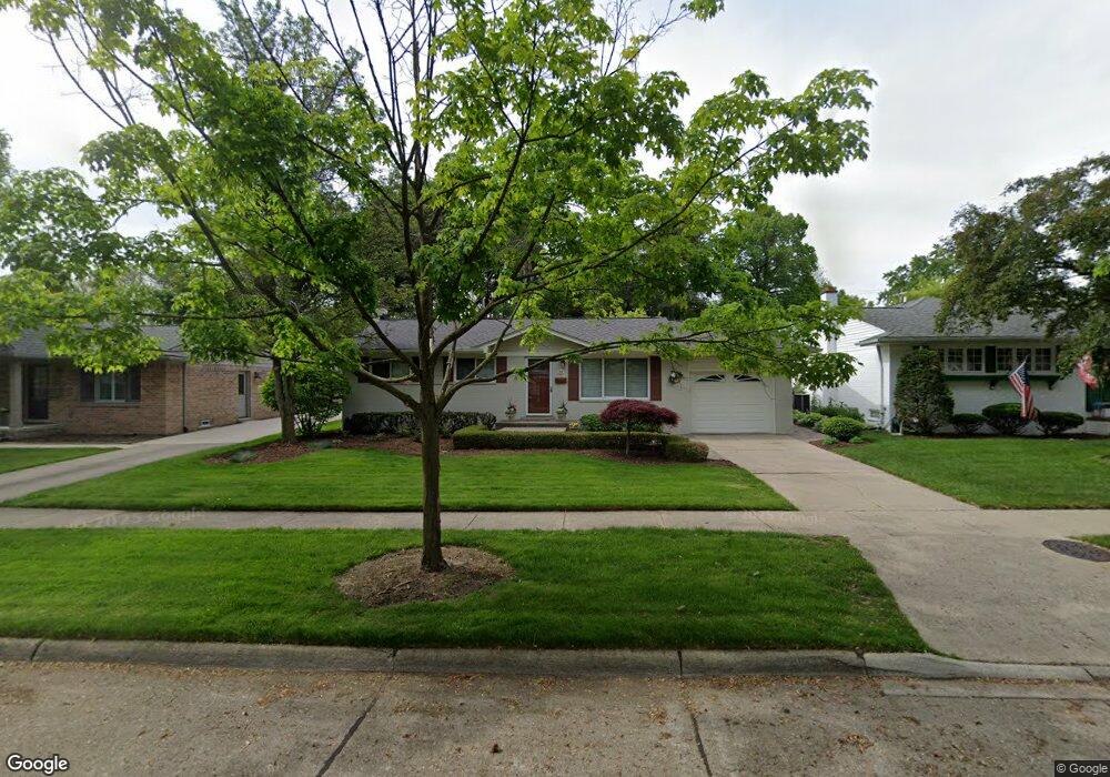
524 Rewold Dr Rochester, MI 48307
Estimated Value: $354,000 - $370,000
3
Beds
2
Baths
1,003
Sq Ft
$358/Sq Ft
Est. Value
About This Home
This home is located at 524 Rewold Dr, Rochester, MI 48307 and is currently estimated at $359,408, approximately $358 per square foot. 524 Rewold Dr is a home located in Oakland County with nearby schools including North Hill Elementary School, Hart Middle School, and Stoney Creek High School.
Ownership History
Date
Name
Owned For
Owner Type
Purchase Details
Closed on
Aug 25, 2011
Sold by
Schaefer Sara A
Bought by
Zuelch Richard and Zuelch Eileen
Current Estimated Value
Purchase Details
Closed on
Jun 1, 2004
Sold by
Oppedisano Anthony
Bought by
Schaefer Sara A
Home Financials for this Owner
Home Financials are based on the most recent Mortgage that was taken out on this home.
Original Mortgage
$195,925
Interest Rate
6.17%
Mortgage Type
FHA
Purchase Details
Closed on
Aug 12, 1999
Sold by
Langefeld Roger O
Bought by
Oppedisano Anthony
Purchase Details
Closed on
Mar 31, 1997
Sold by
Beldean John
Bought by
Langefeld Roger O
Create a Home Valuation Report for This Property
The Home Valuation Report is an in-depth analysis detailing your home's value as well as a comparison with similar homes in the area
Home Values in the Area
Average Home Value in this Area
Purchase History
| Date | Buyer | Sale Price | Title Company |
|---|---|---|---|
| Zuelch Richard | $125,000 | First American Title Ins Co | |
| Schaefer Sara A | $199,000 | Metropolitan Title Company | |
| Oppedisano Anthony | $153,000 | -- | |
| Langefeld Roger O | $63,750 | -- |
Source: Public Records
Mortgage History
| Date | Status | Borrower | Loan Amount |
|---|---|---|---|
| Previous Owner | Schaefer Sara A | $195,925 |
Source: Public Records
Tax History Compared to Growth
Tax History
| Year | Tax Paid | Tax Assessment Tax Assessment Total Assessment is a certain percentage of the fair market value that is determined by local assessors to be the total taxable value of land and additions on the property. | Land | Improvement |
|---|---|---|---|---|
| 2024 | $2,567 | $144,470 | $0 | $0 |
| 2023 | $2,458 | $135,190 | $0 | $0 |
| 2022 | $2,615 | $119,060 | $0 | $0 |
| 2021 | $2,457 | $118,270 | $0 | $0 |
| 2020 | $2,307 | $114,160 | $0 | $0 |
| 2019 | $2,536 | $109,560 | $0 | $0 |
| 2018 | $2,533 | $106,080 | $0 | $0 |
| 2017 | $2,483 | $101,930 | $0 | $0 |
| 2016 | $2,404 | $99,110 | $0 | $0 |
| 2015 | -- | $88,370 | $0 | $0 |
| 2014 | -- | $76,040 | $0 | $0 |
| 2011 | -- | $70,300 | $0 | $0 |
Source: Public Records
Map
Nearby Homes
- 536 Rewold Dr
- 433 Miller Ave Unit 204
- 509 E University Dr Unit 508
- 420 Baldwin Ave Unit 79
- 761 Lounsbury Ave
- 417 Parkdale Ave Unit 13
- 428 East St
- 801 Plate St Unit 201
- 334 Romeo Rd
- 500 Romeo Rd Unit 122
- 714 N Main St
- 804 N Main St Unit 2H
- 804 N Main St Unit 2A
- 804 N Main St Unit 2C
- 1022 Pointe Place Blvd
- 164 Albertson St
- 402 W 4th St
- 446 6th St
- 1228 N Main St
- 1219 N Main St