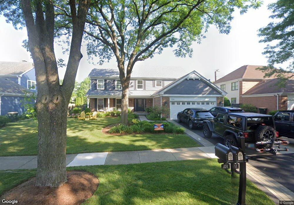
524 W Ashford Ln Arlington Heights, IL 60004
Terramere NeighborhoodEstimated Value: $701,806 - $732,000
3
Beds
4
Baths
3,102
Sq Ft
$232/Sq Ft
Est. Value
About This Home
This home is located at 524 W Ashford Ln, Arlington Heights, IL 60004 and is currently estimated at $718,952, approximately $231 per square foot. 524 W Ashford Ln is a home located in Cook County with nearby schools including Henry W Longfellow Elementary School, Cooper Middle School, and Buffalo Grove High School.
Ownership History
Date
Name
Owned For
Owner Type
Purchase Details
Closed on
Jun 28, 2024
Sold by
Flershem John E and Flershem Eileen R
Bought by
Flershem Family Trust and Flershem
Current Estimated Value
Purchase Details
Closed on
Aug 27, 2010
Sold by
Hogan Michael P and Hogan Dawn L
Bought by
Flershem John E and Flershem Eileen R
Home Financials for this Owner
Home Financials are based on the most recent Mortgage that was taken out on this home.
Original Mortgage
$345,000
Interest Rate
4.54%
Mortgage Type
New Conventional
Create a Home Valuation Report for This Property
The Home Valuation Report is an in-depth analysis detailing your home's value as well as a comparison with similar homes in the area
Home Values in the Area
Average Home Value in this Area
Purchase History
| Date | Buyer | Sale Price | Title Company |
|---|---|---|---|
| Flershem Family Trust | -- | None Listed On Document | |
| Flershem John E | $445,000 | Cti |
Source: Public Records
Mortgage History
| Date | Status | Borrower | Loan Amount |
|---|---|---|---|
| Previous Owner | Flershem John E | $345,000 |
Source: Public Records
Tax History Compared to Growth
Tax History
| Year | Tax Paid | Tax Assessment Tax Assessment Total Assessment is a certain percentage of the fair market value that is determined by local assessors to be the total taxable value of land and additions on the property. | Land | Improvement |
|---|---|---|---|---|
| 2024 | $13,351 | $49,197 | $10,969 | $38,228 |
| 2023 | $12,693 | $49,197 | $10,969 | $38,228 |
| 2022 | $12,693 | $45,918 | $10,969 | $34,949 |
| 2021 | $12,980 | $40,852 | $7,239 | $33,613 |
| 2020 | $12,711 | $40,852 | $7,239 | $33,613 |
| 2019 | $12,709 | $45,141 | $7,239 | $37,902 |
| 2018 | $13,116 | $41,998 | $6,361 | $35,637 |
| 2017 | $12,894 | $41,998 | $6,361 | $35,637 |
| 2016 | $13,057 | $44,320 | $6,361 | $37,959 |
| 2015 | $13,726 | $43,070 | $5,484 | $37,586 |
| 2014 | $13,544 | $43,070 | $5,484 | $37,586 |
| 2013 | $12,573 | $43,070 | $5,484 | $37,586 |
Source: Public Records
Map
Nearby Homes
- 4040 N Harvard Ave
- 812 W Whiting Ln
- 715 W Whiting Ln
- 1112 Auburn Ln
- 456 W Happfield Dr Unit 9CL
- 921 Bernard Dr
- 4121 N Mallard Dr Unit 5
- 715 W Happfield Dr
- 1631 W Partridge Ct Unit 8
- 1854 Checker Rd
- 751 W Happfield Dr Unit 30
- 705 Grove Dr Unit 101
- 872 Old Checker Rd Unit E3
- 746 Old Checker Rd Unit E5
- 535 Estate Dr
- 1545 Chickamauga Ln
- 571 Estate Dr
- 859 Beechwood Rd
- 1942 Trail Ridge St
- 720 Weidner Rd Unit 302
- 528 W Ashford Ln
- 520 W Ashford Ln
- 516 W Ashford Ln
- 521 W Ashford Ln Unit 4
- 525 W Ashford Ln
- 517 W Ashford Ln
- 4215 N Walnut Ave
- 512 W Ashford Ln
- 529 W Ashford Ln
- 513 W Ashford Ln
- 4219 N Walnut Ave
- 514 W Foxdale Ln
- 509 W Ashford Ln
- 508 W Ashford Ln
- 518 W Foxdale Ln
- 510 W Foxdale Ln
- 4210 N Walnut Ave
- 4206 N Walnut Ave Unit 4
- 4214 N Walnut Ave
- 522 W Foxdale Ln