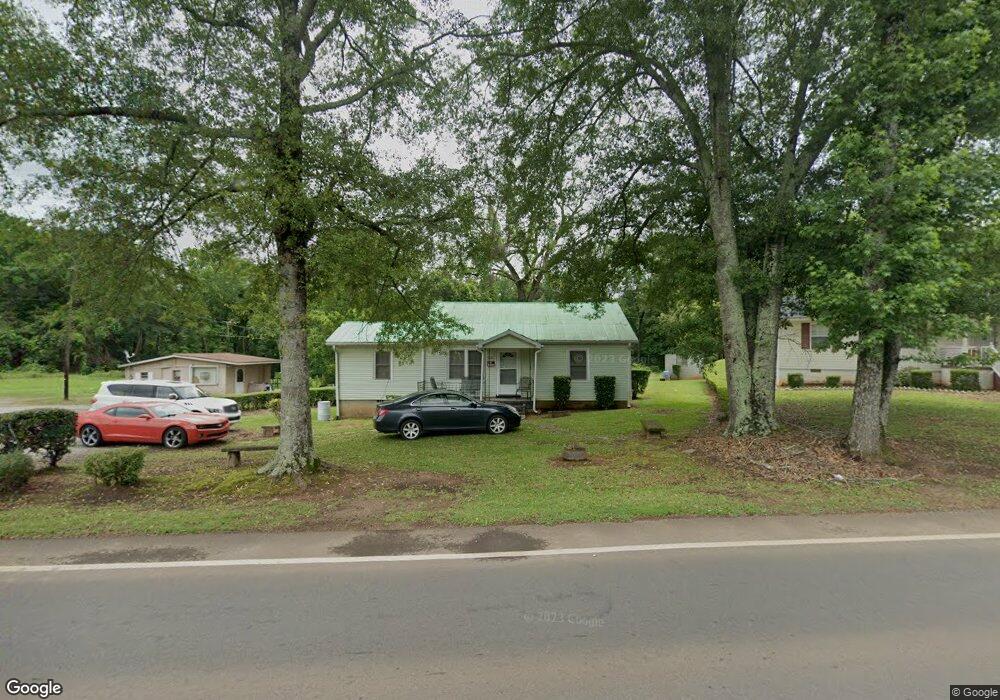
524 W Main St Forsyth, GA 31029
Estimated Value: $88,831 - $132,000
--
Bed
1
Bath
1,022
Sq Ft
$112/Sq Ft
Est. Value
About This Home
This home is located at 524 W Main St, Forsyth, GA 31029 and is currently estimated at $114,944, approximately $112 per square foot. 524 W Main St is a home located in Monroe County with nearby schools including Samuel E. Hubbard Elementary School, Mary Persons High School, and Lighthouse Academy.
Ownership History
Date
Name
Owned For
Owner Type
Purchase Details
Closed on
Mar 1, 2013
Sold by
Redding Lovett Frank
Bought by
Redding Valeria R and Davis Julia Mae Redding
Current Estimated Value
Purchase Details
Closed on
Feb 4, 2013
Sold by
Redding Edgar Lenton
Bought by
Davis Patricia R and Davis Julia Mae
Purchase Details
Closed on
Dec 18, 2012
Sold by
Redding Roxie Sims
Bought by
Redding Lovett Frank
Purchase Details
Closed on
Jun 27, 1977
Sold by
Davis Julia Mae R Etal
Bought by
Redding Roxie Sims Est
Purchase Details
Closed on
Nov 3, 1954
Sold by
Pippin Frank J
Bought by
Redding James
Create a Home Valuation Report for This Property
The Home Valuation Report is an in-depth analysis detailing your home's value as well as a comparison with similar homes in the area
Home Values in the Area
Average Home Value in this Area
Purchase History
| Date | Buyer | Sale Price | Title Company |
|---|---|---|---|
| Redding Valeria R | -- | -- | |
| Davis Patricia R | -- | -- | |
| Redding Lovett Frank | -- | -- | |
| Redding Roxie Sims Est | -- | -- | |
| Redding James | $4,700 | -- |
Source: Public Records
Tax History Compared to Growth
Tax History
| Year | Tax Paid | Tax Assessment Tax Assessment Total Assessment is a certain percentage of the fair market value that is determined by local assessors to be the total taxable value of land and additions on the property. | Land | Improvement |
|---|---|---|---|---|
| 2024 | $147 | $16,360 | $2,200 | $14,160 |
| 2023 | $95 | $14,360 | $2,520 | $11,840 |
| 2022 | $95 | $14,360 | $2,520 | $11,840 |
| 2021 | $97 | $14,360 | $2,520 | $11,840 |
| 2020 | $105 | $14,360 | $2,520 | $11,840 |
| 2019 | $105 | $14,360 | $2,520 | $11,840 |
| 2018 | $106 | $14,360 | $2,520 | $11,840 |
| 2017 | $460 | $14,360 | $2,520 | $11,840 |
| 2016 | $102 | $14,360 | $2,520 | $11,840 |
| 2015 | $99 | $14,360 | $2,520 | $11,840 |
| 2014 | $104 | $14,360 | $2,520 | $11,840 |
Source: Public Records
Map
Nearby Homes
- 507 W Main St
- 119 Country Club Dr
- 333 W Main St
- 292 Martin Luther King Junior Dr
- 451 Georgia 83
- 62 Washington Dr
- 120 Willis Wilder Dr
- 145 Willis Wilder Dr
- 60 Dew Place
- 299 Willis Wilder Dr
- 11 Dew Place
- 71 S Lee St
- 71 S South Lee St
- 289 Willis Wilder Dr
- 3487 Georgia 42
- 309 Willis Wilder Dr
- 319 Willis Wilder Dr
- 95 Mitchell Rd
- 500 W Main St
- 528 W Main St
- 526 W Main St
- 527 W Main St
- 521 W Main St
- 512 W Main St
- 541 W Main St
- 513 W Main St
- 493 Sunset Cir
- 497 Sunset Cir Unit 6A,5
- 497 Sunset Cir Unit 5,6A
- 515 W Main St
- 534 Stroud St
- 511 W Main St
- 511 W Main St
- 486 Sunset Cir
- 490 Sunset Cir
- 505 Stroud St Unit 32
- 505 Stroud St
- 507 W Main St Unit C