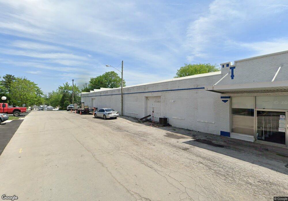
524 W State St Fremont, OH 43420
Estimated Value: $426,299
--
Bed
--
Bath
11,890
Sq Ft
$36/Sq Ft
Est. Value
About This Home
This home is located at 524 W State St, Fremont, OH 43420 and is currently estimated at $426,299, approximately $35 per square foot. 524 W State St is a home located in Sandusky County with nearby schools including Fremont Ross High School, Bishop Hoffman Catholic School - This is St Joe's School now, and St. Joseph School.
Ownership History
Date
Name
Owned For
Owner Type
Purchase Details
Closed on
Nov 10, 1998
Sold by
J J E L Inc
Bought by
Lamar Properties
Current Estimated Value
Home Financials for this Owner
Home Financials are based on the most recent Mortgage that was taken out on this home.
Original Mortgage
$108,750
Outstanding Balance
$24,009
Interest Rate
6.72%
Mortgage Type
Commercial
Estimated Equity
$402,290
Purchase Details
Closed on
Nov 1, 1986
Bought by
Lamar Rentals Llc
Purchase Details
Closed on
Dec 1, 1983
Bought by
Lamar Rentals Llc
Create a Home Valuation Report for This Property
The Home Valuation Report is an in-depth analysis detailing your home's value as well as a comparison with similar homes in the area
Home Values in the Area
Average Home Value in this Area
Purchase History
| Date | Buyer | Sale Price | Title Company |
|---|---|---|---|
| Lamar Properties | $145,000 | -- | |
| Lamar Rentals Llc | $112,000 | -- | |
| Lamar Rentals Llc | $95,000 | -- |
Source: Public Records
Mortgage History
| Date | Status | Borrower | Loan Amount |
|---|---|---|---|
| Open | Lamar Properties | $108,750 |
Source: Public Records
Tax History Compared to Growth
Tax History
| Year | Tax Paid | Tax Assessment Tax Assessment Total Assessment is a certain percentage of the fair market value that is determined by local assessors to be the total taxable value of land and additions on the property. | Land | Improvement |
|---|---|---|---|---|
| 2024 | $2,684 | $60,660 | $36,440 | $24,220 |
| 2023 | $2,684 | $55,130 | $33,110 | $22,020 |
| 2022 | $2,569 | $55,130 | $33,110 | $22,020 |
| 2021 | $2,634 | $55,130 | $33,110 | $22,020 |
| 2020 | $2,612 | $53,310 | $33,110 | $20,200 |
| 2019 | $2,600 | $53,310 | $33,110 | $20,200 |
| 2018 | $2,622 | $53,310 | $33,110 | $20,200 |
| 2017 | $2,599 | $53,310 | $33,110 | $20,200 |
| 2016 | $2,338 | $53,310 | $33,110 | $20,200 |
| 2015 | $2,309 | $53,310 | $33,110 | $20,200 |
| 2014 | $2,262 | $52,330 | $32,100 | $20,230 |
| 2013 | $2,217 | $52,330 | $32,100 | $20,230 |
Source: Public Records
Map
Nearby Homes
- 208 E State St
- 224 Sandusky Ave Unit 226
- 322 4th St
- 516 N Front St
- 433 Sandusky Ave
- 714 E State St
- 427 N Clover St
- 515 S Arch St
- 533 Sandusky Ave Unit 535
- 216 S Buchanan St
- 612 2nd St
- 619 Hayes Ave
- 600 S Buchanan St
- 0 S Buchanan St
- 230 N Pennsylvania Ave
- 309 S Collinwood Blvd
- 1009 Napoleon St
- 501 Jackson St Unit 50
- 616 S Wood St
- 625 Bush Place
- 114 E State St
- 118 Sandusky Ave
- 111 Sandusky Ave
- 124 Sandusky Ave Unit 124
- 111 Howland St
- 121 Elliot St
- 103 Howland St
- 125 E State St
- 127 Sandusky Ave
- 211 Howland St
- 118 Howland St
- 114 Howland St Unit 114
- 202 Sandusky Ave
- 213 Howland St
- 106 Howland St
- 203 Sandusky Ave
- 219 Howland St
- 208 Sandusky Ave
- 208 Howland St
- 226 E State St