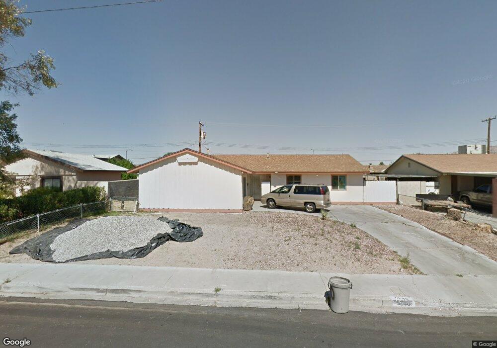
5240 Koa Ave Unit 1 Las Vegas, NV 89122
Estimated Value: $325,261 - $358,000
4
Beds
2
Baths
1,397
Sq Ft
$244/Sq Ft
Est. Value
About This Home
This home is located at 5240 Koa Ave Unit 1, Las Vegas, NV 89122 and is currently estimated at $341,065, approximately $244 per square foot. 5240 Koa Ave Unit 1 is a home located in Clark County with nearby schools including Cynthia Cunningham Elementary School, Francis H Cortney Junior High School, and Chaparral High School.
Ownership History
Date
Name
Owned For
Owner Type
Purchase Details
Closed on
Aug 12, 2011
Sold by
Levit Gennady
Bought by
Levit Betsy
Current Estimated Value
Purchase Details
Closed on
Aug 11, 2011
Sold by
Federal National Mortgage Association
Bought by
Levit Betsy
Purchase Details
Closed on
May 10, 2011
Sold by
Overbay George Dennis and Overbay Cynthia
Bought by
Federal National Mortgage Association
Create a Home Valuation Report for This Property
The Home Valuation Report is an in-depth analysis detailing your home's value as well as a comparison with similar homes in the area
Home Values in the Area
Average Home Value in this Area
Purchase History
| Date | Buyer | Sale Price | Title Company |
|---|---|---|---|
| Levit Betsy | $48,000 | Lawyers Title Of Nevada Hen | |
| Levit Betsy | $48,000 | Lawyers Title Of Nevada Hen | |
| Federal National Mortgage Association | $46,800 | Accommodation |
Source: Public Records
Tax History Compared to Growth
Tax History
| Year | Tax Paid | Tax Assessment Tax Assessment Total Assessment is a certain percentage of the fair market value that is determined by local assessors to be the total taxable value of land and additions on the property. | Land | Improvement |
|---|---|---|---|---|
| 2025 | $666 | $44,608 | $25,900 | $18,708 |
| 2024 | $617 | $44,608 | $25,900 | $18,708 |
| 2023 | $617 | $47,035 | $30,100 | $16,935 |
| 2022 | $571 | $38,180 | $23,100 | $15,080 |
| 2021 | $529 | $35,401 | $21,350 | $14,051 |
| 2020 | $489 | $33,615 | $19,950 | $13,665 |
| 2019 | $458 | $29,640 | $16,450 | $13,190 |
| 2018 | $437 | $26,711 | $14,350 | $12,361 |
| 2017 | $780 | $26,603 | $14,350 | $12,253 |
| 2016 | $411 | $20,929 | $9,100 | $11,829 |
| 2015 | $408 | $16,882 | $7,700 | $9,182 |
| 2014 | $396 | $13,085 | $5,250 | $7,835 |
Source: Public Records
Map
Nearby Homes
- 4210 Canal Cir
- 4289 Chocolate St
- 5461 Palisades Quad Ave
- 4241 S Nellis Blvd
- 5525 Criollo Dr
- 4991 Powell Ave
- 5536 Criollo Dr
- 4951 Plata Del Sol Dr
- 5432 Barstow Ct
- 5303 E Twain Ave Unit 70
- 5303 E Twain Ave Unit 250
- 5303 E Twain Ave Unit 171
- 5303 E Twain Ave Unit 33
- 4831 Monterrey Ave
- 4559 S Nellis Blvd
- 5249 Sun Valley Dr
- 4785 San Sebastian Ave
- 4567 S Nellis Blvd
- 4765 Monterrey Ave
- 4300 Don Quixote St
- 5252 Koa Ave Unit 1
- 5228 Koa Ave
- 5239 Treasure Ave
- 5251 Treasure Ave
- 5227 Treasure Ave
- 5216 Koa Ave
- 5264 Koa Ave Unit 2
- 5253 Koa Ave
- 5229 Koa Ave Unit 2
- 5263 Treasure Ave
- 5215 Treasure Ave
- 5217 Koa Ave
- 5263 Koa Ave
- 5204 Koa Ave
- 5278 Koa Ave
- 5275 Treasure Ave
- 4200 Canal Cir
- 5238 Treasure Ave
- 5250 Treasure Ave
- 4199 Canal Cir