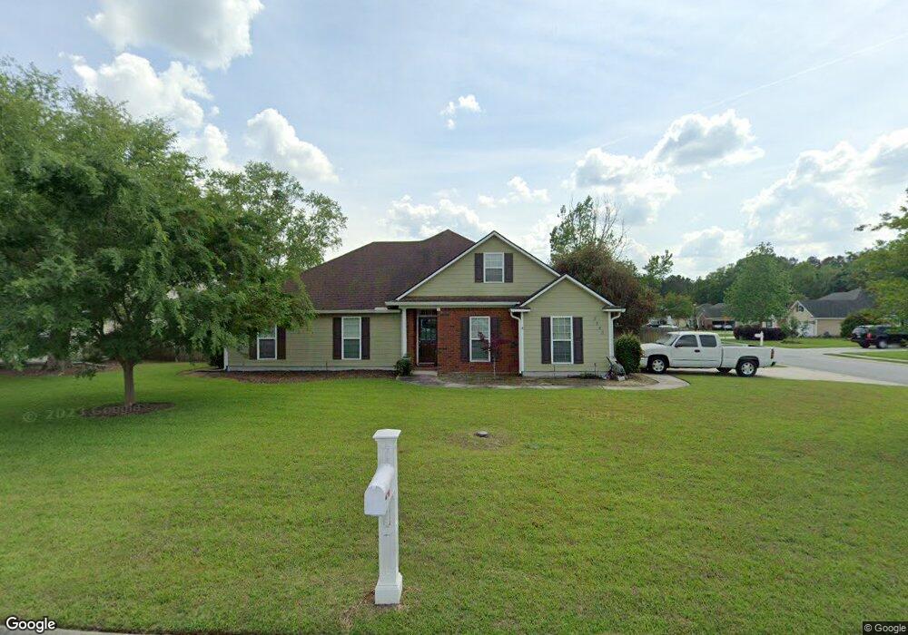
5243 Carys Brook Dr Hahira, GA 31632
Estimated Value: $289,000 - $331,000
4
Beds
2
Baths
1,891
Sq Ft
$162/Sq Ft
Est. Value
About This Home
This home is located at 5243 Carys Brook Dr, Hahira, GA 31632 and is currently estimated at $306,516, approximately $162 per square foot. 5243 Carys Brook Dr is a home located in Lowndes County with nearby schools including Westside Elementary School, Hahira Middle School, and Lowndes High School.
Ownership History
Date
Name
Owned For
Owner Type
Purchase Details
Closed on
Aug 18, 2008
Sold by
Darto Enterprises Inc
Bought by
Rhoades Michael L
Current Estimated Value
Home Financials for this Owner
Home Financials are based on the most recent Mortgage that was taken out on this home.
Original Mortgage
$152,000
Outstanding Balance
$99,172
Interest Rate
6.21%
Mortgage Type
New Conventional
Estimated Equity
$207,344
Purchase Details
Closed on
Feb 9, 2007
Sold by
The Stoker Grp Inc
Bought by
Chase Ted
Home Financials for this Owner
Home Financials are based on the most recent Mortgage that was taken out on this home.
Original Mortgage
$40,299
Interest Rate
6.17%
Mortgage Type
New Conventional
Purchase Details
Closed on
Jul 29, 2005
Bought by
Stoker Group Inc The
Create a Home Valuation Report for This Property
The Home Valuation Report is an in-depth analysis detailing your home's value as well as a comparison with similar homes in the area
Home Values in the Area
Average Home Value in this Area
Purchase History
| Date | Buyer | Sale Price | Title Company |
|---|---|---|---|
| Rhoades Michael L | $192,000 | -- | |
| Darto Enterprises Inc | -- | -- | |
| Chase Ted | $239,400 | -- | |
| Stoker Group Inc The | -- | -- |
Source: Public Records
Mortgage History
| Date | Status | Borrower | Loan Amount |
|---|---|---|---|
| Open | Darto Enterprises Inc | $152,000 | |
| Closed | Rhoades Michael L | $152,000 | |
| Previous Owner | Chase Ted | $40,299 |
Source: Public Records
Tax History Compared to Growth
Tax History
| Year | Tax Paid | Tax Assessment Tax Assessment Total Assessment is a certain percentage of the fair market value that is determined by local assessors to be the total taxable value of land and additions on the property. | Land | Improvement |
|---|---|---|---|---|
| 2024 | $2,419 | $104,803 | $12,800 | $92,003 |
| 2023 | $2,419 | $104,803 | $12,800 | $92,003 |
| 2022 | $2,302 | $86,374 | $12,800 | $73,574 |
| 2021 | $2,056 | $74,507 | $12,800 | $61,707 |
| 2020 | $1,764 | $68,944 | $12,800 | $56,144 |
| 2019 | $1,781 | $68,944 | $12,800 | $56,144 |
| 2018 | $1,799 | $68,944 | $12,800 | $56,144 |
| 2017 | $1,820 | $68,944 | $12,800 | $56,144 |
| 2016 | $1,824 | $68,944 | $12,800 | $56,144 |
| 2015 | $1,750 | $68,944 | $12,800 | $56,144 |
| 2014 | $1,785 | $68,944 | $12,800 | $56,144 |
Source: Public Records
Map
Nearby Homes
- 5202 Carlton Ridge Cir
- 5109 Village Way
- 5084 Village Way
- 5041 Carlton Ridge Cir
- 5172 Carlton Ridge Cir
- 5153 Village Way
- 4900 Tillman Crossing
- 4617 Blackwater Dr
- 5235 Old Magnolia Cir
- 5330 Forest Glen Cir
- 4267 Whisperwood Cir
- 4501 Wellington Woods Dr
- 4762 Blackwater Dr
- 4227 Tillman Bluff Rd
- 5460 Union Rd
- 4504 Wellington Woods Dr
- 4469 Green Island Rd
- 4801 Springbrook Dr
- 5211 Abbott Cir
- 1000 Ballantyne Ln
- 5237 Carys Brook Dr
- 5114 Village Way
- 5229 Carys Brook Dr
- 5208 Carlton Ridge Cir
- 5244 Carys Brook Dr
- 5214 Carlton Ridge Cir
- 5108 Village Way
- 5238 Carys Brook Dr
- 5220 Carlton Ridge Cir
- 5221 Carys Brook Dr
- 5230 Carys Brook Dr
- 5196 Carlton Ridge Cir
- 5100 Village Way
- 5189 Carlton Ridge Cir
- 5189 Carlton Ridge Cir
- 5115 Village Way
- 5121 Village Way
- 5220 Carys Brook Dr
- 5130 Village Way
- 5145 Waverly Tree Dr