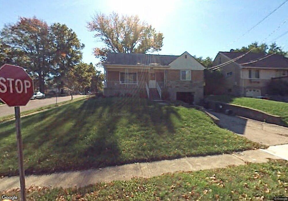
5247 Highview Dr Cincinnati, OH 45238
West Price Hill NeighborhoodEstimated Value: $199,000 - $242,000
4
Beds
1
Bath
1,859
Sq Ft
$121/Sq Ft
Est. Value
About This Home
This home is located at 5247 Highview Dr, Cincinnati, OH 45238 and is currently estimated at $225,812, approximately $121 per square foot. 5247 Highview Dr is a home located in Hamilton County with nearby schools including Covedale School, Gilbert A. Dater High School, and Western Hills High School.
Ownership History
Date
Name
Owned For
Owner Type
Purchase Details
Closed on
Feb 28, 1997
Sold by
Goldsberry Richard C and Goldsberry Carolyn M
Bought by
Glatthaar Laura L
Current Estimated Value
Home Financials for this Owner
Home Financials are based on the most recent Mortgage that was taken out on this home.
Original Mortgage
$78,200
Outstanding Balance
$7,598
Interest Rate
7.93%
Mortgage Type
FHA
Estimated Equity
$218,214
Create a Home Valuation Report for This Property
The Home Valuation Report is an in-depth analysis detailing your home's value as well as a comparison with similar homes in the area
Home Values in the Area
Average Home Value in this Area
Purchase History
| Date | Buyer | Sale Price | Title Company |
|---|---|---|---|
| Glatthaar Laura L | $78,000 | Blue Chip Title Agency Inc |
Source: Public Records
Mortgage History
| Date | Status | Borrower | Loan Amount |
|---|---|---|---|
| Open | Glatthaar Laura L | $78,200 |
Source: Public Records
Tax History
| Year | Tax Paid | Tax Assessment Tax Assessment Total Assessment is a certain percentage of the fair market value that is determined by local assessors to be the total taxable value of land and additions on the property. | Land | Improvement |
|---|---|---|---|---|
| 2025 | $3,536 | $56,483 | $6,608 | $49,875 |
| 2023 | $3,507 | $56,483 | $6,608 | $49,875 |
| 2022 | $2,388 | $34,195 | $6,566 | $27,629 |
| 2021 | $2,281 | $34,195 | $6,566 | $27,629 |
| 2020 | $2,347 | $34,195 | $6,566 | $27,629 |
| 2019 | $2,333 | $31,084 | $5,968 | $25,116 |
| 2018 | $2,336 | $31,084 | $5,968 | $25,116 |
| 2017 | $2,218 | $31,084 | $5,968 | $25,116 |
| 2016 | $2,362 | $32,687 | $6,377 | $26,310 |
| 2015 | $2,133 | $32,687 | $6,377 | $26,310 |
| 2014 | $2,148 | $32,687 | $6,377 | $26,310 |
| 2013 | $2,475 | $37,146 | $7,249 | $29,897 |
Source: Public Records
Map
Nearby Homes
- 5152 Highview Dr
- 1023 Woodbriar Ln
- 1063 Anderson Ferry Rd
- 5140 Willnet Dr
- 1137 Covedale Ave
- 949 Anderson Ferry Rd
- 1005 Covedale Ave
- 1092 Morado Dr
- 5114 Cleves Warsaw Pike
- 1088 Morado Dr
- 990 Covedale Ave
- 5153 Dresden Ct
- 5132 Ralph Ave
- 5004 Cleves Warsaw Pike
- 5005 Western Hills Ave
- 1075 Coronado Ave
- 1650 Colonial Dr
- 5360 Carefree Ct
- 5330 Plumridge Dr
- 1127 Rulison Ave
- 5251 Highview Dr
- 1097 Beechmeadow Ln
- 5255 Highview Dr
- 5239 Highview Dr
- 1093 Beechmeadow Ln
- 5259 Highview Dr
- 5235 Highview Dr
- 1098 Beechmeadow Ln
- 1089 Beechmeadow Ln
- 5248 Highview Dr
- 5254 Highview Dr
- 5263 Highview Dr
- 5231 Highview Dr
- 5240 Highview Dr
- 5258 Highview Dr
- 1085 Beechmeadow Ln
- 1090 Beechmeadow Ln
- 5236 Highview Dr
- 5267 Highview Dr
- 1088 Beechmeadow Ln
Your Personal Tour Guide
Ask me questions while you tour the home.