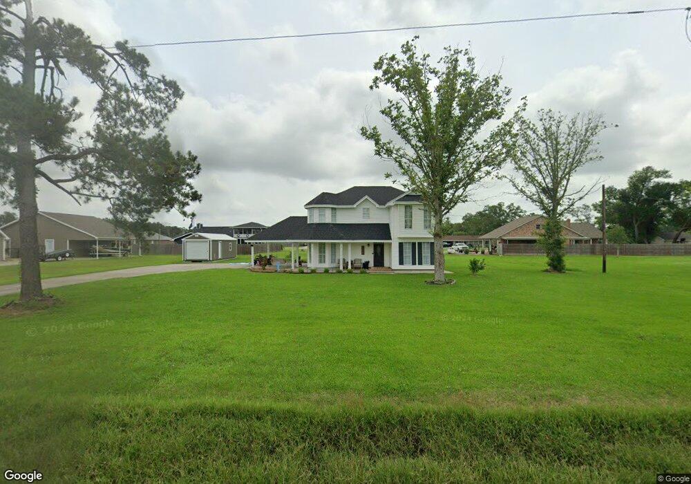
5247 Pete Seay Rd Sulphur, LA 70665
Estimated Value: $192,953 - $236,000
3
Beds
2
Baths
2,129
Sq Ft
$102/Sq Ft
Est. Value
About This Home
This home is located at 5247 Pete Seay Rd, Sulphur, LA 70665 and is currently estimated at $217,988, approximately $102 per square foot. 5247 Pete Seay Rd is a home located in Calcasieu Parish with nearby schools including Cypress Cove Elementary School, W.W. Lewis Middle School, and Sulphur High School.
Ownership History
Date
Name
Owned For
Owner Type
Purchase Details
Closed on
Oct 2, 2021
Sold by
Mcnicol David W and Mcnicol Debora M
Bought by
Ponder Nathan Lee and Ponder Lacey Levine
Current Estimated Value
Home Financials for this Owner
Home Financials are based on the most recent Mortgage that was taken out on this home.
Original Mortgage
$190,000
Outstanding Balance
$171,591
Interest Rate
2.88%
Mortgage Type
New Conventional
Estimated Equity
$46,397
Create a Home Valuation Report for This Property
The Home Valuation Report is an in-depth analysis detailing your home's value as well as a comparison with similar homes in the area
Purchase History
| Date | Buyer | Sale Price | Title Company |
|---|---|---|---|
| Ponder Nathan Lee | $200,000 | None Listed On Document |
Source: Public Records
Mortgage History
| Date | Status | Borrower | Loan Amount |
|---|---|---|---|
| Open | Ponder Nathan Lee | $190,000 |
Source: Public Records
Tax History
| Year | Tax Paid | Tax Assessment Tax Assessment Total Assessment is a certain percentage of the fair market value that is determined by local assessors to be the total taxable value of land and additions on the property. | Land | Improvement |
|---|---|---|---|---|
| 2025 | $706 | $13,710 | $2,430 | $11,280 |
| 2024 | $706 | $13,710 | $2,430 | $11,280 |
| 2023 | $697 | $13,710 | $2,430 | $11,280 |
| 2022 | $683 | $13,710 | $2,430 | $11,280 |
| 2021 | $1,532 | $13,710 | $2,430 | $11,280 |
| 2020 | $1,370 | $12,480 | $2,330 | $10,150 |
| 2019 | $1,517 | $13,530 | $2,250 | $11,280 |
| 2018 | $685 | $13,530 | $2,250 | $11,280 |
| 2017 | $1,574 | $13,530 | $2,250 | $11,280 |
| 2016 | $1,554 | $13,530 | $2,250 | $11,280 |
| 2015 | $1,659 | $13,530 | $2,250 | $11,280 |
Source: Public Records
Map
Nearby Homes
- 2173 W Dave Dugas Rd
- 2014 N Iona Dr
- 5276 Rock Dr
- 2231 W Dave Dugas Rd
- 5221 E Iona Dr
- 2212 Bon Vie Dr
- 2131 Madewood St
- 2151 Madewood St
- 2167 Madewood St
- 2181 Madewood St
- 4903 Poplar Grove St
- 2300 Bonvie Dr
- 0 Madewood St Unit SWL21010711
- 0 Madewood St Unit SWL21010704
- 0 Madewood St Unit SWL21010691
- 0 Myrtle Hill St Unit SWL21010697
- 0 Madewood St Unit SWL21010708
- 0 Myrtle Hill St Unit SWL21010699
- 0 Madewood St Unit SWL21010700
- 0 Madewood St Unit SWL21010707
- 5271 Pete Seay Rd
- 5225 Pete Seay Rd
- 5214 Claire Dr
- 5208 Claire Dr
- 5205 Pete Seay Rd
- 5290 Pete Seay Rd
- 5114 Claire Dr
- 5194 Claire Dr
- 5209 Claire Dr
- 5215 Claire Dr
- 5121 Claire Dr
- 5221 Claire Dr
- 5115 Claire Dr
- 5109 Pete Seay Rd
- 2092 W Dave Dugas Rd
- 5252 Rock Dr
- 5264 Rock Dr
- 5172 Rock Dr
- 5164 Rock Dr
- 2008 N Iona Dr
Your Personal Tour Guide
Ask me questions while you tour the home.